The primary goal of this project was to collect airborne blue-green LiDAR and hyperspectral visible to near infrared data over a small area on the Bolivar Peninsula between Galveston Bay and the Gulf of Mexico to test the LiDAR effectiveness in the turbid waters of Galveston Bay, and to create a baseline map that can be used to monitor future coastal change.
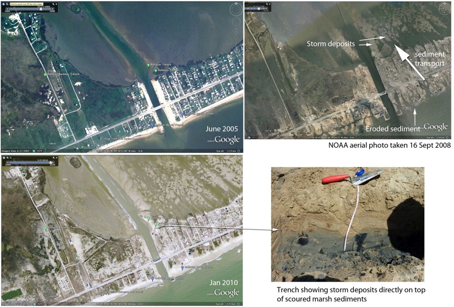
Rollover Pass on the Bolivar Peninsula, before and after Hurricane Ike, showing storm surge deposits. Green pins (left images) show locations of sediment samples and cores. The top right image was taken 3 days after the storm and shows the sediment pathway as it eroded from the beach and transported and deposited in the bay. Lower right image shows the hurricane deposits on top of former marsh sediments exposed in a trench (arrow shows trench location).
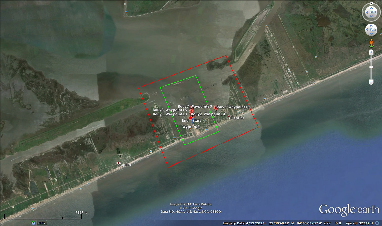
Transect boundaries (approximate) for aerial data collection. Buoy locations are marked with red pins.