Earth Science & Remote Sensing Missions on ISS
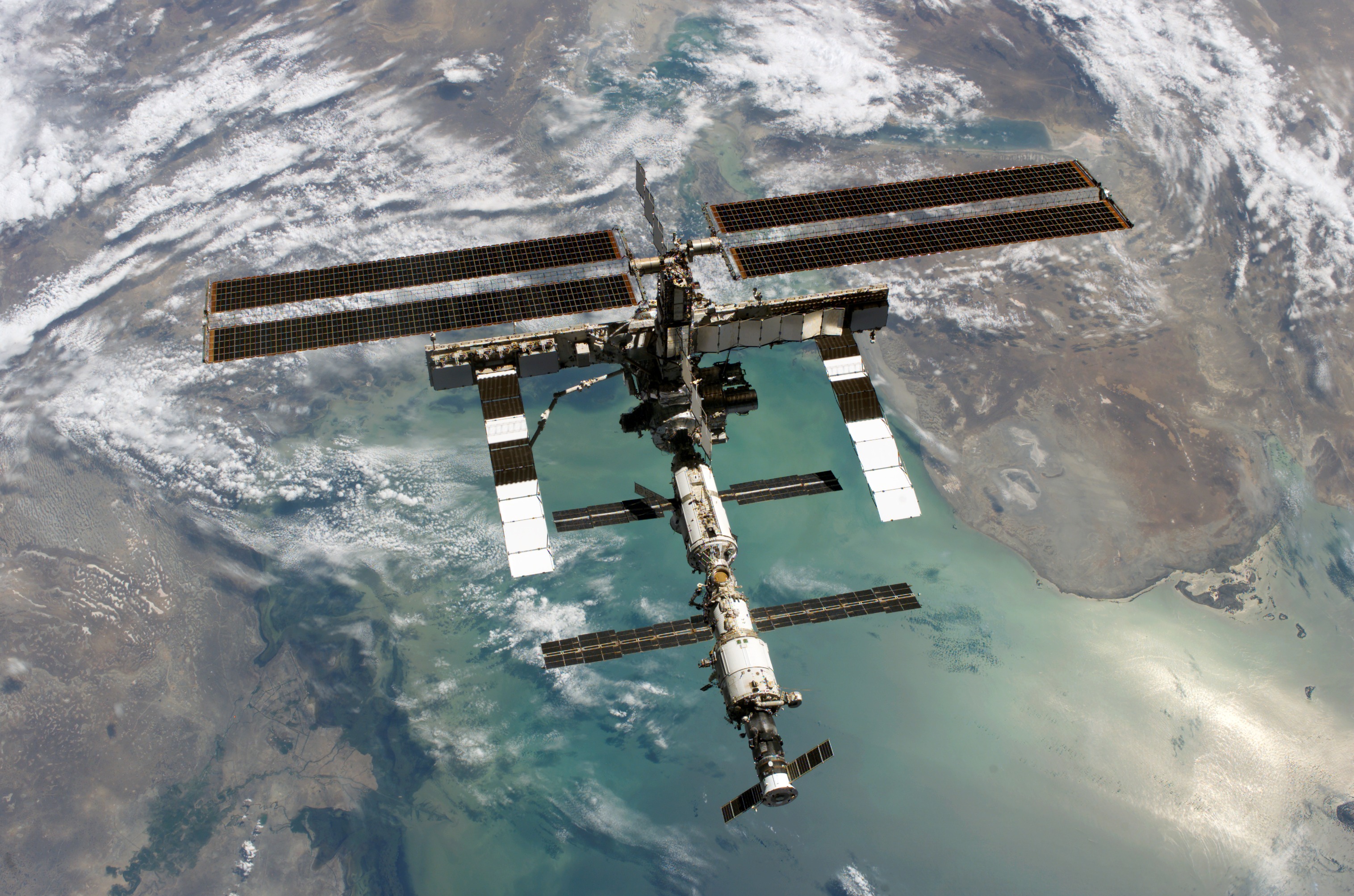
The International Space Station (ISS) provides a unique platform to view and study the Earth from space by supporting crew-operated and ground-commanded sensor systems. Multiple instruments, both externally mounted and operated from inside the Station, are used to collect data on the Earth's oceans, atmosphere, and land surface. Missions that have completed operations; are currently operating; and are planned for deployment on the ISS are presented below.
Overview of the International Space Station
Researcher's guide to the International Space Station*
External Payload Proposer's Guide*
* Requires Acrobat Reader to read
Overview of the International Space Station
Researcher's guide to the International Space Station*
External Payload Proposer's Guide*
* Requires Acrobat Reader to read
Current Missions
All
Atmosphere
Land
Ocean
Education

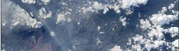
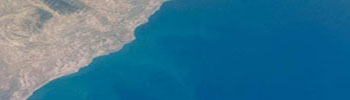
Crew Earth Observations (CEO)
Launch Date: November 2000
Works with scientists and classrooms around the world to use astronaut photography for scientific purposes
Atmosphere-Space Interactions Monitor (ASIM)
Launch Date: April 2018
Studying giant electrical discharges (lightning) in the high-altitude atmosphere above thunderstorms

DLR Earth-Sensing Imaging Spectrometer (DESIS)
Launch Date: June 2018
Imaging the Earth from the visible through the near infrared
ECOsystem Spaceborne Thermal Radiometer Experiment on Space Station (ECOSTRESS)
Launch Date: June 2018
Use thermal infrared (TIR) measurements over the diurnal cycle to address critical questions on plant-water dynamics and future ecosystem changes
Global Ecosystem Dynamics Investigation (GEDI)
Launch Date: October 2018
Characterize the effects of changing climate and land use on ecosystem structure and dynamics to improve quantification and understanding of the Earth's carbon cycle and biodiversity

Hyperspectral Imager Suite (HISUI)
Launch Date: 2019
Consists of a relfective telescope and two spectrometers to perform Earth observations
Lightning Image Sensor (LIS)
Launch Date: February 2017
The ISS LIS will provide real-time lightning data using the ISS Low Rate Telemetry channel for data sparse regions, especially over the ocean

Mini Extreme Universe Space Observatory (Mini-EUSO)
Launch Date: 2019
Designed to perform observations of the UV light emission from Earth
NanoRacks-ISS-HEIST
Launch Date: February 2018
Provides an effective space-based visible/near infrared (VNIR) hyperspectral sensing platform replacement for the decommissioned Hyperspectral Imaging Coastal Observatory (HICO) and Hyperion sensor aboard Earth Observing-1 (EO-1).
Orbiting Carbon Observatory - 3 (OCO-3)
Launch Date: April 2019
Consists of three high resolution grating spectrometers which collect space-based measurements of atmospheric carbon dioxide (CO2) to assess the spatial and temporal variability of CO2 over an annual cycle

Sally Ride EarthKAM
Launch Date: March 2001
Thousands of students can remotely control a digital camera mounted on the ISS and use it to take photographs of coastlines, mountain ranges, and other features

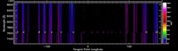
Stratospheric Aerosol and Gas Experiment (SAGE-III)
Launch Date: February 2017
Study ozone and measure the amount of ozone loss in the Earth's atmosphere

Terminator Experiment
Launch Date: 2019
Designed to characterize mass and energy transfers between layers of the atmosphere
Total Solar Irradiance (TSI) Spectral Solar Irradiance (SSI) (TSIS-1)
Launch Date: September 2017
Will provide absolute measurements of the total solar irradiance (TSI) and spectral solar irradiance (SSI), important for accurate scientific models of climate change and solar variability
Uragan-GC (Hurricane-GC)
Launch Date: November 2000
Further developed a sequence of visual observations of the Earth surface started earlier in the Mir station
Urthecast
Launch Date: November 2013
Four high-resolution cameras provide high definition video from the ISS
Future Missions
All
Atmosphere
Land
Ocean
Education
Climate Absolute Radiance and Refractivity Observatory (CLARREO)
Launch Date: 2023
Using a solar spectrometer, CLARREO performs measurements of solar reflectance providing better insight of Earth's cloud radiative feedback for understanding impacts to climate

Global navigation satellite systems reflectometry, radio occultation and scatterometry (GEROS)
Launch Date: 2019
Map ocean variability at finer spatial and temporal scales over a range of seas in tropical and temperate regions
Completed Missions
All
Atmosphere
Land
Ocean
Education
Agricultural Camera (AgCam; ISSAC)
March 2009 - March 2010
AgCam took frequent images, in visible and infrared light, of vegetated areas on Earth
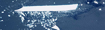
Cloud-Aerosol Transport System (CATS)
January 2015 - October 2018
Uses LiDAR to provide measurements of the particulate contents within the atmosphere, including clouds and aerosols
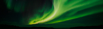
Coordinated Aurora Photography from Earth and Space (AuroraMAX)
September 2011 - May 2012
Crew members on the ISS took photographs of the Aurora Borealis from ISS as a public outreach initiative designed to inspire the public and learn more about solar-terrestrial science
Crew Earth Observations - International Polar Year (CEO-IPY)
September 2006 - April 2009
Supported an international collaboration of scientists studying the Earth's Polar Regions from 2007 to 2009
Diatomeya (Diatom)
November 2000 - April 2009
Used high-resolution photographs from space to examine boundaries between different types of ocean waters and how they change over time
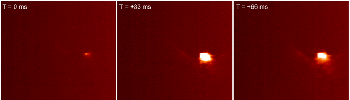
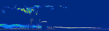
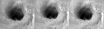
Global Lightning and sprIte MeasurementS on JEM-EF (JEM-GLIMS)
December 2012 - September 2015
Investigated the spatial distribution of lightning and plasma phenomena and their discharge characteristics throughout the atmosphere during night observation times

High Definition Earth-Viewing (HDEV)
March 2014 - August 2019
Four commercially available HD cameras were placed on the exterior of the ISS and produced a live strean video of Earth for viewing online.
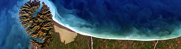
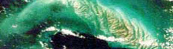
Hyperspectral Imager for the Coastal Oceans (HICO)
March 2009 - Fall 2014
The HICO camera images allow the study of the ocean’s bathymetry, shallow sea floor, water visibility and chlorophyll content, which indicates the presence of microscopic species of plankton
Ionosphere, Mesosphere, upper Atmosphere, and Plasmasphere mapping (IMAP)
October 2012 - September 2015
Studied the energy and plasma activity and related global transportation near the rim of atmosphere, at the highest altitudes, using a visible light spectrometer
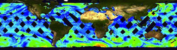
ISS-Rapid Scatterometer (RapidScat)
September 2014 - November 2016
Provide a gap-filler ocean vector winds measurement capability to mitigate the loss of the NASA Quick Scatterometer
ISS SERVIR Environmental Research and Visualization System (ISERV)
May 2012 - March 2015
Automatically takes images of Earth through a small telescope with an off-the-shelf digital camera mounted in the ISS Destiny module

Meteor Composition Determination (Meteor)
March 2016 - February 2019
Make first space-based observations of the chemical composition of meteors entering Earth's atmosphere
Observation of Environmental Phenomena (IMEDIAS)
August 2001 - December 2001
Aimed to put together a collection of original satellite images
Plankton-Linza-SA
December 2001 - June 2002
Obtain experimental data characterizing the effects of atmospheric, hydrophysical and geological factors on biological productivity of ocean waters surround the Republic of South Africa
Remote Atmospheric and Ionospheric Detection System (RAIDS)
April 2009 - September 2016
Designed to perform a comprehensive study of naturally occurring airglow emissions in the upper atmosphere
Rusalka-MKS (Mermaid-ISS)
October 2008 - May 2012
Test of the procedure to determine carbon dioxide and methane content in the Earth atmosphere to understand a role of natural processes and human activity determining the atmospheric content of NI2 and NI4
Seiner
October 2008 - September 2013
Investigation of the world oceans areas for check search and determine of the current position coordinates of bioproductive water areas
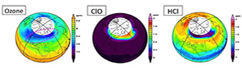
Superconducting Submillimeter-Wave Limb-Emission Sounder (SMILES)
March 2009 - September 2014
Evaluate quantitatively the recovery and stability of the stratospheric ozone layer
Tropical Cyclone
September 2014 - April 2020
This CASIS-funded experiment demonstrates the feasibility of studying tropical cyclones from space, which aid in alerting populations and governments around the world when a storm is approaching
Volny-PK-1 (Waves-PK-1)
March 2001 - October 2005
Recording and mapping of the wave processes in upper mesosphere and lower thermosphere by wave-like disturbances in the boundary surface between optically thin and optically dense atmosphere
Facilities
All
Complete
Current
Future

Multi-User System for Earth Sensing (MUSES)
Launch Date: 2016
Hosts Earth-observing instruments, such as high-resolution digital cameras, and provide precision pointing and other accommodations.
Multi-mission Consolidated Experiment
Launch Date: 2012
JAXA developed a Multi-mission Consolidated Equipment (MCE), as a series of the Exposed Facility (EF) experiments for the Kibo Second Phase Utilization.
NightPod
Launch Date: 2011
The NightPod camera stand tracks the movement of Earth passing under the ISS, keeping any target fixed in the middle of the viewfinder.
Window Observational Research Facility (WORF)
Launch Date: 2010
Provides a facility for Earth science remote sensing instruments using the Destiny science window with highest quality optics.
