< STS073-744-50 >
| NASA Photo ID | STS073-744-50 |
| Focal Length | 250mm |
| Date taken | 1995.10.27 |
| Time taken | 18:19:51 GMT |
Resolutions offered for this image:
3872 x 3904 pixels 634 x 639 pixels 5700 x 5900 pixels 500 x 518 pixels 640 x 480 pixels
3872 x 3904 pixels 634 x 639 pixels 5700 x 5900 pixels 500 x 518 pixels 640 x 480 pixels

Cloud masks available for this image:
Spacecraft nadir point: 33.5° N, 117.8° W
Photo center point: 34.0° N, 118.0° W
Photo center point by machine learning:
Photo center point: 34.0° N, 118.0° W
Photo center point by machine learning:
Nadir to Photo Center: North
Spacecraft Altitude: 144 nautical miles (267km)
Country or Geographic Name: | USA-CALIFORNIA |
Features: | LOS ANGELES AREA, COAST |
| Features Found Using Machine Learning: | |
Cloud Cover Percentage: | 0 (no clouds present) |
Sun Elevation Angle: | 40° |
Sun Azimuth: | 156° |
Camera: | Hasselblad |
Focal Length: | 250mm |
Camera Tilt: | 13 degrees |
Format: | 2443: Kodak Aerochrome 2443, color IR, thin base, EA-5 process thru June 1999, E-6 process afterward |
Film Exposure: | Normal |
| Additional Information | |
| Width | Height | Annotated | Cropped | Purpose | Links |
|---|---|---|---|---|---|
| 3872 pixels | 3904 pixels | No | No | Earth From Space collection | Download Image |
| 634 pixels | 639 pixels | No | No | Earth From Space collection | Download Image |
| 5700 pixels | 5900 pixels | No | No | Download Image Download Color Calibration Image for this Image |
|
| 500 pixels | 518 pixels | No | No | Download Image Download Color Calibration Image for this Image |
|
| 640 pixels | 480 pixels | No | No | Download Image |
Download Packaged File
Download a Google Earth KML for this Image
View photo footprint information
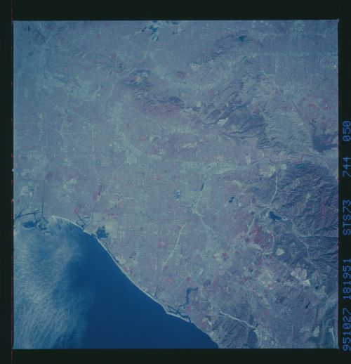
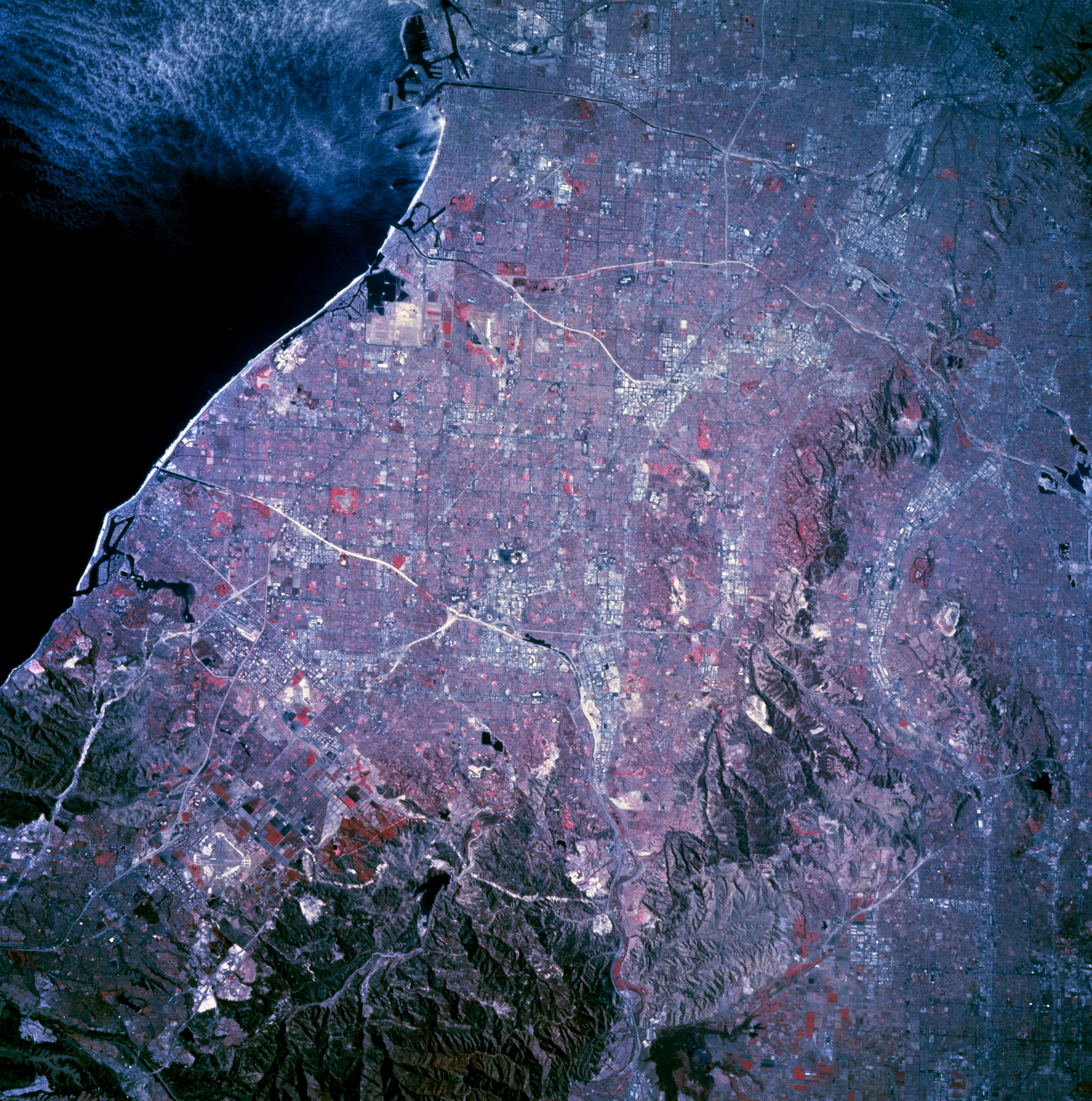
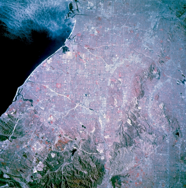
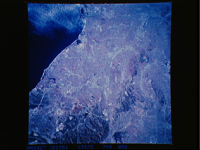
No GeoTIFF is available for this photo.Image Caption: STS073-744-050 Southern Metropolitan Los Angeles, California, U.S.A. October 1995
This photograph, except for the hilly regions in the southeastern quadrant, Chino Hills, and Puente Hills, features one of the world's most densely populated urban areas. Many of the larger commercial and industrial complexes of southeastern metropolitan Los Angeles can be identified by their highly reflective surfaces (concrete and steel). By contrast, the isolated reddish areas map parks and golf courses. Many of the white, highly reflective linear features are combinations of river courses (concrete aqueducts) and the major freeways that parallel them--the Santa Ana, San Gabriel, and Los Angeles Rivers have accompanying freeways (Riverside, San Gabriel, and Long Beach, respectively). Visible are two major harbor facilities along the Long Beach coast and a vast street grid pattern that characterizes this dynamic region.
This photograph, except for the hilly regions in the southeastern quadrant, Chino Hills, and Puente Hills, features one of the world's most densely populated urban areas. Many of the larger commercial and industrial complexes of southeastern metropolitan Los Angeles can be identified by their highly reflective surfaces (concrete and steel). By contrast, the isolated reddish areas map parks and golf courses. Many of the white, highly reflective linear features are combinations of river courses (concrete aqueducts) and the major freeways that parallel them--the Santa Ana, San Gabriel, and Los Angeles Rivers have accompanying freeways (Riverside, San Gabriel, and Long Beach, respectively). Visible are two major harbor facilities along the Long Beach coast and a vast street grid pattern that characterizes this dynamic region.
