STS073-744-49
| NASA Photo ID | STS073-744-49 |
| Focal Length | 250mm |
| Date taken | 1995.10.27 |
| Time taken | 18:19:47 GMT |
Resolutions offered for this image:
3904 x 3872 pixels 639 x 634 pixels 5700 x 5900 pixels 500 x 518 pixels 640 x 480 pixels
3904 x 3872 pixels 639 x 634 pixels 5700 x 5900 pixels 500 x 518 pixels 640 x 480 pixels

Cloud masks available for this image:
Spacecraft nadir point: 33.6° N, 118.1° W
Photo center point: 34.0° N, 118.5° W
Photo center point by machine learning:
Photo center point: 34.0° N, 118.5° W
Photo center point by machine learning:
Nadir to Photo Center: Northwest
Spacecraft Altitude: 144 nautical miles (267km)
Country or Geographic Name: | USA-CALIFORNIA |
Features: | LOS ANGELES, COAST |
| Features Found Using Machine Learning: | |
Cloud Cover Percentage: | 0 (no clouds present) |
Sun Elevation Angle: | 40° |
Sun Azimuth: | 155° |
Camera: | Hasselblad |
Focal Length: | 250mm |
Camera Tilt: | 13 degrees |
Format: | 2443: Kodak Aerochrome 2443, color IR, thin base, EA-5 process thru June 1999, E-6 process afterward |
Film Exposure: | Normal |
| Additional Information | |
| Width | Height | Annotated | Cropped | Purpose | Links |
|---|---|---|---|---|---|
| 3904 pixels | 3872 pixels | No | No | Earth From Space collection | Download Image |
| 639 pixels | 634 pixels | No | No | Earth From Space collection | Download Image |
| 5700 pixels | 5900 pixels | No | No | Download Image | |
| 500 pixels | 518 pixels | No | No | Download Image | |
| 640 pixels | 480 pixels | No | No | Download Image |
Download Packaged File
Download a Google Earth KML for this Image
View photo footprint information
Download a GeoTIFF for this photo
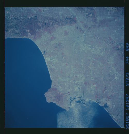
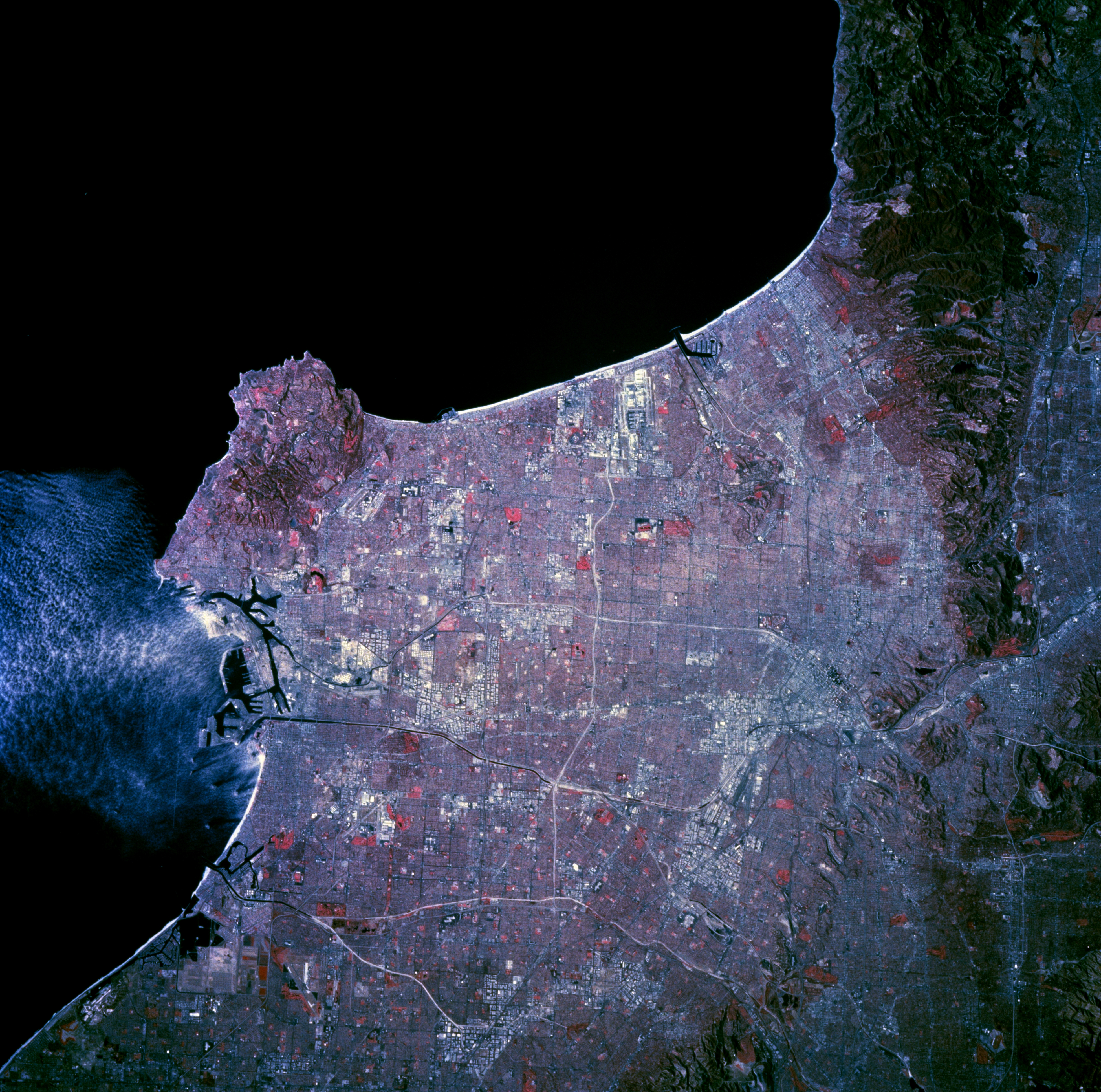
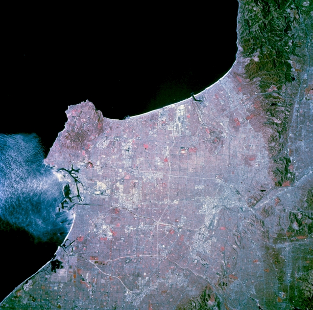
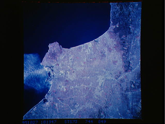
Image Caption: STS073-744-049 Central Los Angeles, California, U.S.A. November 1995
The network of freeways that crisscrosses metropolitan Los Angeles is captured in this near-vertical, color infrared photograph. Several major freeways--Long Beach, San Gabriel River, and Riverside--are immediately adjacent to and parallel with the major rivers that drain the basin. This relationship of freeway and river enhances the detectability of these corridors as highly reflective, white lines. The dark lines are either part of the road network or water channels for agriculture. Scattered industrial and commercial features appear as highly reflective, larger spatial areas. The central business district is visible. The east-west-oriented runways of Los Angeles International Airport are discernible midway between the Palos Verdes Hills and the Santa Monica Mountains adjacent to Santa Monica Bay. Two major port facilities lie east of the Palos Verdes Peninsula. Color infrared film displays green vegetation (parks, college campuses, or golf courses) as reds in the photograph.
The network of freeways that crisscrosses metropolitan Los Angeles is captured in this near-vertical, color infrared photograph. Several major freeways--Long Beach, San Gabriel River, and Riverside--are immediately adjacent to and parallel with the major rivers that drain the basin. This relationship of freeway and river enhances the detectability of these corridors as highly reflective, white lines. The dark lines are either part of the road network or water channels for agriculture. Scattered industrial and commercial features appear as highly reflective, larger spatial areas. The central business district is visible. The east-west-oriented runways of Los Angeles International Airport are discernible midway between the Palos Verdes Hills and the Santa Monica Mountains adjacent to Santa Monica Bay. Two major port facilities lie east of the Palos Verdes Peninsula. Color infrared film displays green vegetation (parks, college campuses, or golf courses) as reds in the photograph.
