< STS068-227-45 >
| NASA Photo ID | STS068-227-45 |
| Focal Length | 250mm |
| Date taken | 1994.10.01 |
| Time taken | 22:07:54 GMT |
Cloud masks available for this image:
Spacecraft nadir point: 24.3° S, 74.2° W
Photo center point: 20.0° S, 68.5° W
Photo center point by machine learning:
Photo center point: 20.0° S, 68.5° W
Photo center point by machine learning:
Nadir to Photo Center: Northeast
Spacecraft Altitude: 118 nautical miles (219km)
Camera: | Hasselblad |
Focal Length: | 250mm |
Camera Tilt: | High Oblique |
Format: | 5046: Kodak, natural color positive, Lumiere 100/5046, ASA 100, standard base |
Film Exposure: | Normal |
| Additional Information | |
| Width | Height | Annotated | Cropped | Purpose | Links |
|---|---|---|---|---|---|
| 5700 pixels | 5900 pixels | No | No | Download Image Download Color Calibration Image for this Image |
|
| 500 pixels | 518 pixels | No | No | Download Image Download Color Calibration Image for this Image |
|
| 640 pixels | 480 pixels | No | No | Download Image |
Download Packaged File
Download a Google Earth KML for this Image
View photo footprint information
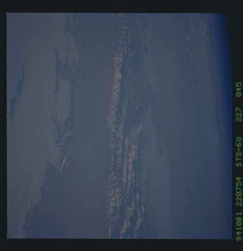
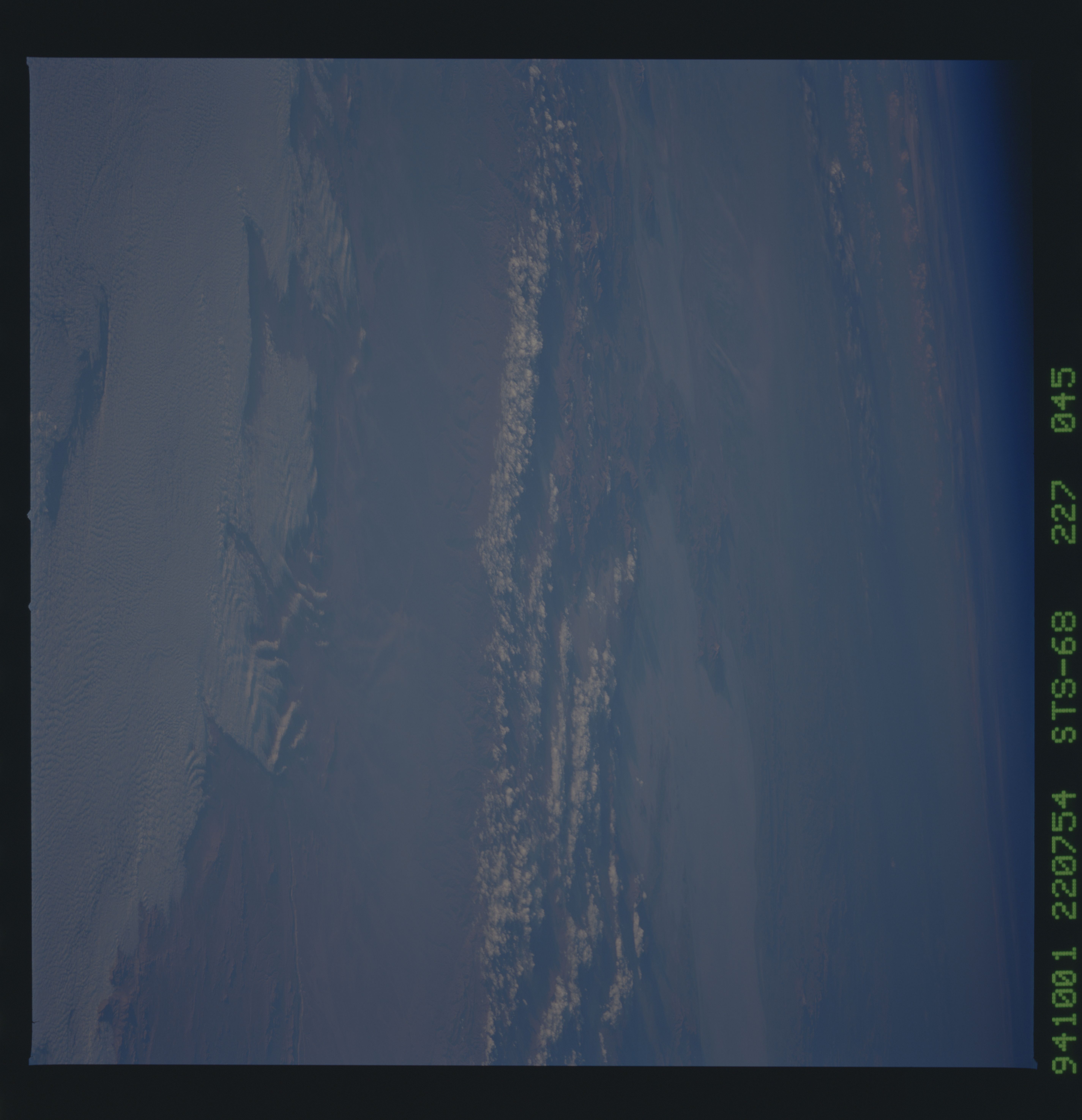
No GeoTIFF is available for this photo.Image Caption: This low-sun view shows the Altilano of Bolvia and the
largest dry lake of the Andes, Salar Uyuni. A series of dust plumes
blow from the east side of the smaller Salar Coipasa due north (left)
of Uyuni. This is the 8th dust event seen in this region since Sept
1983 (STS-08) and indicates that Altiplano dust blowing east is a
geological constant of the region. It also tends to confirm existing
weak statistics that October is the prime month for the development of
dust plumes. Altiplano dust is probably a prominent supplier of
nutrient to Amazonian soils, perhaps more important than Saharan dust
carried long distances through the atmosphere: the latest theory is
that Saharan dust is the prime source of Amazon soil nutrient.
