[Skip to Content]
Earth From Space
Earth from Space logo  56 Matches Search ResultsEarth from Space logo

Image: gray corner Image: gray corner
View Image Information
Image: Geographic Location
Image: gray corner Image: gray corner

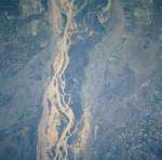
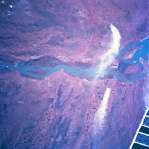
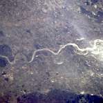
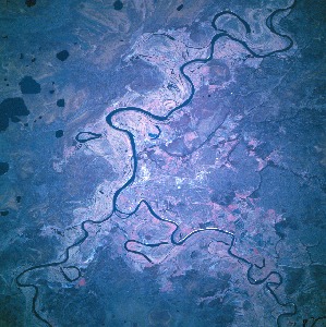
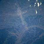
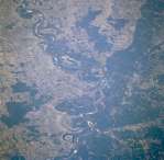
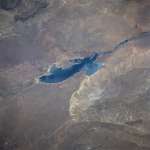
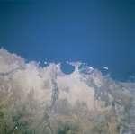
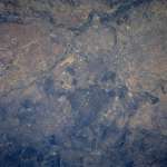
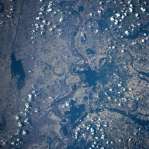
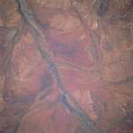
Photo #: ISS016-E-22772 Technical Info
All Available Images Lo-Resolution 301k
Features: FLOOD PLAIN, APPLECROSS, PERTH METRO AREA, PERTH, RIVER, SUNGLINT
Geographic Region: AUSTRALIA-WA


Image: gray corner Image: gray corner
View Image Information
Image: Geographic Location
Image: gray corner Image: gray corner

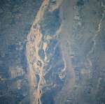
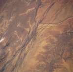
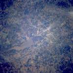
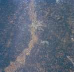
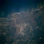
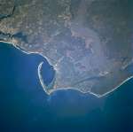
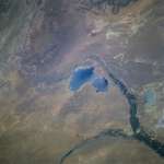
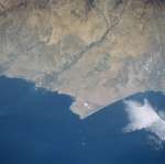
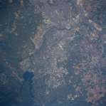
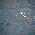
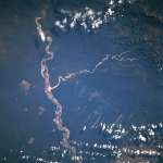
Photo #: ISS022-E-19513 Technical Info
All Available Images Lo-Resolution 275k
Features: COLONEL JOSEFA AREA, CHANNEL, RIVER, RIO NEGRO, FLOOD PLAIN
Geographic Region: ARGENTINA


Image: gray corner Image: gray corner
View Image Information
Image: Geographic Location
Image: gray corner Image: gray corner

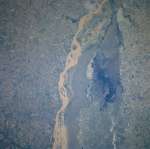
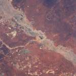
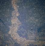
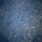
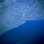
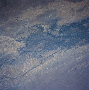
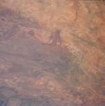
Photo #: NM23-719-442 Technical Info
All Available Images Lo-Resolution 475k
Features: SEDIMENT, RIVER, RIO PARANA, AGRICULTURE, FLOOD PLAIN
Geographic Region: ARGENTINA


Image: gray corner Image: gray corner
View Image Information
Image: Geographic Location
Image: gray corner Image: gray corner

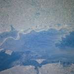
Photo #: NM23-719-444 Technical Info
All Available Images Lo-Resolution 471k
Features: AGRICULTURE, FLOOD PLAIN, SEDIMENT, RIO PARANA, RIVER
Geographic Region: ARGENTINA


Image: gray corner Image: gray corner
View Image Information
Image: Geographic Location
Image: gray corner Image: gray corner

Photo #: NM23-719-446 Technical Info
All Available Images Lo-Resolution 462k
Features: FLOOD PLAIN, AGRICULTURE, LAKE, RIO PARANA, RIVER, SEDIMENT
Geographic Region: ARGENTINA


Image: gray corner Image: gray corner
View Image Information
Image: Geographic Location
Image: gray corner Image: gray corner

Photo #: NM23-719-448 Technical Info
All Available Images Lo-Resolution 428k
Features: SWAMP, RIVER, RIO PARANA, FLOOD PLAIN, AGRICULTURE
Geographic Region: ARGENTINA


Image: gray corner Image: gray corner
View Image Information
Image: Geographic Location
Image: gray corner Image: gray corner

Photo #: NM23-773-56 Technical Info
All Available Images Lo-Resolution 376k
Features: SMOKE, RIVER, RIO PARANA, FLOOD PLAIN
Geographic Region: PARAGUAY


Image: gray corner Image: gray corner
View Image Information
Image: Geographic Location
Image: gray corner Image: gray corner

Photo #: STS051-101-54 Technical Info
All Available Images Lo-Resolution 310k
Features: FLOOD PLAIN, DESERT, GEORGINA RIVER, RIVER
Geographic Region: AUSTRALIA-Q


Image: gray corner Image: gray corner
View Image Information
Image: Geographic Location
Image: gray corner Image: gray corner

Photo #: STS055-81-59 Technical Info
All Available Images Lo-Resolution 359k
Features: SWAMP, RIVER, AGRICULTURE, ATCHAFALAYA FORK, PLAIN, RED R., FLOOD PLAIN
Geographic Region: USA-LOUISIANA


Image: gray corner Image: gray corner
View Image Information
Image: Geographic Location
Image: gray corner Image: gray corner

Photo #: STS056-76-13 Technical Info
All Available Images Lo-Resolution 402k
Features: TOWNS, SAVANNAH R., RIVER, AGR., FLOOD PLAIN
Geographic Region: USA-SOUTH CAROLINA


Image: gray corner Image: gray corner
View Image Information
Image: Geographic Location
Image: gray corner Image: gray corner

Photo #: STS056-96-47 Technical Info
All Available Images Lo-Resolution 327k
Features: COAST, RIVER, SEDIMENT, AIRPORT, FITZROY RIVER, FLOOD PLAIN
Geographic Region: AUSTRALIA-WA


Image: gray corner Image: gray corner
View Image Information
Image: Geographic Location
Image: gray corner Image: gray corner

Photo #: STS059-L06-10 Technical Info
All Available Images Lo-Resolution 274k
Features: FLOOD PLAIN, DESERT, BASIN, BARKLY TABLELAND, RIVER
Geographic Region: AUSTRALIA-Q


Image: gray corner Image: gray corner
View Image Information
Image: Geographic Location
Image: gray corner Image: gray corner

Photo #: STS062-81-7 Technical Info
All Available Images Lo-Resolution 417k
Features: RIVER, OHIO R., FLOOD PLAIN, CINCINNATI AREA, AIRPORT
Geographic Region: USA-INDIANA


Image: gray corner Image: gray corner
View Image Information
Image: Geographic Location
Image: gray corner Image: gray corner

Photo #: STS062-83-57 Technical Info
All Available Images Lo-Resolution 392k
Features: RIVER, AGR, AGRICULTURE, FLOOD PLAIN, MISS. R.
Geographic Region: USA-MISSOURI


Image: gray corner Image: gray corner
View Image Information
Image: Geographic Location
Image: gray corner Image: gray corner

Photo #: STS062-86-106 Technical Info
All Available Images Lo-Resolution 371k
Features: ARKANSAS & MISSISSIPPI R, RIVER, AGRICULTURE, FLOOD PLAIN
Geographic Region: USA-MISSISSIPPI


Image: gray corner Image: gray corner
View Image Information
Image: Geographic Location
Image: gray corner Image: gray corner

Photo #: STS062-86-107 Technical Info
All Available Images Lo-Resolution 363k
Features: RIVER, AGRICULTURE, MISSISSIPPI R, FLOOD PLAIN
Geographic Region: USA-MISSISSIPPI


Image: gray corner Image: gray corner
View Image Information
Image: Geographic Location
Image: gray corner Image: gray corner

Photo #: STS062-98-62 Technical Info
All Available Images Lo-Resolution 391k
Features: FLOOD PLAIN, HIGHWAY, JACKSON, ROSS BENNETT RES, HILL, RESERVOIR, AIRPORT, RIVER, URBAN AREA
Geographic Region: USA-MISSISSIPPI


Image: gray corner Image: gray corner
View Image Information
Image: Geographic Location
Image: gray corner Image: gray corner

Photo #: STS062-113-148 Technical Info
All Available Images Lo-Resolution 349k
Features: PLAYA, FLOOD PLAIN, DARLING R. VA., AGRICULTURE, RIVER, WARREGO R, BASIN
Geographic Region: AUSTRALIA-Q


Image: gray corner Image: gray corner
View Image Information
Image: Geographic Location
Image: gray corner Image: gray corner

Photo #: STS066-119-94 Technical Info
All Available Images Lo-Resolution 316k
Features: HAMILTON RIVER, RIVER, BURKE R., BASIN, FLOOD PLAIN
Geographic Region: AUSTRALIA-Q


Image: gray corner Image: gray corner
View Image Information
Image: Geographic Location
Image: gray corner Image: gray corner

Photo #: STS066-126-97 Technical Info
All Available Images Lo-Resolution 338k
Features: RIVER, URBAN AREA, PENSACOLA, BAY, AGRICULTURE, PLAIN, COAST, SWAMP, DELTA, FLOOD PLAIN, HIGHWAY
Geographic Region: USA-FLORIDA


Image: gray corner Image: gray corner
View Image Information
Image: Geographic Location
Image: gray corner Image: gray corner

Photo #: STS066-158-95 Technical Info
All Available Images Lo-Resolution 126k
Features: AGRICULTURE, FLOOD PLAIN, MISSISSIPPI RIVER, RIVER
Geographic Region: USA-MISSISSIPPI


Image: gray corner Image: gray corner
View Image Information
Image: Geographic Location
Image: gray corner Image: gray corner

Photo #: STS066-158-97 Technical Info
All Available Images Lo-Resolution 137k
Features: RIVER, URBAN AREA, AIRPORT, RESERVOIR, MEMPHIS AREA, ESCARPMENT, FLOOD PLAIN
Geographic Region: USA-TENNESSEE


Image: gray corner Image: gray corner
View Image Information
Image: Geographic Location
Image: gray corner Image: gray corner

Photo #: STS066-158-98 Technical Info
All Available Images Lo-Resolution 135k
Features: RIVER, FLOOD PLAIN, MS. RIVER, LAKE, DYERSBURG AREA
Geographic Region: USA-TENNESSEE


Image: gray corner Image: gray corner
View Image Information
Image: Geographic Location
Image: gray corner Image: gray corner

Photo #: STS068-167-X Technical Info
All Available Images Lo-Resolution 304k
Features: FLOOD PLAIN, LAKE, MOUNTAIN, HIGHWAY, LITTLE ROCK, AGRICULTURE, ARKANSAS RIVER, RIVER
Geographic Region: USA-ARKANSAS


Image: gray corner Image: gray corner
View Image Information
Image: Geographic Location
Image: gray corner Image: gray corner

Photo #: STS068-167-Y Technical Info
All Available Images Lo-Resolution 319k
Features: RIVER, ARKANSAS RIVER, PINE BLUFF, FOREST, FLOOD PLAIN
Geographic Region: USA-ARKANSAS


Image: gray corner Image: gray corner
View Image Information
Image: Geographic Location
Image: gray corner Image: gray corner

Photo #: STS068-200-105 Technical Info
All Available Images Lo-Resolution 394k
Features: RIVER, FLOOD PLAIN, TOBOL RIVER VALLEY
Geographic Region: RUSSIAN FEDERATION


Image: gray corner Image: gray corner
View Image Information
Image: Geographic Location
Image: gray corner Image: gray corner

Photo #: STS068-200-106 Technical Info
All Available Images Lo-Resolution 387k
Features: RIVER, TOBOL RIVER VALLEY, FLOOD PLAIN
Geographic Region: RUSSIAN FEDERATION


Image: gray corner Image: gray corner
View Image Information
Image: Geographic Location
Image: gray corner Image: gray corner

Photo #: STS068-232-42 Technical Info
All Available Images Lo-Resolution 51k
Features: FLOOD PLAIN, CADDO LAKE, SHREVEPORT, AIRPORT, RESERVOIR, PLAIN, RIVER, URBAN AREA
Geographic Region: USA-LOUISIANA


Image: gray corner Image: gray corner
View Image Information
Image: Geographic Location
Image: gray corner Image: gray corner

Photo #: STS068-232-43 Technical Info
All Available Images Lo-Resolution 67k
Features: AGRICULTURE, RESERVOIR, FOREST, SMOKE, HIGHWAY, MONROE, OUACHITA R, FLOOD PLAIN
Geographic Region: USA-MISSISSIPPI


Image: gray corner Image: gray corner
View Image Information
Image: Geographic Location
Image: gray corner Image: gray corner

Photo #: STS068-244-70 Technical Info
All Available Images Lo-Resolution 349k
Features: OBIHIRO, PLAIN, AGRICULTURE, RIVER, FLOOD PLAIN, HIGHWAY, MOUNTAIN, HOKKAIDO
Geographic Region: JAPAN


Image: gray corner Image: gray corner
View Image Information
Image: Geographic Location
Image: gray corner Image: gray corner

Photo #: STS073-706-6 Technical Info
All Available Images Lo-Resolution 322k
Features: COAST, HIGHWAY, FLOOD PLAIN, RIVER, URBAN AREA, RIVERS, AIRPORT, PLAIN, SAVANNAH, ESTUARY
Geographic Region: USA-GEORGIA


Image: gray corner Image: gray corner
View Image Information
Image: Geographic Location
Image: gray corner Image: gray corner

Photo #: STS073-726-31 Technical Info
All Available Images Lo-Resolution 350k
Features: RES., RIVER, RESERVOIR, PLAIN, AGRICULTURE, HILL, RED RIVER, FLOOD PLAIN
Geographic Region: USA-LOUISIANA


Image: gray corner Image: gray corner
View Image Information
Image: Geographic Location
Image: gray corner Image: gray corner

Photo #: STS073-759-31 Technical Info
All Available Images Lo-Resolution 335k
Features: VICKSBURG, MISSISSIPPI R., ESCARPMENT, FLOOD PLAIN, RIVER, AGRICULTURE, FOREST, HILL
Geographic Region: USA-MISSISSIPPI


Image: gray corner Image: gray corner
View Image Information
Image: Geographic Location
Image: gray corner Image: gray corner

Photo #: STS075-723-25 Technical Info
All Available Images Lo-Resolution 279k
Features: SWAMP, COAST, FLOOD PLAIN, DRAINAGE, CANAL, BAY, FOREST, CAPE SAN BLAS
Geographic Region: USA-FLORIDA


Image: gray corner Image: gray corner
View Image Information
Image: Geographic Location
Image: gray corner Image: gray corner

Photo #: STS078-734-7 Technical Info
All Available Images Lo-Resolution 373k
Features: RED R., FLOOD PLAIN, WICHITA FALLS, AGRICULTURE, AIRPORT, PLAIN, RIVER, AGR, URBAN AREA
Geographic Region: USA-TEXAS


Image: gray corner Image: gray corner
View Image Information
Image: Geographic Location
Image: gray corner Image: gray corner

Photo #: STS078-734-54 Technical Info
All Available Images Lo-Resolution 392k
Features: RIVER, URBAN AREA, ST. JOSEPH, FLOOD PLAIN, AIRPORT, HIGHWAY, MISSOURI R.
Geographic Region: USA-MISSOURI


Image: gray corner Image: gray corner
View Image Information
Image: Geographic Location
Image: gray corner Image: gray corner

Photo #: STS078-736-30 Technical Info
All Available Images Lo-Resolution 403k
Features: OHIO R., AGR., RIVER, AIRPORT, HILL, HIGHWAY, FLOOD PLAIN, CINCINNATI
Geographic Region: USA-OHIO


Image: gray corner Image: gray corner
View Image Information
Image: Geographic Location
Image: gray corner Image: gray corner

Photo #: STS078-758-94 Technical Info
All Available Images Lo-Resolution 438k
Features: AGRICULTURE, ILLINOIS & MISSISSIPPI R, FLOOD PLAIN, FOREST, RIVER
Geographic Region: USA-ILLINOIS


Image: gray corner Image: gray corner
View Image Information
Image: Geographic Location
Image: gray corner Image: gray corner

Photo #: STS079-812-85 Technical Info
All Available Images Lo-Resolution 359k
Features: LAKE, MISSISSIPPI R, FLOOD PLAIN, VALLEY, RIVER, AGRICULTURE, FOREST, CLARKSDALE
Geographic Region: USA-MISSISSIPPI


Image: gray corner Image: gray corner
View Image Information
Image: Geographic Location
Image: gray corner Image: gray corner

Photo #: STS081-728-88 Technical Info
All Available Images Lo-Resolution 316k
Features: DESERT, RIVER, RAMOS MEXIA RESERVOIR, RESERVOIR, FLOOD PLAIN
Geographic Region: ARGENTINA


Image: gray corner Image: gray corner
View Image Information
Image: Geographic Location
Image: gray corner Image: gray corner

Photo #: STS081-728-89 Technical Info
All Available Images Lo-Resolution 306k
Features: DESERT, RIVER, PLANICIE BANDERITA LAKE, RESERVOIR, FLOOD PLAIN
Geographic Region: ARGENTINA


Image: gray corner Image: gray corner
View Image Information
Image: Geographic Location
Image: gray corner Image: gray corner

Photo #: STS084-712-99 Technical Info
All Available Images Lo-Resolution 354k
Features: SEA, FLOOD PLAIN, RIVER, COAST, DANUBE RIVER, CONSTANTA
Geographic Region: ROMANIA


Image: gray corner Image: gray corner
View Image Information
Image: Geographic Location
Image: gray corner Image: gray corner

Photo #: STS084-727-46 Technical Info
All Available Images Lo-Resolution 269k
Features: CHIMBOTE, FLOOD PLAIN, AGRICULTURE, RIVER, COAST, DESERT
Geographic Region: PERU


Image: gray corner Image: gray corner
View Image Information
Image: Geographic Location
Image: gray corner Image: gray corner

Photo #: STS084-727-49 Technical Info
All Available Images Lo-Resolution 286k
Features: FLOOD PLAIN, HUACHO, AGRICULTURE, RIVER, COAST, DESERT
Geographic Region: PERU


Image: gray corner Image: gray corner
View Image Information
Image: Geographic Location
Image: gray corner Image: gray corner

Photo #: STS085-750-7 Technical Info
All Available Images Lo-Resolution 371k
Features: RIVER, BASIN, FLOOD PLAIN, MADRID, RESERVOIR, AIRPORT
Geographic Region: SPAIN


Image: gray corner Image: gray corner
View Image Information
Image: Geographic Location
Image: gray corner Image: gray corner

Photo #: STS090-721-40 Technical Info
All Available Images Lo-Resolution 357k
Features: FLOOD PLAIN, LAKE, HIGHWAY, URBAN AREA, RIVER, AGR, SACRAMENTO, HILL, AIRPORT, RESERVOIR, AGRICULTURE
Geographic Region: USA-CALIFORNIA


Image: gray corner Image: gray corner
View Image Information
Image: Geographic Location
Image: gray corner Image: gray corner

Photo #: STS090-721-76 Technical Info
All Available Images Lo-Resolution 335k
Features: WACO, BRAZOS R., L. WACO, RIVER, AIRPORT, PLAIN, HILL, HIGHWAY, LAKE, FLOOD PLAIN
Geographic Region: USA-TEXAS


Image: gray corner Image: gray corner
View Image Information
Image: Geographic Location
Image: gray corner Image: gray corner

Photo #: STS090-755-60 Technical Info
All Available Images Lo-Resolution 389k
Features: ST. LOUIS, RIVER, URBAN AREA, HIGHWAY, AIRPORT, HILL, FLOOD PLAIN
Geographic Region: USA-MISSOURI


Image: gray corner Image: gray corner
View Image Information
Image: Geographic Location
Image: gray corner Image: gray corner

Photo #: STS091-707-17 Technical Info
All Available Images Lo-Resolution 374k
Features: LAKE, FLOOD PLAIN, FOREST, ATCHAFALAYA RIVER, SWAMP, RIVER
Geographic Region: USA-LOUISIANA


Image: gray corner Image: gray corner
View Image Information
Image: Geographic Location
Image: gray corner Image: gray corner

Photo #: STS091-707-24 Technical Info
All Available Images Lo-Resolution 385k
Features: RIVER, AR. RIVER, FOREST, FLOOD PLAIN, AGRICULTURE, LAKE, MISSISSIPPI R.
Geographic Region: USA-MISSISSIPPI


Image: gray corner Image: gray corner
View Image Information
Image: Geographic Location
Image: gray corner Image: gray corner

Photo #: STS091-707-27 Technical Info
All Available Images Lo-Resolution 394k
Features: AGRICULTURE, FLOOD PLAIN, MISSISSIPPI RIVER, AGR., RIVER
Geographic Region: USA-ARKANSAS


Image: gray corner Image: gray corner
View Image Information
Image: Geographic Location
Image: gray corner Image: gray corner

Photo #: STS091-708-14 Technical Info
All Available Images Lo-Resolution 303k
Features: SWAMP, R. PARAGUAI, FLOOD PLAIN, CACERES, RIVER, HILL, MTS., PLAIN
Geographic Region: BRAZIL


Image: gray corner Image: gray corner
View Image Information
Image: Geographic Location
Image: gray corner Image: gray corner

Photo #: STS091-714-66 Technical Info
All Available Images Lo-Resolution 358k
Features: RIVER, DESERT, SYRDAR RIVER, FLOOD PLAIN, AGRICULTURE
Geographic Region: KAZAKHSTAN


Image: gray corner Image: gray corner
View Image Information
Image: Geographic Location
Image: gray corner Image: gray corner

Photo #: STS41D-42-23 Technical Info
All Available Images Lo-Resolution 320k
Features: FLOOD PLAIN, RIVER, GASCOYNE RIVER
Geographic Region: AUSTRALIA-WA


Image: gray corner Image: gray corner
View Image Information
Image: Geographic Location
Image: gray corner Image: gray corner

Photo #: STS51A-45-58 Technical Info
All Available Images Lo-Resolution 323k
Features: AGRICULTURE, RIO GRANDE, FLOOD PLAIN, SEDIMENT, RIVER
Geographic Region: BOLIVIA


Image: gray corner Image: gray corner
View Image Information
Image: Geographic Location
Image: gray corner Image: gray corner

Photo #: STS51I-40-27 Technical Info
All Available Images Lo-Resolution 326k
Features: FLOOD PLAIN, MOUNTAIN, RIVER, LYONS RIVER
Geographic Region: AUSTRALIA-WA


NASA
Home Page
JSC
Home Page
JSC Digital
Image Collection
Earth Science &
Remote Sensing
NASA meatball logo
This service is provided by the International Space Station program and the JSC Earth Science & Remote Sensing Unit, ARES Division, Exploration Integration Science Directorate.
ESRS logo