STS61A-48-4
| NASA Photo ID | STS61A-48-4 |
| Focal Length | 250mm |
| Date taken | 1985.11.03 |
| Time taken | 02:57:14 GMT |
Resolutions offered for this image:
4096 x 4096 pixels 640 x 640 pixels 5700 x 5900 pixels 500 x 518 pixels 640 x 480 pixels 514 x 513 pixels
4096 x 4096 pixels 640 x 640 pixels 5700 x 5900 pixels 500 x 518 pixels 640 x 480 pixels 514 x 513 pixels

Cloud masks available for this image:
Spacecraft nadir point: 16.9° N, 103.2° E
Photo center point: 18.0° N, 102.5° E
Photo center point by machine learning:
Photo center point: 18.0° N, 102.5° E
Photo center point by machine learning:
Nadir to Photo Center: Northwest
Spacecraft Altitude: 176 nautical miles (326km)
Country or Geographic Name: | LAOS |
Features: | MEKONG RIVER |
| Features Found Using Machine Learning: | |
Cloud Cover Percentage: | 5 (1-10)% |
Sun Elevation Angle: | 47° |
Sun Azimuth: | 137° |
Camera: | Hasselblad |
Focal Length: | 250mm |
Camera Tilt: | 24 degrees |
Format: | 5017: Kodak, natural color positive, Ektachrome, X Professional, ASA 64, standard base |
Film Exposure: | Normal |
| Additional Information | |
| Width | Height | Annotated | Cropped | Purpose | Links |
|---|---|---|---|---|---|
| 4096 pixels | 4096 pixels | No | No | Earth From Space collection | Download Image |
| 640 pixels | 640 pixels | No | No | Earth From Space collection | Download Image |
| 5700 pixels | 5900 pixels | No | No | Download Image | |
| 500 pixels | 518 pixels | No | No | Download Image | |
| 640 pixels | 480 pixels | No | No | Download Image | |
| 514 pixels | 513 pixels | Download Image |
Download Packaged File
Download a Google Earth KML for this Image
View photo footprint information
Download a GeoTIFF for this photo
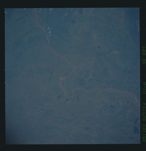
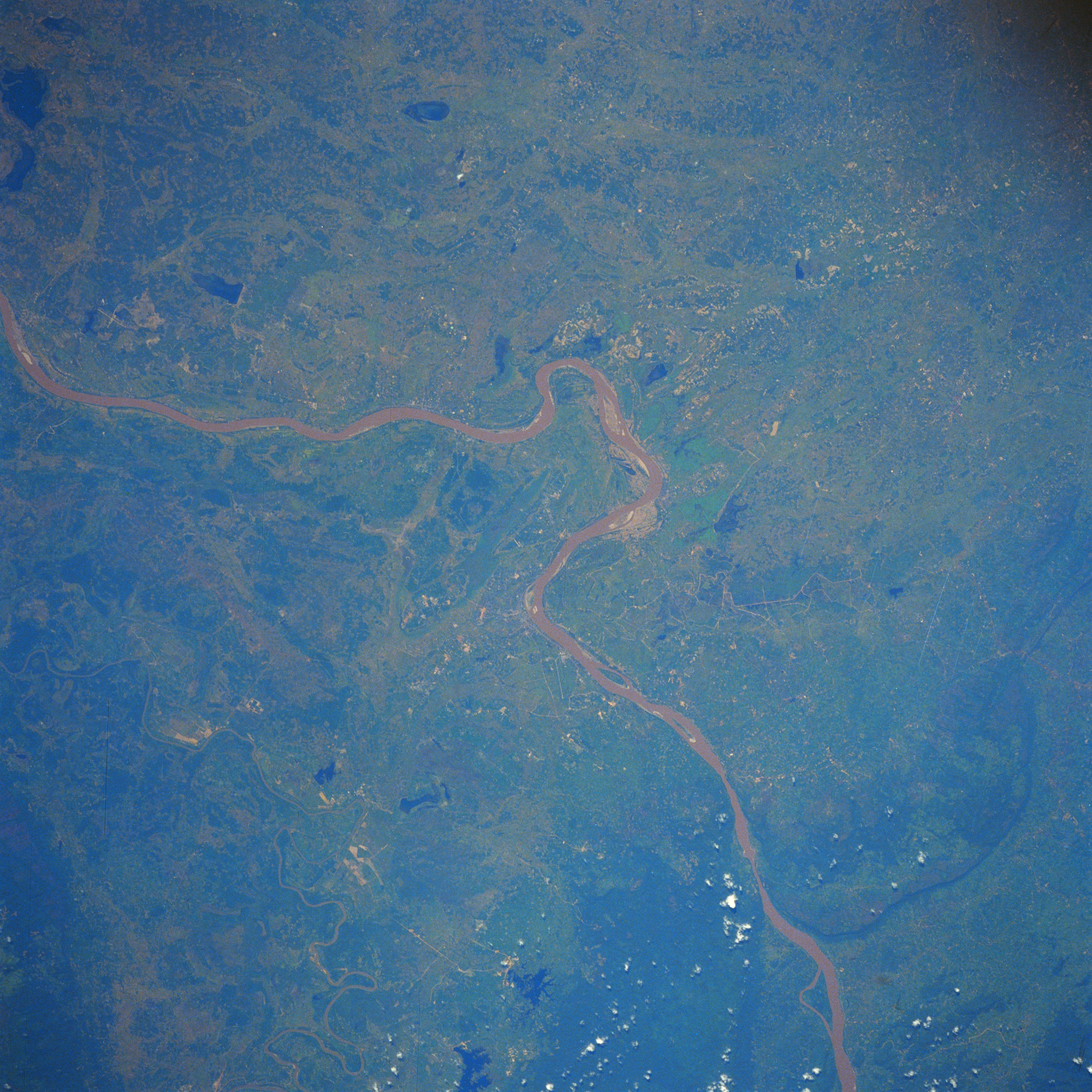
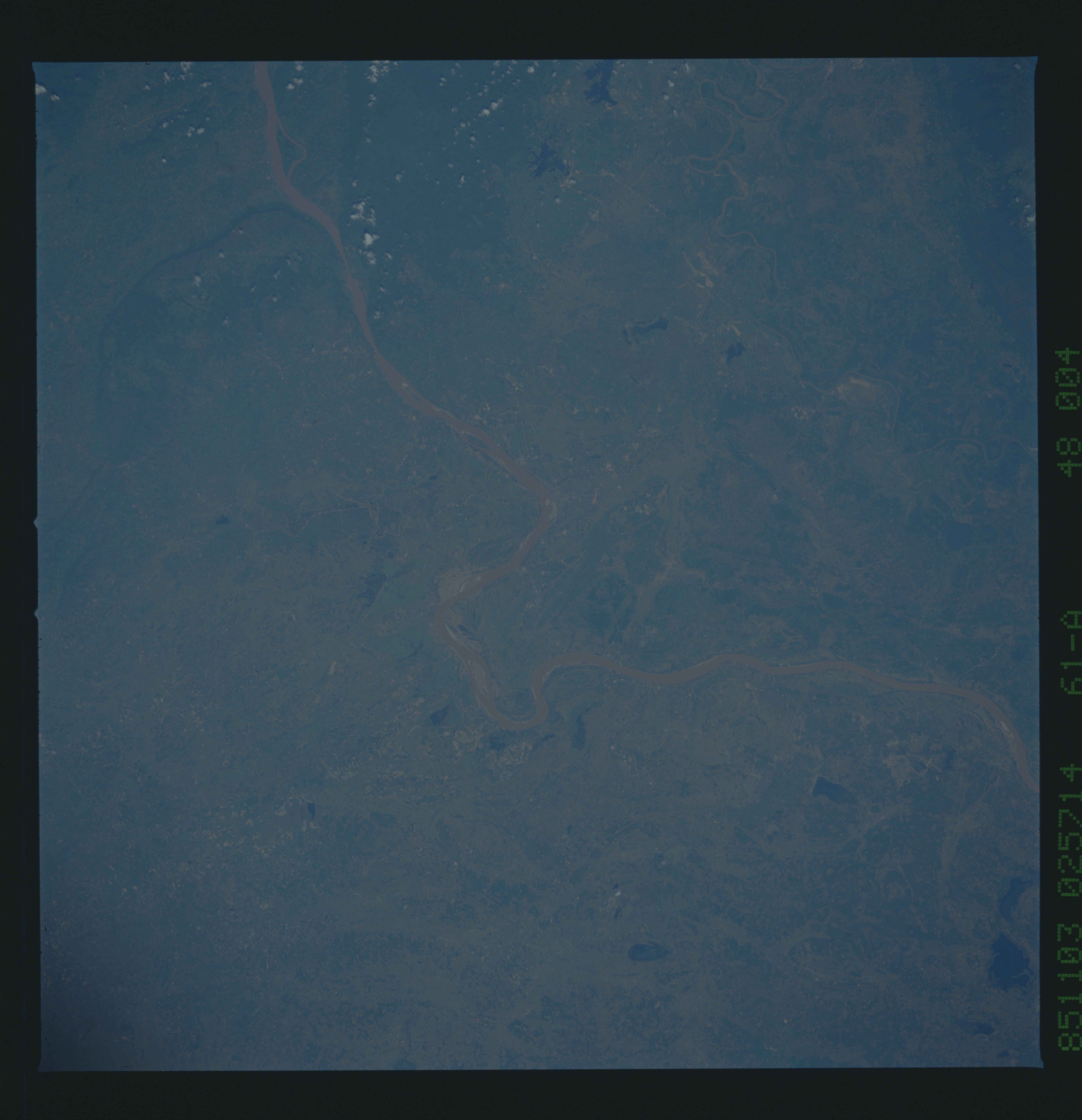
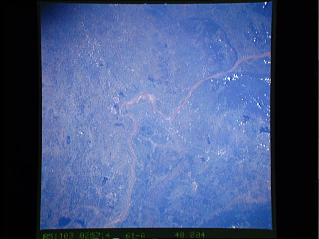
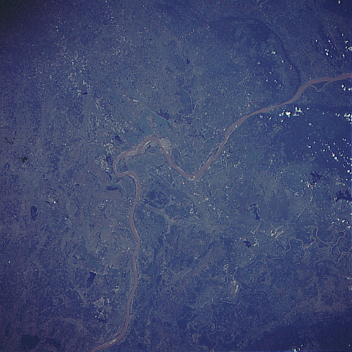
Image Caption: STS61A-48-0004 Mekong River, Laos November 1985
The muddy (brownish-looking) Mekong River, the major "highway" into Laos, forms part of the border between Laos (north) and Thailand (south). The Mekong has created fertile alluvial plains on both sides of the river valley. The Ngum River, a much smaller tributary stream of the Mekong, can also be seen as it meanders across the landscape north of the Mekong. The location of the Laotian capital, Vientiane, is barely discernible on the north side of the Mekong where the river makes its last sharp turn to the west (slightly below center). Vientiane is the smallest capital city (less than 400000 people) of all the countries on the mainland of Southeast Asia. The dark irregular shaped features that are scattered across the image are small lakes or reservoirs. Low, vegetated hills (dark areas bottom center and right) can be identified where the Mekong has cut a channel through the hills as the water flows southeasterly.
The muddy (brownish-looking) Mekong River, the major "highway" into Laos, forms part of the border between Laos (north) and Thailand (south). The Mekong has created fertile alluvial plains on both sides of the river valley. The Ngum River, a much smaller tributary stream of the Mekong, can also be seen as it meanders across the landscape north of the Mekong. The location of the Laotian capital, Vientiane, is barely discernible on the north side of the Mekong where the river makes its last sharp turn to the west (slightly below center). Vientiane is the smallest capital city (less than 400000 people) of all the countries on the mainland of Southeast Asia. The dark irregular shaped features that are scattered across the image are small lakes or reservoirs. Low, vegetated hills (dark areas bottom center and right) can be identified where the Mekong has cut a channel through the hills as the water flows southeasterly.
