STS108-718-41
| NASA Photo ID | STS108-718-41 |
| Focal Length | 110mm |
| Date taken | 2001.12.11 |
| Time taken | 12:47:07 GMT |
Resolutions offered for this image:
1031 x 1024 pixels 2063 x 2048 pixels 4127 x 4096 pixels 515 x 512 pixels 4095 x 4095 pixels 640 x 640 pixels 400 x 400 pixels
1031 x 1024 pixels 2063 x 2048 pixels 4127 x 4096 pixels 515 x 512 pixels 4095 x 4095 pixels 640 x 640 pixels 400 x 400 pixels


Cloud masks available for this image:
Spacecraft nadir point: 29.9° N, 31.1° E
Photo center point: 26.5° N, 35.0° E
Photo center point by machine learning:
Photo center point: 26.5° N, 35.0° E
Photo center point by machine learning:
Nadir to Photo Center: Southeast
Spacecraft Altitude: 200 nautical miles (370km)
Country or Geographic Name: | RED SEA |
Features: | PAN-SINAI, SAUDI ARABIA |
| Features Found Using Machine Learning: | |
Cloud Cover Percentage: | 50 (26-50)% |
Sun Elevation Angle: | 22° |
Sun Azimuth: | 224° |
Camera: | Hasselblad |
Focal Length: | 110mm |
Camera Tilt: | High Oblique |
Format: | 5069: Kodak Elite 100S, E6 Reversal, Replaces Lumiere, Warmer in tone vs. Lumiere |
Film Exposure: | |
| Additional Information | |
| Width | Height | Annotated | Cropped | Purpose | Links |
|---|---|---|---|---|---|
| 1031 pixels | 1024 pixels | No | No | Download Image | |
| 2063 pixels | 2048 pixels | No | No | Download Image | |
| 4127 pixels | 4096 pixels | No | No | Download Image | |
| 515 pixels | 512 pixels | No | No | Download Image | |
| 4095 pixels | 4095 pixels | No | No | Public Affairs Office (PAO) | Download Image |
| 640 pixels | 640 pixels | No | No | Public Affairs Office (PAO) | Download Image |
| 400 pixels | 400 pixels | No | No | Photographic Highlights | Download Image |
Download Packaged File
Download a Google Earth KML for this Image
View photo footprint information
Download a GeoTIFF for this photo
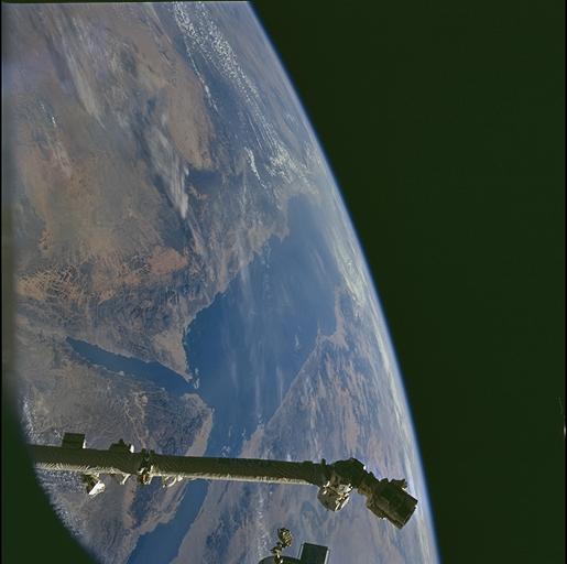
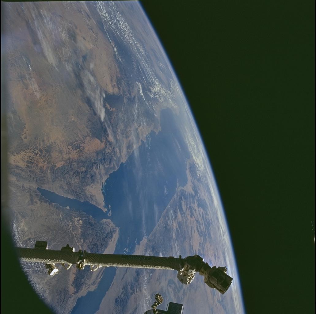
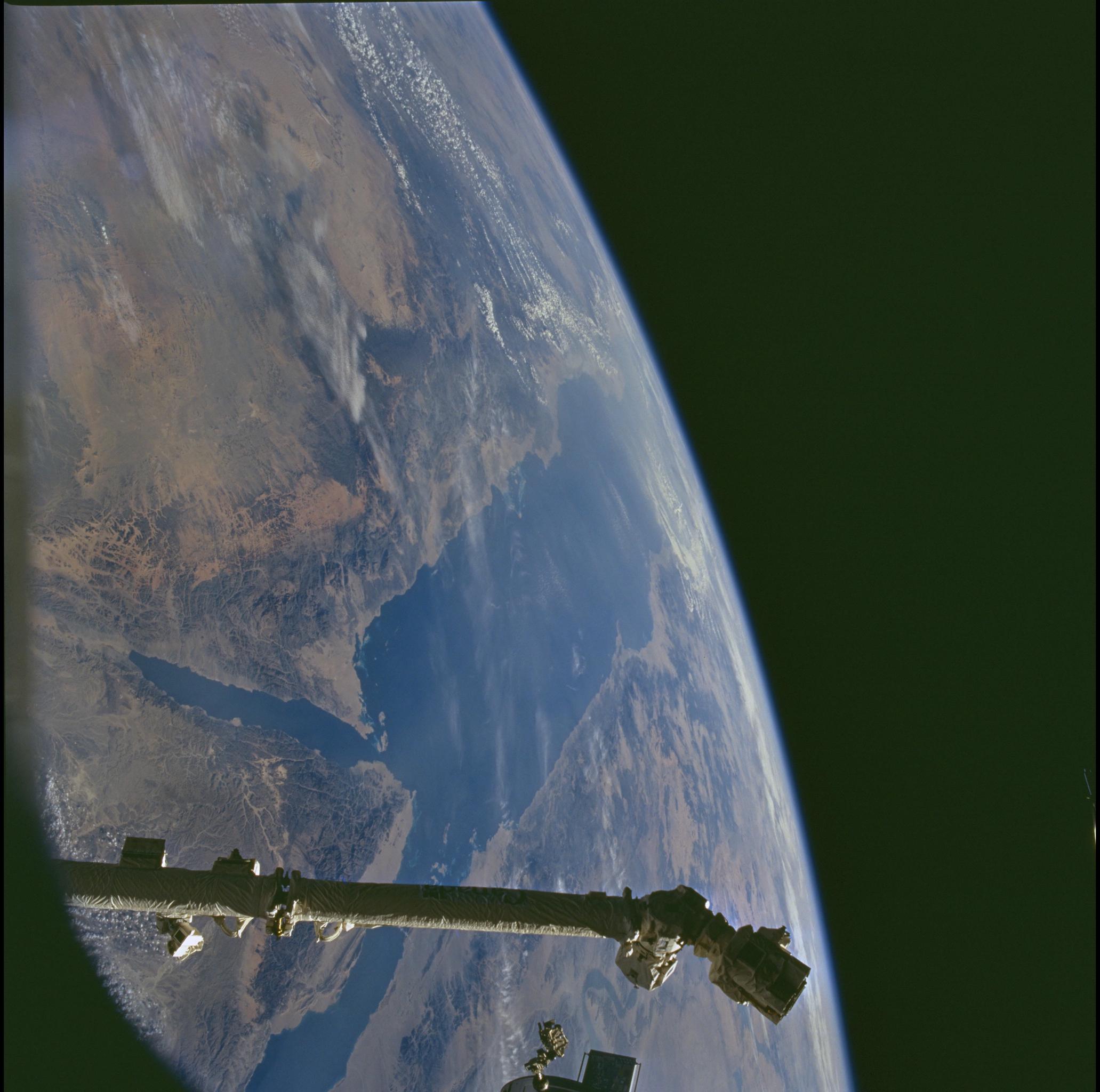
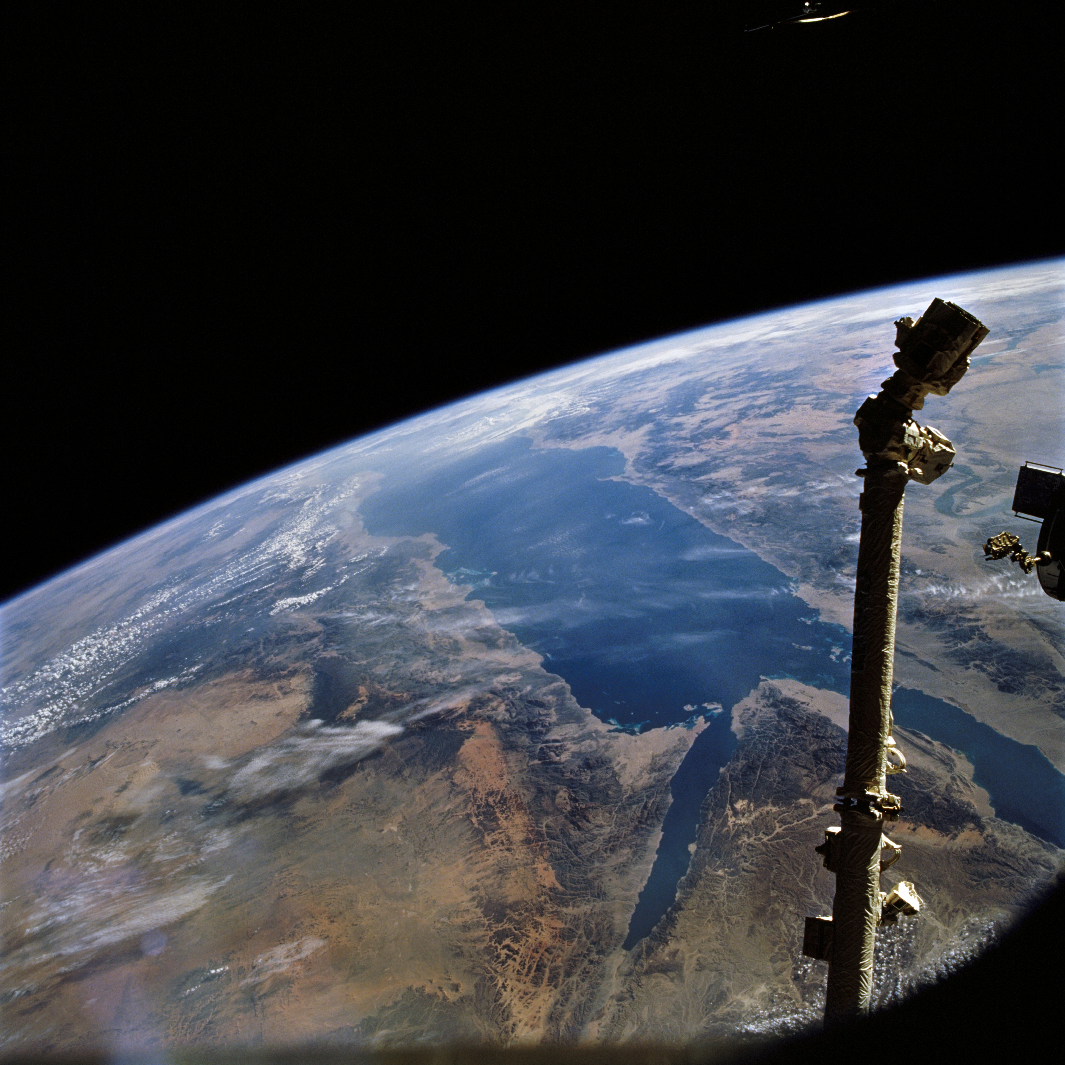
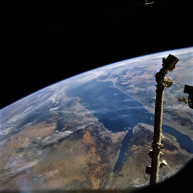
Image Caption: The triangular Sinai Penisula of Egypt appears behind the Canada Arm in the
foreground (lower right), with the Gulf of Suez to its west (far right) and the
Gulf of Aqaba (center bottom). These gulfs join to become the Red Sea which
stretches away south to the horizon down the left side of this south-looking
view. Saudi Arabia lies to the left and Egypt and Sudan to the right.
The Red Sea is widening as Saudi Arabia pulls northeast (left). The margins
of the sea are appropriately parallel. The Red Sea is one of the youngest seas
on the planet.
