STS106-702-84
| NASA Photo ID | STS106-702-84 |
| Focal Length | 40mm |
| Date taken | 2000.09.10 |
| Time taken | 12:04:09 GMT |
Resolutions offered for this image:
1030 x 1024 pixels 2063 x 2048 pixels 4127 x 4096 pixels 515 x 512 pixels 1470 x 1296 pixels 400 x 352 pixels
1030 x 1024 pixels 2063 x 2048 pixels 4127 x 4096 pixels 515 x 512 pixels 1470 x 1296 pixels 400 x 352 pixels

Cloud masks available for this image:
Spacecraft nadir point: 50.9° N, 2.9° W
Photo center point: 47.0° N, 6.0° E
Photo center point by machine learning:
Photo center point: 47.0° N, 6.0° E
Photo center point by machine learning:
Nadir to Photo Center: East
Spacecraft Altitude: 188 nautical miles (348km)
Country or Geographic Name: | FRANCE |
Features: | PAN-WEST COAST, ALPS |
| Features Found Using Machine Learning: | |
Cloud Cover Percentage: | 10 (1-10)% |
Sun Elevation Angle: | 44° |
Sun Azimuth: | 179° |
Camera: | Hasselblad |
Focal Length: | 40mm |
Camera Tilt: | High Oblique |
Format: | 5069: Kodak Elite 100S, E6 Reversal, Replaces Lumiere, Warmer in tone vs. Lumiere |
Film Exposure: | |
| Additional Information | |
| Width | Height | Annotated | Cropped | Purpose | Links |
|---|---|---|---|---|---|
| 1030 pixels | 1024 pixels | No | No | Download Image | |
| 2063 pixels | 2048 pixels | No | No | Download Image | |
| 4127 pixels | 4096 pixels | No | No | Download Image | |
| 515 pixels | 512 pixels | No | No | Download Image | |
| 1470 pixels | 1296 pixels | No | No | Download Image | |
| 400 pixels | 352 pixels | Download Image |
Download Packaged File
Download a Google Earth KML for this Image
View photo footprint information
Download a GeoTIFF for this photo
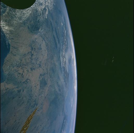
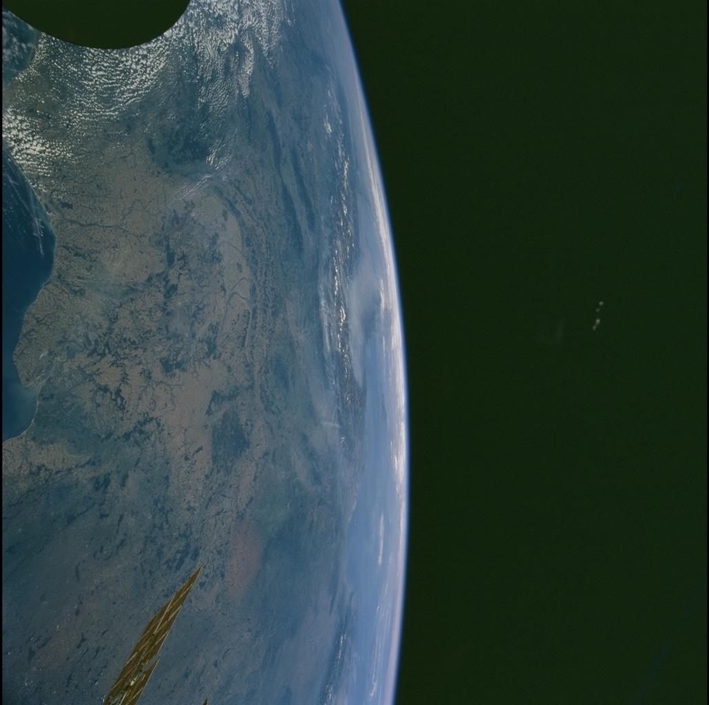
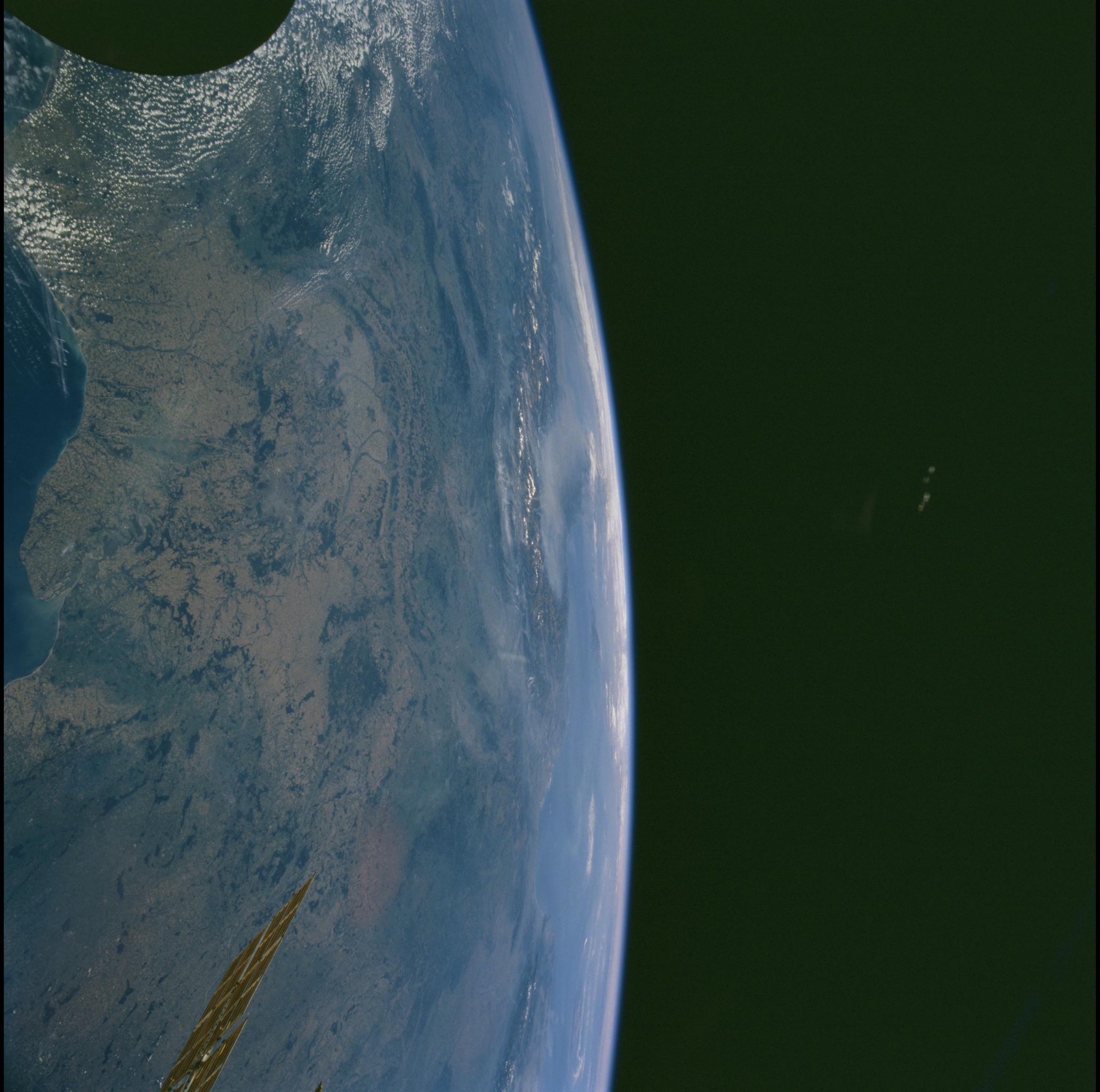
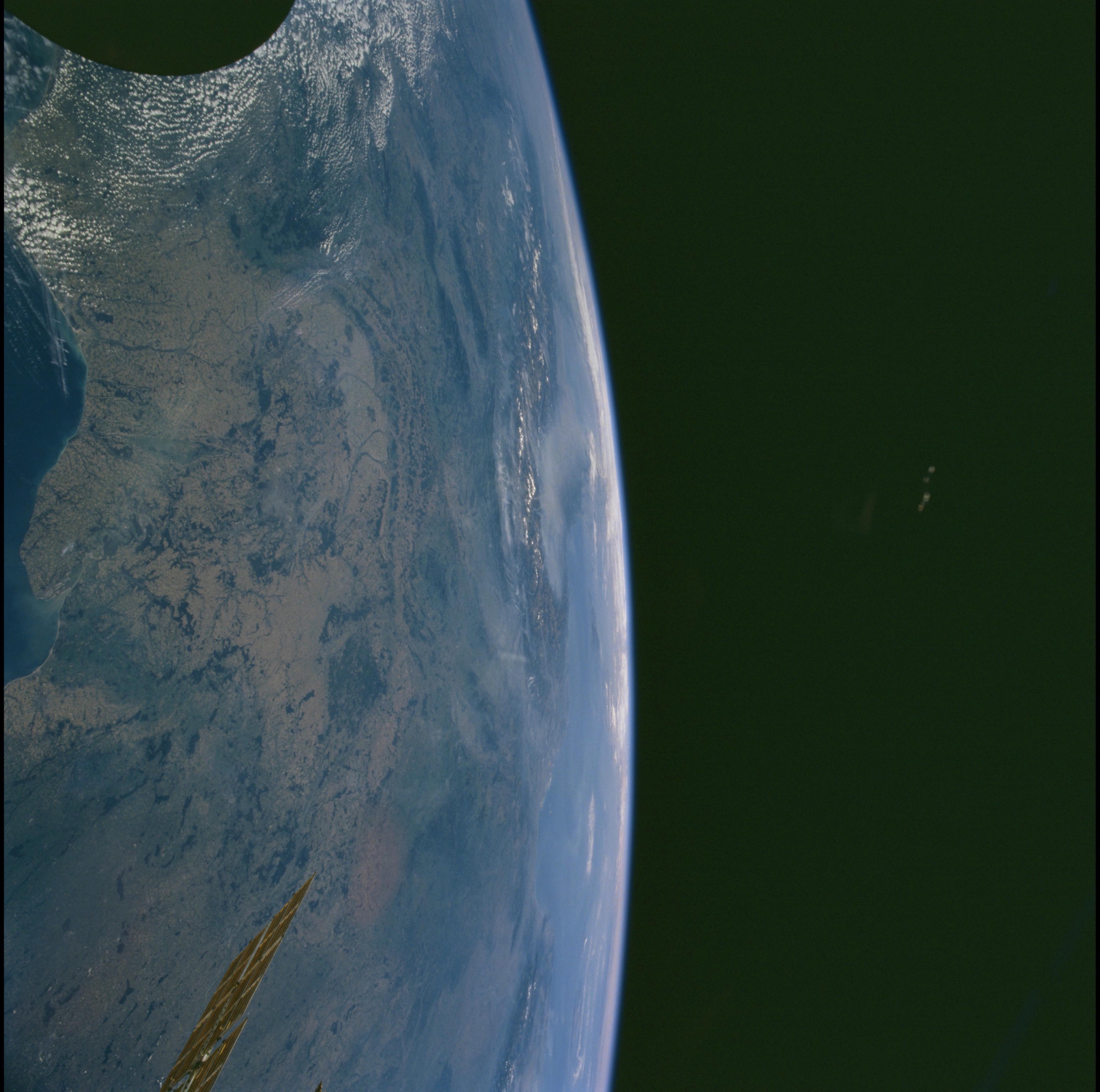
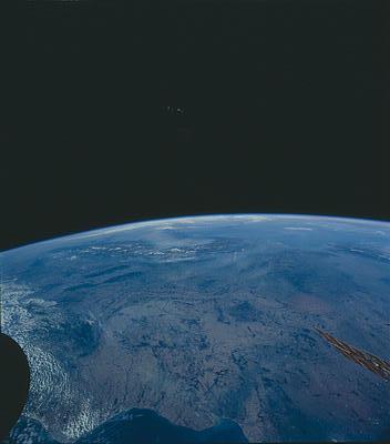
Image Caption: Source:Patricia W. Dickerson
Rhine and Rhine Rifts, Alps
The Rhine and Rhone rift valleys, as well as the transform fault zone
(between Basel, Switzerland and Dijon, France) that connects the two,
are centered in the view with the snow-capped Alps in the far distance.
The great folded and faulted ranges of the Alps began forming during
Eurasian-African plate collision about 60 million years ago. Those
structures in the western Alps are cut by younger (23 million years to
present), north-trending Rhone rift faults, as well as by
northeast-trending structures of the transform zone. The dark, forested
Vosges (W) and Schwarzwald (E) uplifts flank the Rhine valley (east of
center).
