STS103-729-63
| NASA Photo ID | STS103-729-63 |
| Focal Length | 250mm |
| Date taken | 1999.12.26 |
| Time taken | 22:01:52 GMT |
Resolutions offered for this image:
540 x 380 pixels 1031 x 1024 pixels 2063 x 2048 pixels 4127 x 4096 pixels 515 x 512 pixels 400 x 280 pixels
540 x 380 pixels 1031 x 1024 pixels 2063 x 2048 pixels 4127 x 4096 pixels 515 x 512 pixels 400 x 280 pixels


Cloud masks available for this image:
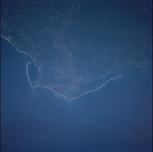
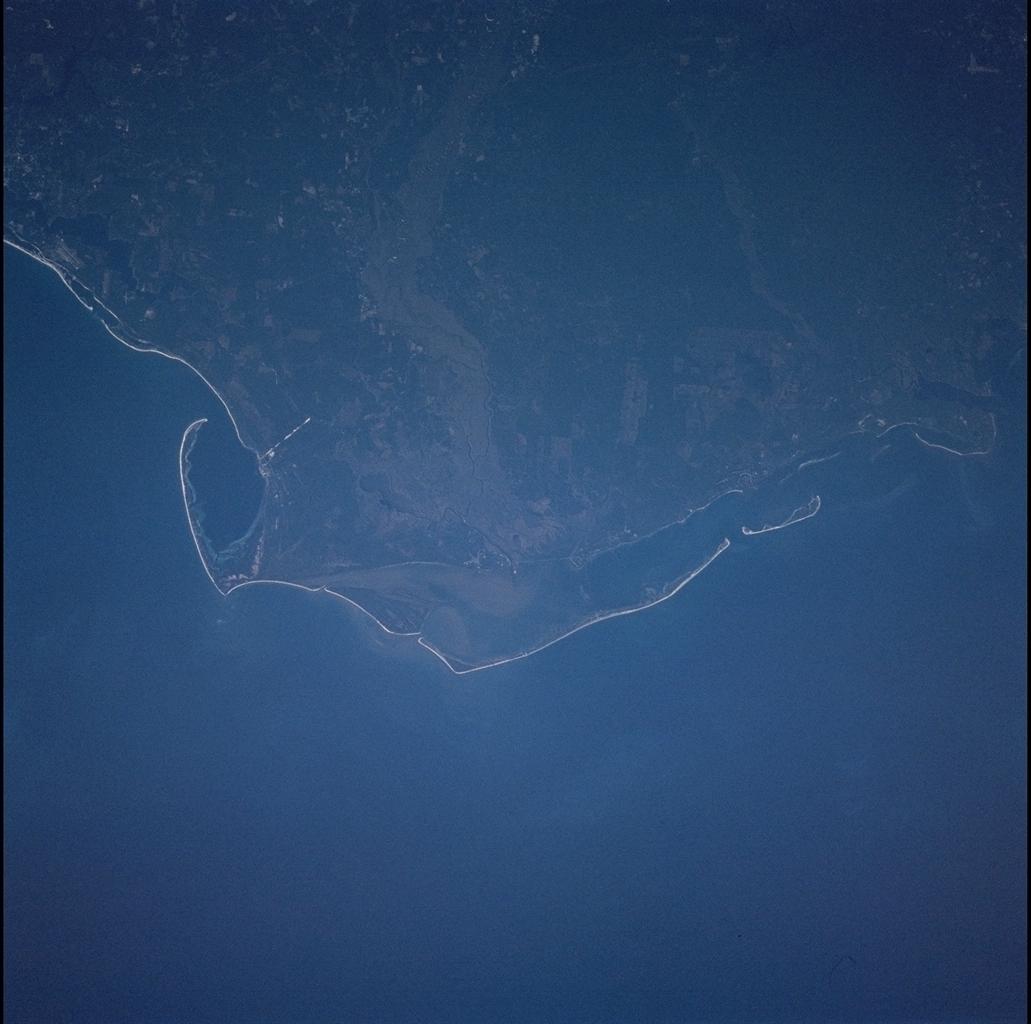
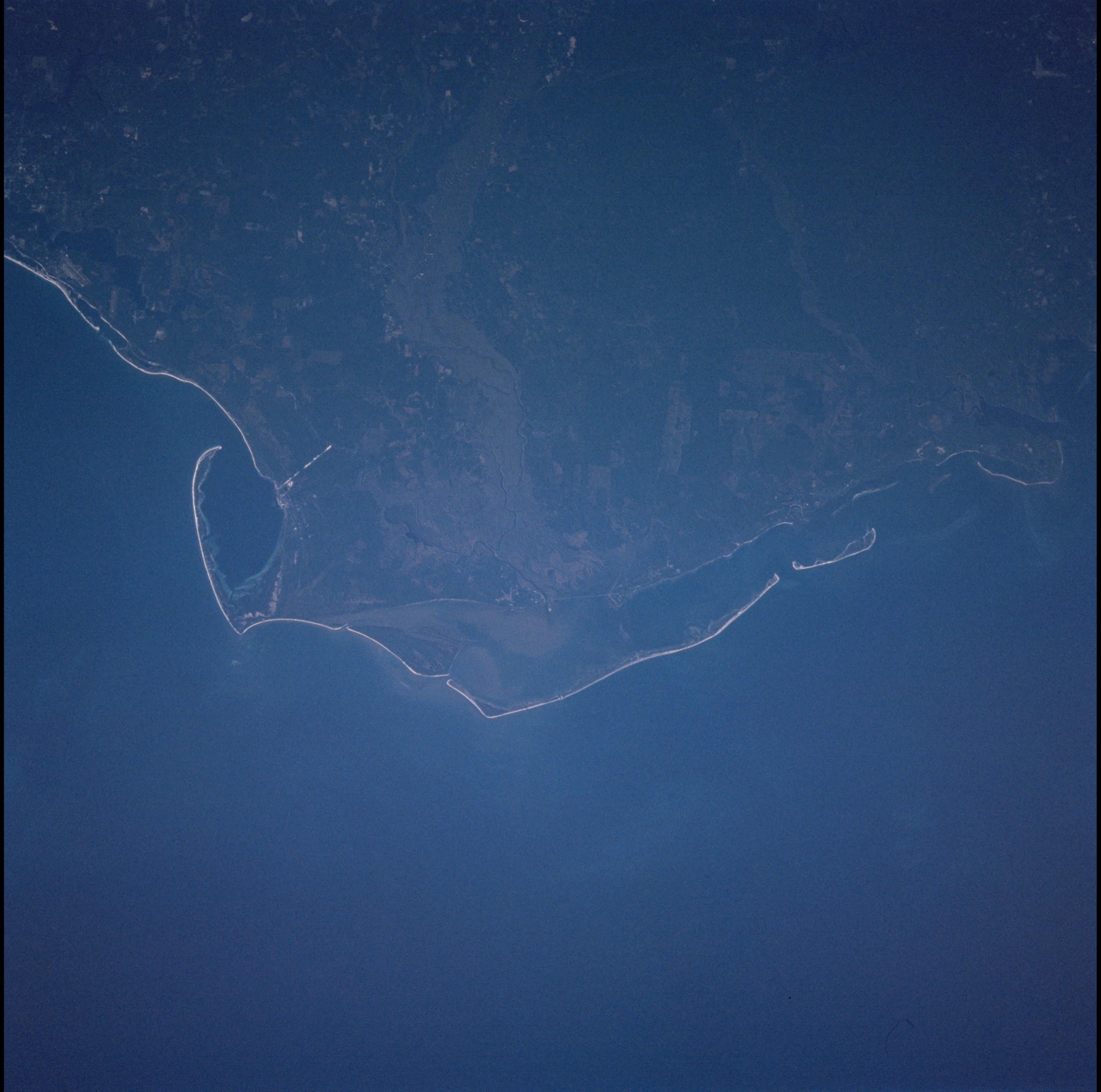
Spacecraft nadir point: 28.0° N, 86.1° W
Photo center point: 30.0° N, 85.0° W
Photo center point by machine learning:
Photo center point: 30.0° N, 85.0° W
Photo center point by machine learning:
Nadir to Photo Center: Northeast
Spacecraft Altitude: 301 nautical miles (557km)
Country or Geographic Name: | USA-FLORIDA |
Features: | APALACHICOLA RIVER DELTA |
| Features Found Using Machine Learning: | |
Cloud Cover Percentage: | 10 (1-10)% |
Sun Elevation Angle: | 10° |
Sun Azimuth: | 237° |
Camera: | Hasselblad |
Focal Length: | 250mm |
Camera Tilt: | 24 degrees |
Format: | 5069: Kodak Elite 100S, E6 Reversal, Replaces Lumiere, Warmer in tone vs. Lumiere |
Film Exposure: | |
| Additional Information | |
| Width | Height | Annotated | Cropped | Purpose | Links |
|---|---|---|---|---|---|
| 540 pixels | 380 pixels | Yes | Yes | NASA's Earth Observatory web site | Download Image |
| 1031 pixels | 1024 pixels | No | No | Download Image | |
| 2063 pixels | 2048 pixels | No | No | Download Image | |
| 4127 pixels | 4096 pixels | No | No | Download Image | |
| 515 pixels | 512 pixels | No | No | Download Image | |
| 400 pixels | 280 pixels | Yes | Yes | Photographic Highlights | Download Image |
Download Packaged File
Download a Google Earth KML for this Image
View photo footprint information
Download a GeoTIFF for this photo
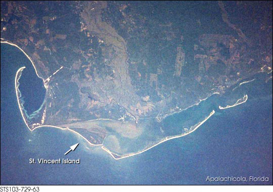
Image Caption: Sediments from the Apalachicola River delta complex form islands of sand ridges (cheniers). During high flow, the river delivers abundant sediment to the delta; as flow wanes the stream drops its load of coarser material around the channel mouth, to be redistributed primarily by waves. Variations in sediment supply and wave energy result in alternating bands of sand and mud. To see more detail of cheniers see St. Vincent Island, STS102-349-35.
