STS099-735-46

| NASA Photo ID | STS099-735-46 |
| Focal Length | 250mm |
| Date taken | 2000.02.__ |
| Time taken | GMT |
Resolutions offered for this image:
1031 x 1024 pixels 4096 x 4096 pixels 2063 x 2048 pixels 4127 x 4096 pixels 515 x 512 pixels 1308 x 1280 pixels
1031 x 1024 pixels 4096 x 4096 pixels 2063 x 2048 pixels 4127 x 4096 pixels 515 x 512 pixels 1308 x 1280 pixels


Cloud masks available for this image:
Spacecraft nadir point:
Photo center point: 28.0° N, 87.0° E
Photo center point by machine learning:
Photo center point: 28.0° N, 87.0° E
Photo center point by machine learning:
Nadir to Photo Center:
Spacecraft Altitude: nautical miles (0km)
Country or Geographic Name: | CHINA |
Features: | HIMALAYA, MOUNT EVEREST |
| Features Found Using Machine Learning: | |
Cloud Cover Percentage: | 25 (11-25)% |
Sun Elevation Angle: | ° |
Sun Azimuth: | ° |
Camera: | Hasselblad |
Focal Length: | 250mm |
Camera Tilt: | |
Format: | 5069: Kodak Elite 100S, E6 Reversal, Replaces Lumiere, Warmer in tone vs. Lumiere |
Film Exposure: | |
| Additional Information | |
| Width | Height | Annotated | Cropped | Purpose | Links |
|---|---|---|---|---|---|
| 1031 pixels | 1024 pixels | No | No | Download Image | |
| 4096 pixels | 4096 pixels | No | No | Download Image | |
| 2063 pixels | 2048 pixels | No | No | Download Image | |
| 4127 pixels | 4096 pixels | No | No | Download Image | |
| 515 pixels | 512 pixels | No | No | Download Image | |
| 1308 pixels | 1280 pixels | No | No | Download Image |
Download Packaged File
Download a Google Earth KML for this Image
View photo footprint information
Download a GeoTIFF for this photo
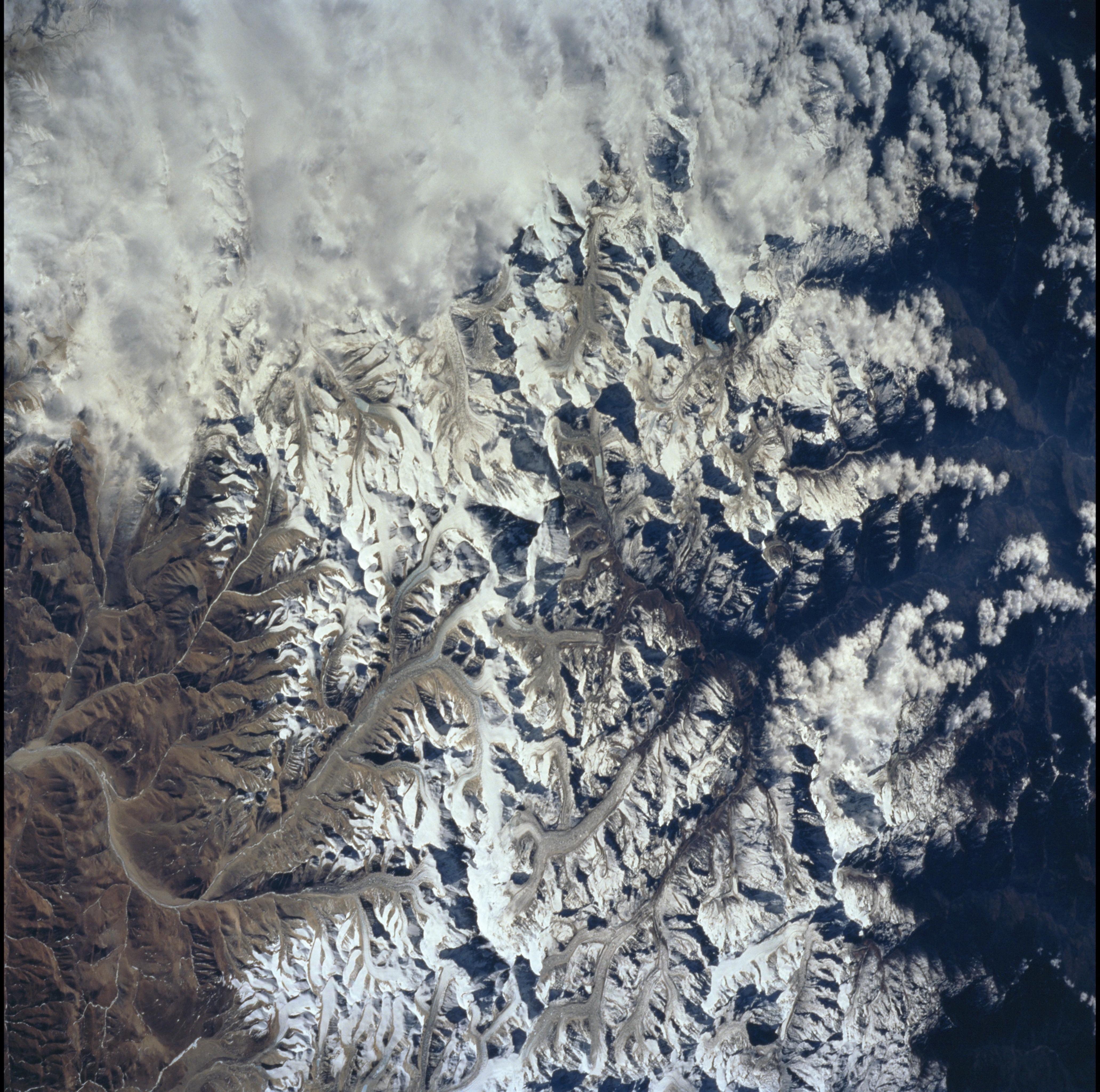
Image Caption: Mt. Everest, eastern Himalaya, Tibet Autonomous Region of China
Mt. Everest (29,028 ft/8848 m; center of photo), also called Qomolangma Feng,
is just north of the border between Nepal and China. The Himalayas and the
Tibetan Plateau are products of the collision of the Indian and Eurasian tectonic
plates. With the continuing northward march of India, the crust of the Earth has
become thicker and the Tibetan Plateau has been uplifted to an average
elevation of about 15,000 feet. At the summit of Mt. Everest are fossil-bearing
limestones that were deposited beneath the sea around 510 million years ago
(Cambrian to Ordovician time).
Glaciers, moraines, and outwash plains are spectacularly displayed. Glacial
meltwaters in this area feed the Arun River, eventually reaching the Ganges on
the plains of India.
