STS098-E-5325

| NASA Photo ID | STS098-E-5325 |
| Focal Length | mm |
| Date taken | 2001.02.16 |
| Time taken | 19:41:27 GMT |

Cloud masks available for this image:
Spacecraft nadir point: 30.7° N, 78.3° W
Photo center point: 22.0° N, 78.0° W
Photo center point by machine learning:
Photo center point: 22.0° N, 78.0° W
Photo center point by machine learning:
Nadir to Photo Center: South
Spacecraft Altitude: 202 nautical miles (374km)
Country or Geographic Name: | CUBA |
Features: | CAYO ROMANO, B. DE JIGUEY |
| Features Found Using Machine Learning: | |
Cloud Cover Percentage: | 10 (1-10)% |
Sun Elevation Angle: | 37° |
Sun Azimuth: | 222° |
Camera: | |
Focal Length: | mm |
Camera Tilt: | High Oblique |
Format: | 3060E: 3060 x 2036 pixel CCD, RGBG array |
Film Exposure: | |
| Additional Information | |
| Width | Height | Annotated | Cropped | Purpose | Links |
|---|---|---|---|---|---|
| 540 pixels | 366 pixels | Photographic Highlights | Download Image | ||
| 3040 pixels | 2064 pixels | No | No | Download Image | |
| 640 pixels | 434 pixels | No | No | Download Image |
Download Packaged File
Download a Google Earth KML for this Image
View photo footprint information
Download a GeoTIFF for this photo
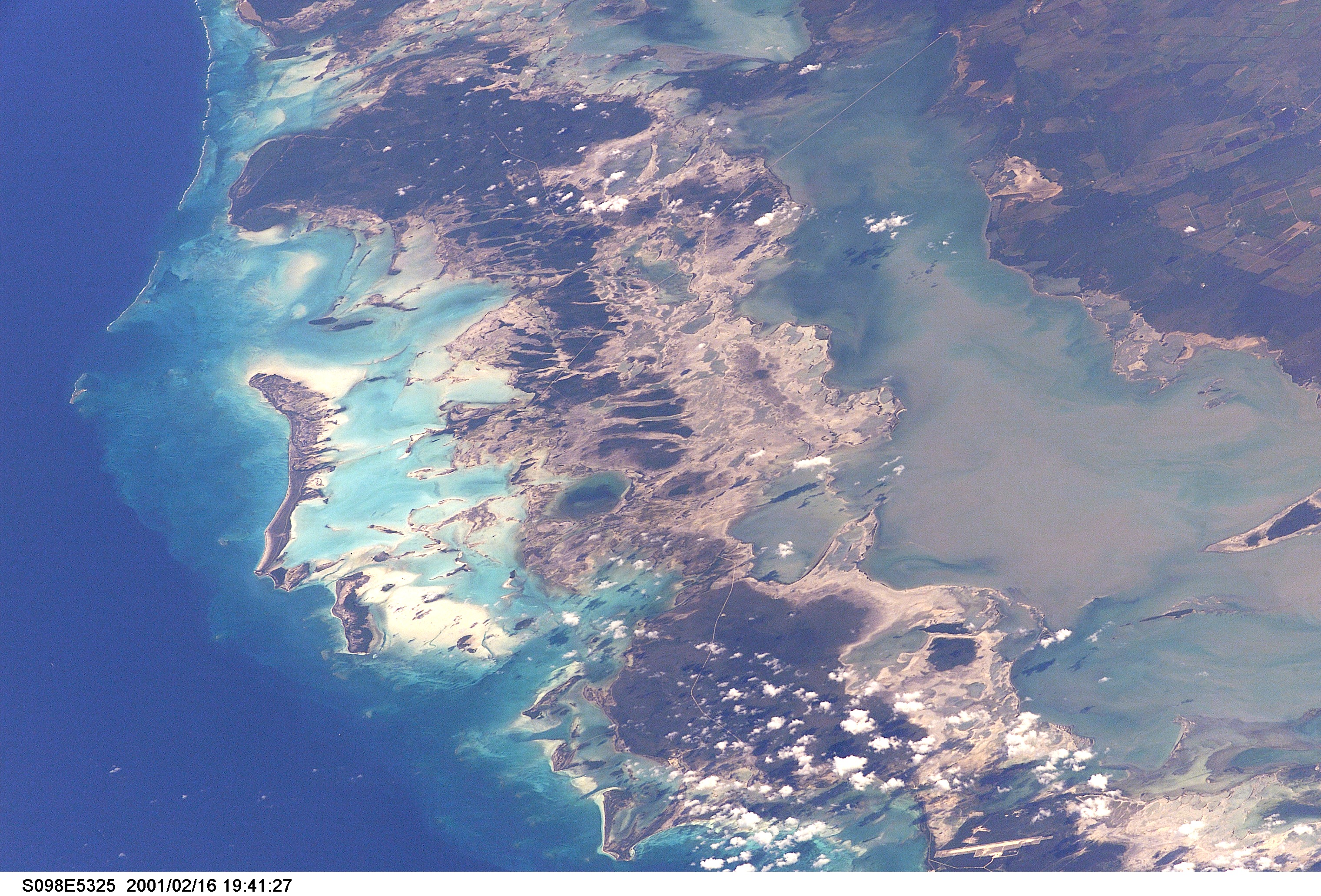
Image Caption: Cayo Romano, Cuba
Off the northern coast of Cuba and not far from the Bahamas, Cayo Romano is the largest of the island chain known as the Sabana-Camaguey Archipelago (or more romantically as the Jardines del Rey, Gardens of the King). Some of the efforts to increase its desirability as a tourist destination are visible in this photograph, including a causeway to the mainland in the upper right corner, and a causeway connecting it to Cayo Coco. The airstrip built on Cayo Coco in 1995 is visible as the long rectangular white patch at the bottom right. The land of the island is low-lying with much of it covered by mangroves and wetlands, and is home to an estimated 30,000 flamingoes. A barrier reef can be seen on the left side of the photo. There are plans for a number of new hotels on both Cayo Coco and Cayo Romano, expanding the number of hotel rooms from about around a thousand to over 22,000.
Off the northern coast of Cuba and not far from the Bahamas, Cayo Romano is the largest of the island chain known as the Sabana-Camaguey Archipelago (or more romantically as the Jardines del Rey, Gardens of the King). Some of the efforts to increase its desirability as a tourist destination are visible in this photograph, including a causeway to the mainland in the upper right corner, and a causeway connecting it to Cayo Coco. The airstrip built on Cayo Coco in 1995 is visible as the long rectangular white patch at the bottom right. The land of the island is low-lying with much of it covered by mangroves and wetlands, and is home to an estimated 30,000 flamingoes. A barrier reef can be seen on the left side of the photo. There are plans for a number of new hotels on both Cayo Coco and Cayo Romano, expanding the number of hotel rooms from about around a thousand to over 22,000.
