STS094-735-67

| NASA Photo ID | STS094-735-67 |
| Focal Length | 100mm |
| Date taken | 1997.07.05 |
| Time taken | 18:20:51 GMT |
Resolutions offered for this image:
4018 x 4018 pixels 639 x 639 pixels 517 x 512 pixels 480 x 478 pixels
4018 x 4018 pixels 639 x 639 pixels 517 x 512 pixels 480 x 478 pixels
Cloud masks available for this image:
Spacecraft nadir point: 23.1° N, 156.8° W
Photo center point: 21.0° N, 157.0° W
Photo center point by machine learning:
Photo center point: 21.0° N, 157.0° W
Photo center point by machine learning:
Nadir to Photo Center: South
Spacecraft Altitude: 159 nautical miles (294km)
Camera: | Hasselblad |
Focal Length: | 100mm |
Camera Tilt: | 38 degrees |
Format: | 5069: Kodak Elite 100S, E6 Reversal, Replaces Lumiere, Warmer in tone vs. Lumiere |
Film Exposure: | Normal |
| Additional Information | |
| Width | Height | Annotated | Cropped | Purpose | Links |
|---|---|---|---|---|---|
| 4018 pixels | 4018 pixels | No | No | Earth From Space collection | Download Image |
| 639 pixels | 639 pixels | No | No | Earth From Space collection | Download Image |
| 517 pixels | 512 pixels | No | No | Download Image | |
| 480 pixels | 478 pixels | Download Image |
Download Packaged File
Download a Google Earth KML for this Image
View photo footprint information
Download a GeoTIFF for this photo
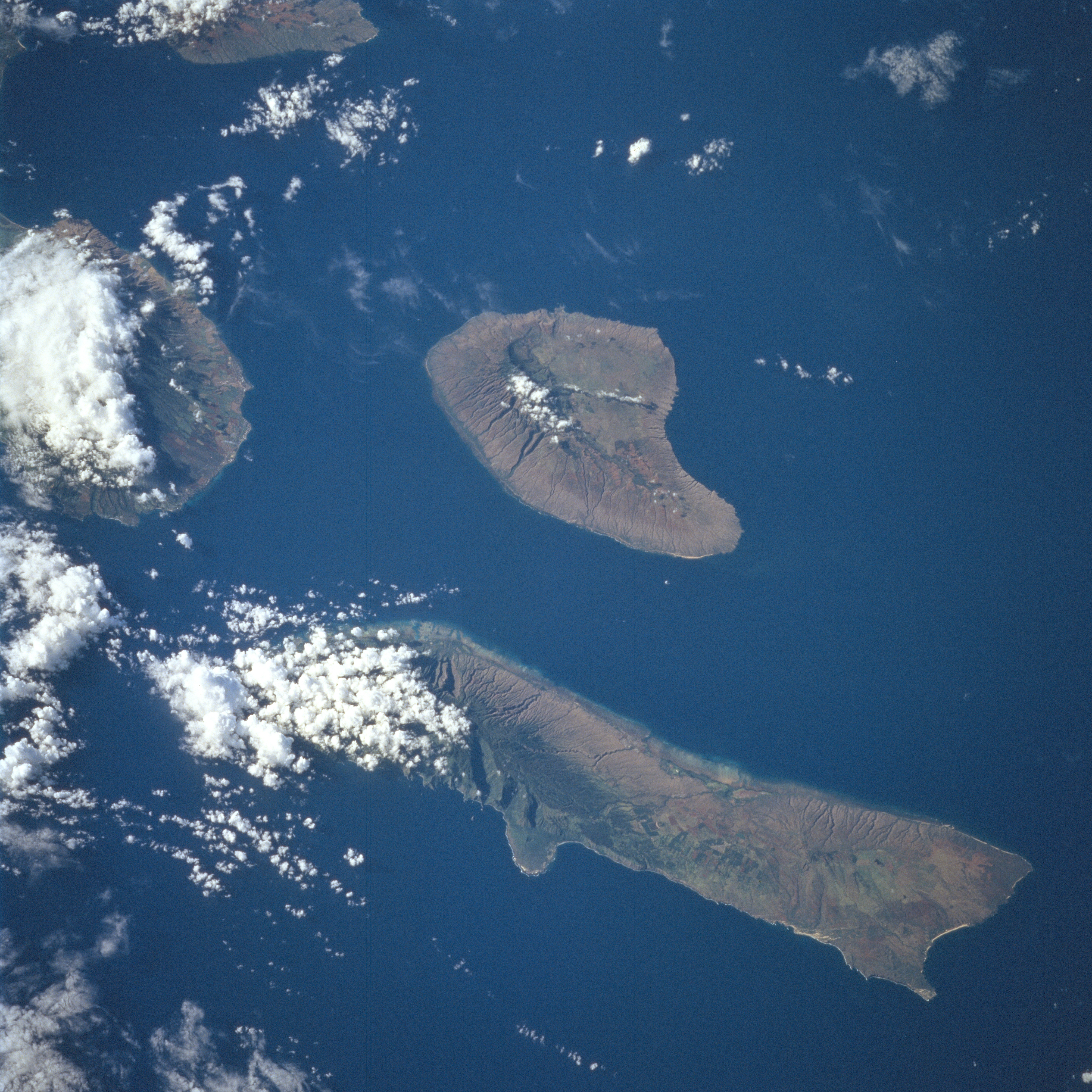
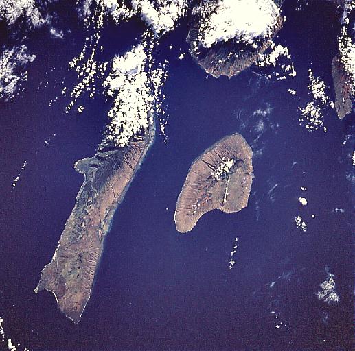
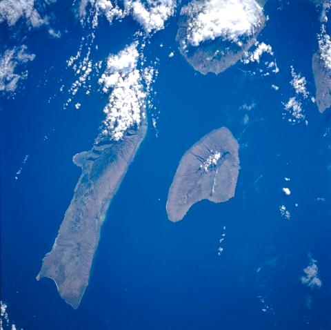
Image Caption: STS094-735-067 Molokai, Lanai, Hawaiian Islands July 1997
The Hawaiian Islands of Molokai (long narrow island) and Lanai (near the center of the image) can be seen in this east-looking view. The island of Molokai is 40 miles (64 km) long and 7 miles (11 km) wide, and covers an area of 261 sq. miles (676 sq. km). The island, volcanic in nature, is generally mountainous. Kalaupapa Peninsula, located on the north side of Molokai near the left center of the image, is accessible only over a 2000 feet (610 meter) high mountain pass. It is on the Kalaupapa Peninsula that Father Damien, a Belgian Missionary, established a government leper colony in 1860. Today, along with increased tourism, Molokai has many cattle ranches and pineapple plantations. The island of Lanai covers an area of 141 sq. miles (365 sq. km). For many years, the island was used for sugarcane raising and cattle grazing. In 1922, the entire island of Lanai was purchased by a large pineapple company, which has developed the island into a pineapple-growing center. Cut by the top of the image, the western tip of the island of Maui can be seen.
The Hawaiian Islands of Molokai (long narrow island) and Lanai (near the center of the image) can be seen in this east-looking view. The island of Molokai is 40 miles (64 km) long and 7 miles (11 km) wide, and covers an area of 261 sq. miles (676 sq. km). The island, volcanic in nature, is generally mountainous. Kalaupapa Peninsula, located on the north side of Molokai near the left center of the image, is accessible only over a 2000 feet (610 meter) high mountain pass. It is on the Kalaupapa Peninsula that Father Damien, a Belgian Missionary, established a government leper colony in 1860. Today, along with increased tourism, Molokai has many cattle ranches and pineapple plantations. The island of Lanai covers an area of 141 sq. miles (365 sq. km). For many years, the island was used for sugarcane raising and cattle grazing. In 1922, the entire island of Lanai was purchased by a large pineapple company, which has developed the island into a pineapple-growing center. Cut by the top of the image, the western tip of the island of Maui can be seen.
