STS073-711-96
| NASA Photo ID | STS073-711-96 |
| Focal Length | 250mm |
| Date taken | 1995.10.27 |
| Time taken | 06:42:31 GMT |
Resolutions offered for this image:
5248 x 5248 pixels 640 x 640 pixels 5700 x 5900 pixels 500 x 518 pixels 640 x 480 pixels
5248 x 5248 pixels 640 x 640 pixels 5700 x 5900 pixels 500 x 518 pixels 640 x 480 pixels
Cloud masks available for this image:
Spacecraft nadir point: 13.1° S, 131.3° E
Photo center point: 12.5° S, 131.0° E
Photo center point by machine learning:
Photo center point: 12.5° S, 131.0° E
Photo center point by machine learning:
Nadir to Photo Center: North
Spacecraft Altitude: 147 nautical miles (272km)
Country or Geographic Name: | AUSTRALIA-NT |
Features: | DARWIN, BYNOE HARBOR, BAYS |
| Features Found Using Machine Learning: | |
Cloud Cover Percentage: | 5 (1-10)% |
Sun Elevation Angle: | 36° |
Sun Azimuth: | 264° |
Camera: | Hasselblad |
Focal Length: | 250mm |
Camera Tilt: | 15 degrees |
Format: | 5046: Kodak, natural color positive, Lumiere 100/5046, ASA 100, standard base |
Film Exposure: | Normal |
| Additional Information | |
| Width | Height | Annotated | Cropped | Purpose | Links |
|---|---|---|---|---|---|
| 5248 pixels | 5248 pixels | No | No | Earth From Space collection | Download Image |
| 640 pixels | 640 pixels | No | No | Earth From Space collection | Download Image |
| 5700 pixels | 5900 pixels | No | No | Download Image | |
| 500 pixels | 518 pixels | No | No | Download Image | |
| 640 pixels | 480 pixels | No | No | Download Image |
Download Packaged File
Download a Google Earth KML for this Image
View photo footprint information
Download a GeoTIFF for this photo
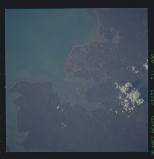
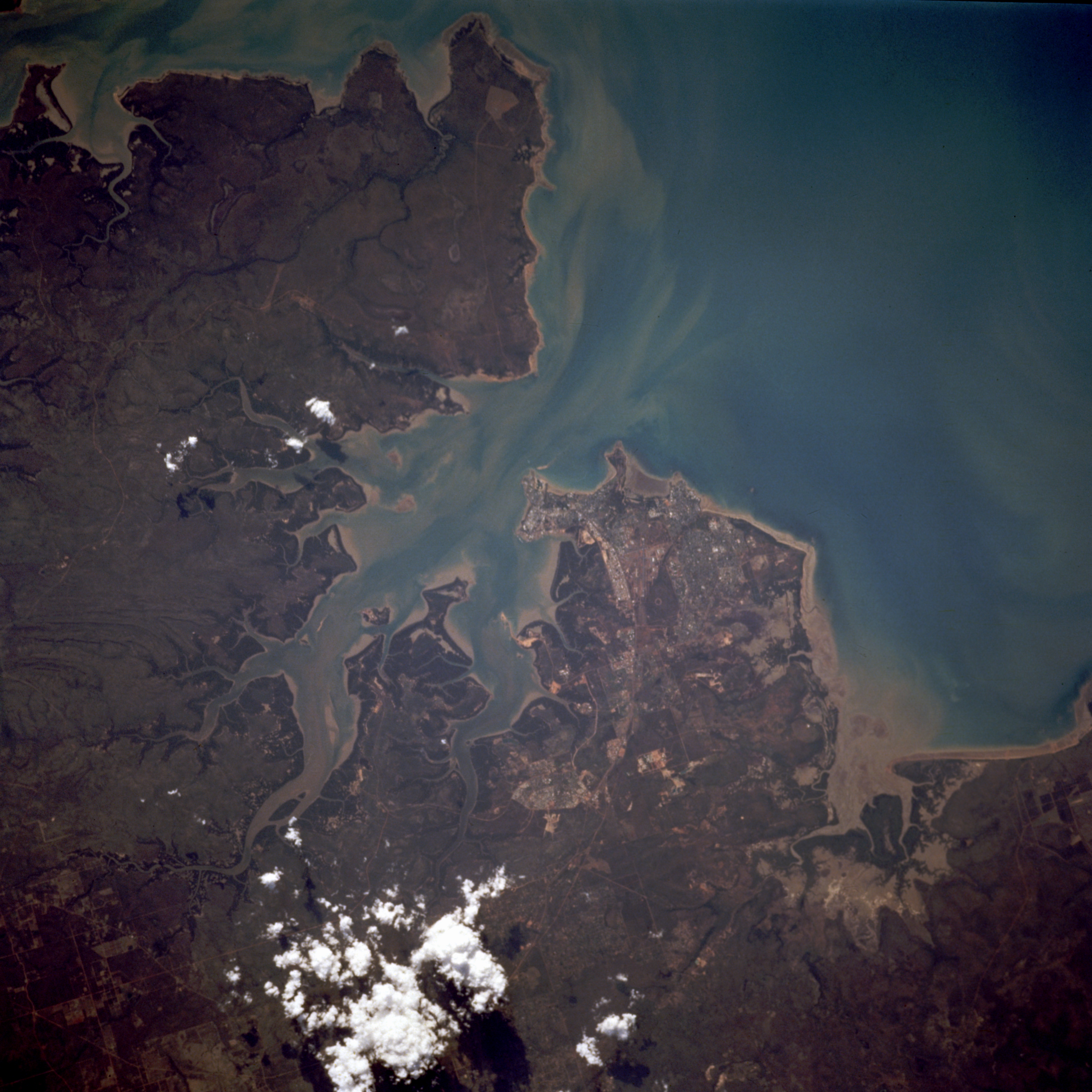
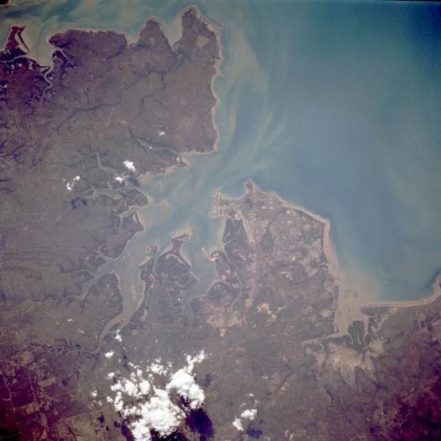
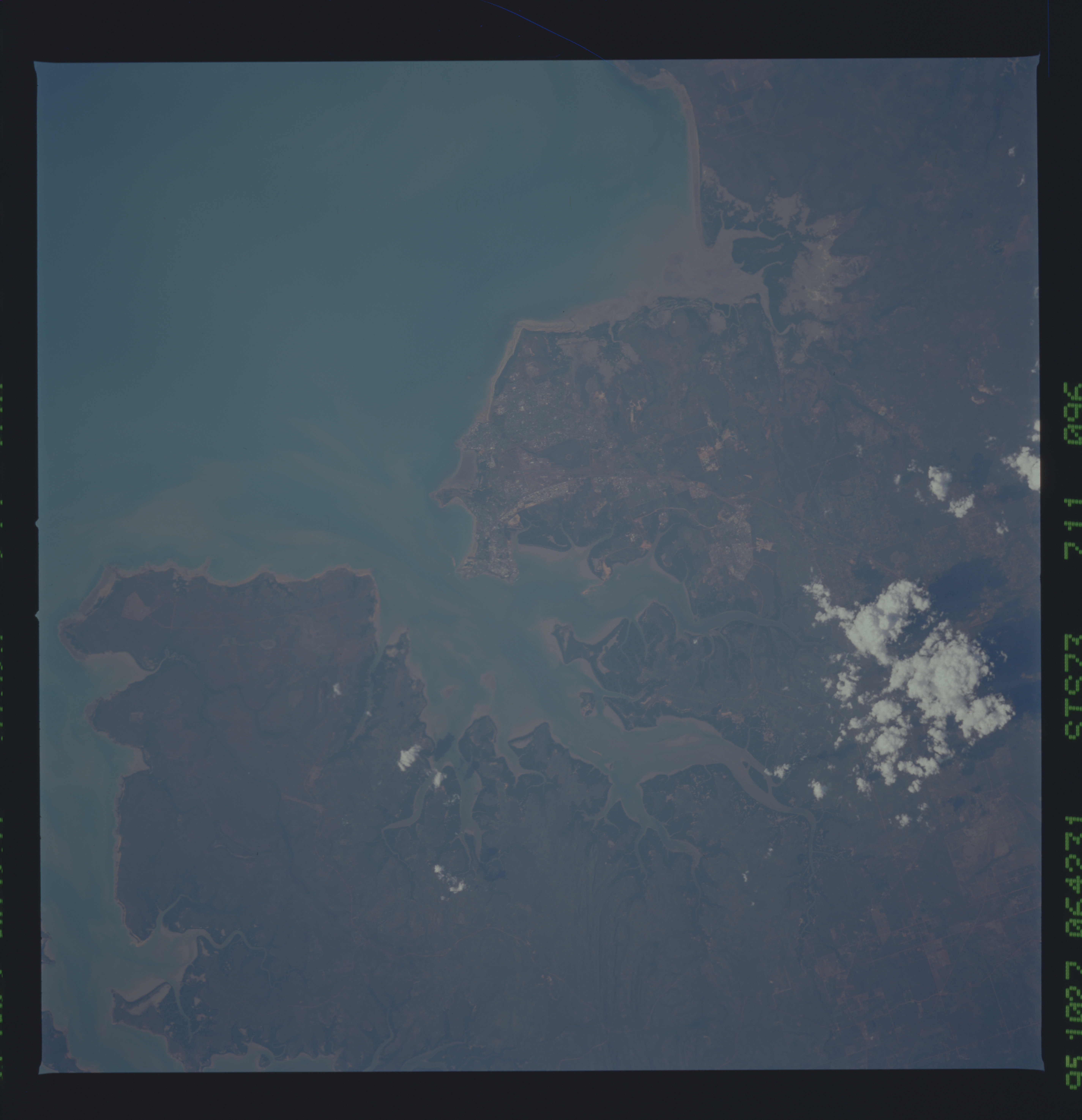
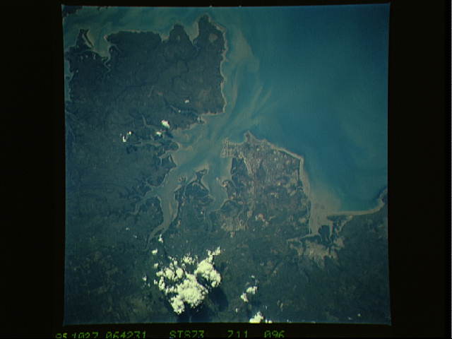
Image Caption: STS073-711-096 Darwin, Northern Territory, Australia September 1995
Darwin, with an estimated population of 80 000, is the largest urban center along the entire north coast of Australia and is tied for fourteenth in size in the country. It is the only general seaport, the principal trading town, and the administrative center of the Northern Territory. Darwin is close enough to the tropics to be influenced by the monsoons during the winter months; however, for 8 or 9 months of the year, severe drought prevails. Both manmade and natural features are visible in this near-vertical photograph--several roads southeast of the urban area; an airport near the downtown area; Beagle Gulf and Shoal Bay, north and east, respectively, of the city; and dark stands of mangrove vegetation along the shoreline.
Darwin, with an estimated population of 80 000, is the largest urban center along the entire north coast of Australia and is tied for fourteenth in size in the country. It is the only general seaport, the principal trading town, and the administrative center of the Northern Territory. Darwin is close enough to the tropics to be influenced by the monsoons during the winter months; however, for 8 or 9 months of the year, severe drought prevails. Both manmade and natural features are visible in this near-vertical photograph--several roads southeast of the urban area; an airport near the downtown area; Beagle Gulf and Shoal Bay, north and east, respectively, of the city; and dark stands of mangrove vegetation along the shoreline.
