STS069-729-22
| NASA Photo ID | STS069-729-22 |
| Focal Length | 100mm |
| Date taken | 1995.09.11 |
| Time taken | 20:30:47 GMT |
Resolutions offered for this image:
3971 x 3936 pixels 639 x 634 pixels 5700 x 5900 pixels 500 x 518 pixels 640 x 480 pixels 960 x 945 pixels 960 x 945 pixels
3971 x 3936 pixels 639 x 634 pixels 5700 x 5900 pixels 500 x 518 pixels 640 x 480 pixels 960 x 945 pixels 960 x 945 pixels


Cloud masks available for this image:
Spacecraft nadir point: 23.1° N, 155.7° W
Photo center point: 21.0° N, 156.5° W
Photo center point by machine learning:
Photo center point: 21.0° N, 156.5° W
Photo center point by machine learning:
Nadir to Photo Center: South
Spacecraft Altitude: 215 nautical miles (398km)
Camera: | Hasselblad |
Focal Length: | 100mm |
Camera Tilt: | 32 degrees |
Format: | 5046: Kodak, natural color positive, Lumiere 100/5046, ASA 100, standard base |
Film Exposure: | Normal |
| Additional Information | |
| Width | Height | Annotated | Cropped | Purpose | Links |
|---|---|---|---|---|---|
| 3971 pixels | 3936 pixels | No | No | Earth From Space collection | Download Image |
| 639 pixels | 634 pixels | No | No | Earth From Space collection | Download Image |
| 5700 pixels | 5900 pixels | No | No | Download Image | |
| 500 pixels | 518 pixels | No | No | Download Image | |
| 640 pixels | 480 pixels | No | No | Download Image | |
| 960 pixels | 945 pixels | Yes | No | Download Image | |
| 960 pixels | 945 pixels | Download Image |
Download Packaged File
Download a Google Earth KML for this Image
View photo footprint information
Download a GeoTIFF for this photo
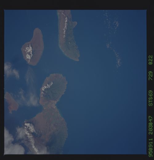
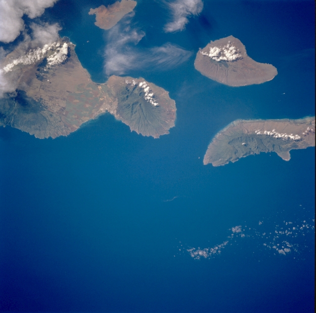
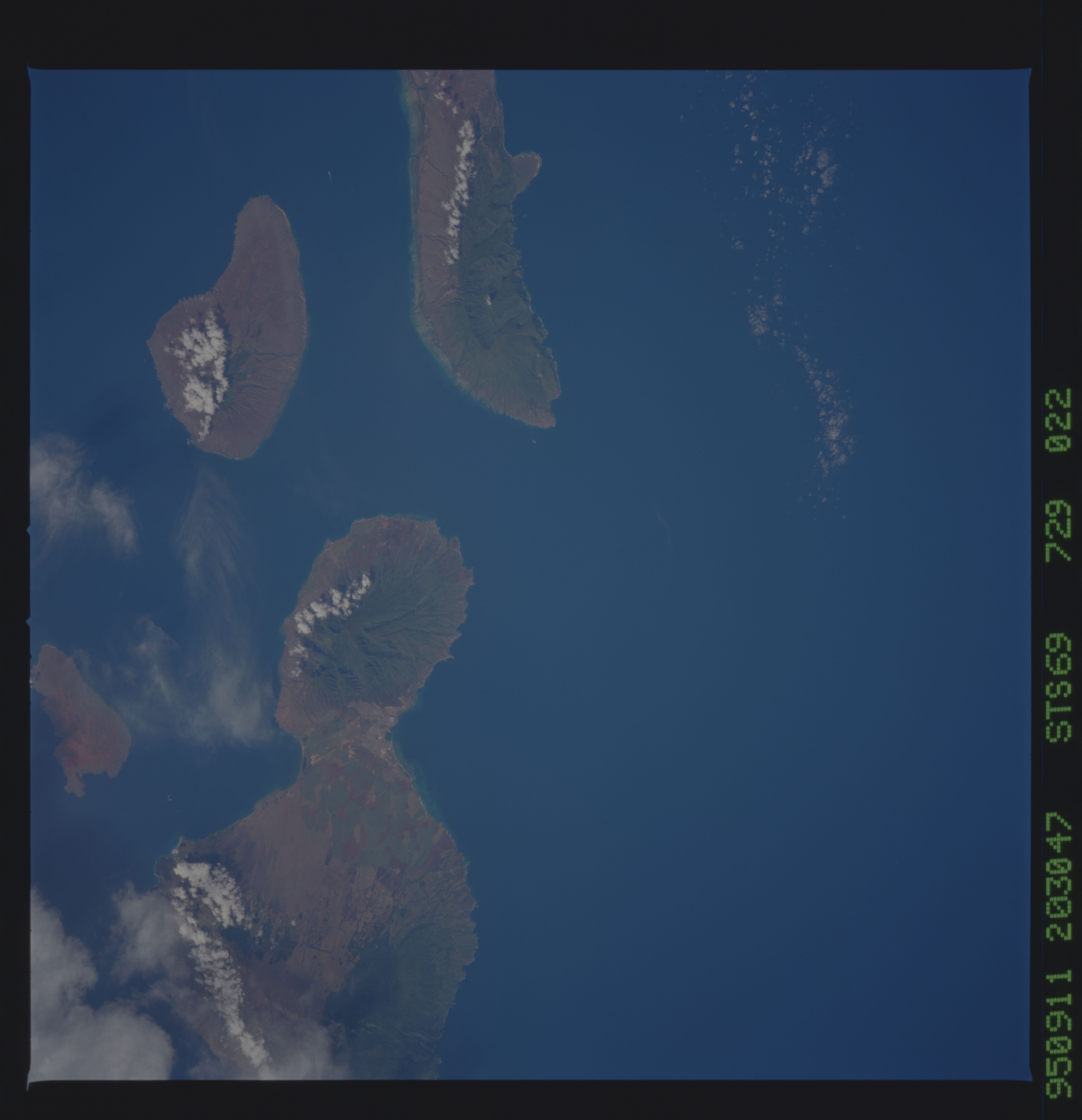
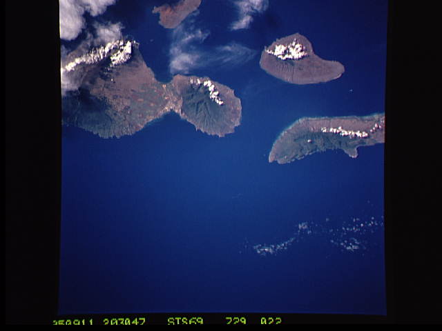
Image Caption: STS069-729-022 Maui, Molokai, and Lanai, Hawaii, U.S.A. September 1995
This synoptic photograph provides evidence of the impact of the northeast trade winds on the rainfall pattern of these islands. The orographic effect of the volcanic mountains on each island has produced a green pattern of vegetation, predominately on the northeast-facing slopes, while the rain shadow--drier leeward sides of the islands--allows less vegetation, resulting in a brown landscape. This photograph features cloud formations on the southwestern-facing slopes. Large, multicolored, cultivated field patterns appear in the valley between the two volcanic mountains on Maui.
This synoptic photograph provides evidence of the impact of the northeast trade winds on the rainfall pattern of these islands. The orographic effect of the volcanic mountains on each island has produced a green pattern of vegetation, predominately on the northeast-facing slopes, while the rain shadow--drier leeward sides of the islands--allows less vegetation, resulting in a brown landscape. This photograph features cloud formations on the southwestern-facing slopes. Large, multicolored, cultivated field patterns appear in the valley between the two volcanic mountains on Maui.
