STS068-244-15

| NASA Photo ID | STS068-244-15 |
| Focal Length | 250mm |
| Date taken | 1994.10.06 |
| Time taken | 20:11:43 GMT |
Resolutions offered for this image:
3904 x 3872 pixels 639 x 634 pixels 5700 x 5900 pixels 500 x 518 pixels 640 x 480 pixels
3904 x 3872 pixels 639 x 634 pixels 5700 x 5900 pixels 500 x 518 pixels 640 x 480 pixels
Cloud masks available for this image:
Spacecraft nadir point: 39.7° N, 123.2° W
Photo center point: 39.0° N, 122.5° W
Photo center point by machine learning:
Photo center point: 39.0° N, 122.5° W
Photo center point by machine learning:
Nadir to Photo Center: Southeast
Spacecraft Altitude: 116 nautical miles (215km)
Country or Geographic Name: | USA-CALIFORNIA |
Features: | CLEAR LAKE, COAST RANGE |
| Features Found Using Machine Learning: | |
Cloud Cover Percentage: | 5 (1-10)% |
Sun Elevation Angle: | 45° |
Sun Azimuth: | 184° |
Camera: | Hasselblad |
Focal Length: | 250mm |
Camera Tilt: | 27 degrees |
Format: | 5046: Kodak, natural color positive, Lumiere 100/5046, ASA 100, standard base |
Film Exposure: | Normal |
| Additional Information | |
| Width | Height | Annotated | Cropped | Purpose | Links |
|---|---|---|---|---|---|
| 3904 pixels | 3872 pixels | No | No | Earth From Space collection | Download Image |
| 639 pixels | 634 pixels | No | No | Earth From Space collection | Download Image |
| 5700 pixels | 5900 pixels | No | No | Download Image | |
| 500 pixels | 518 pixels | No | No | Download Image | |
| 640 pixels | 480 pixels | No | No | Download Image |
Download Packaged File
Download a Google Earth KML for this Image
View photo footprint information
Download a GeoTIFF for this photo
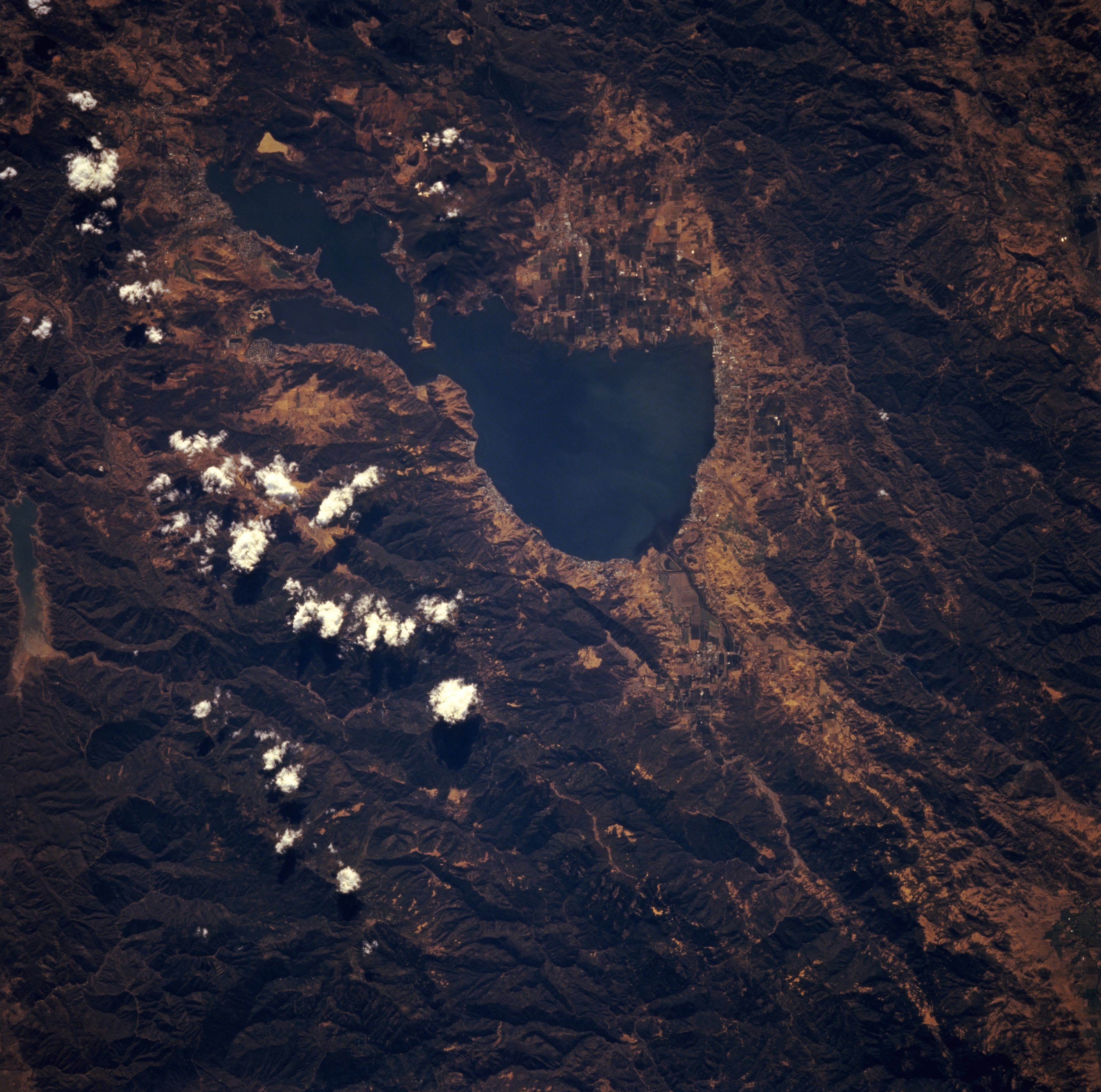
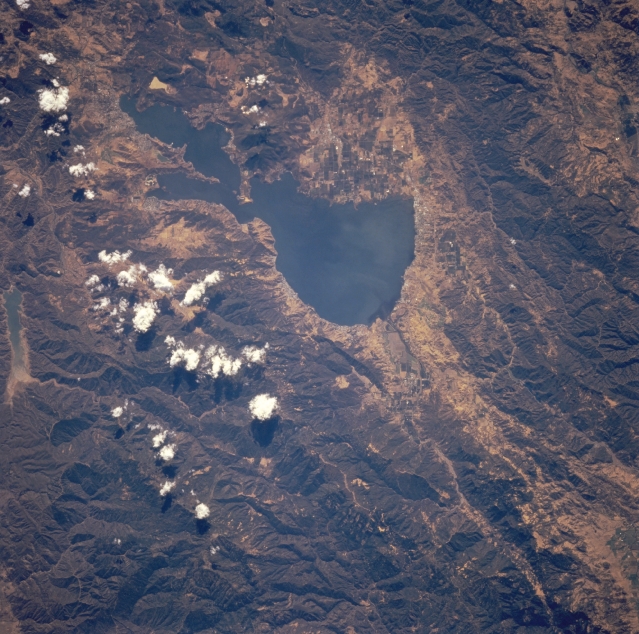
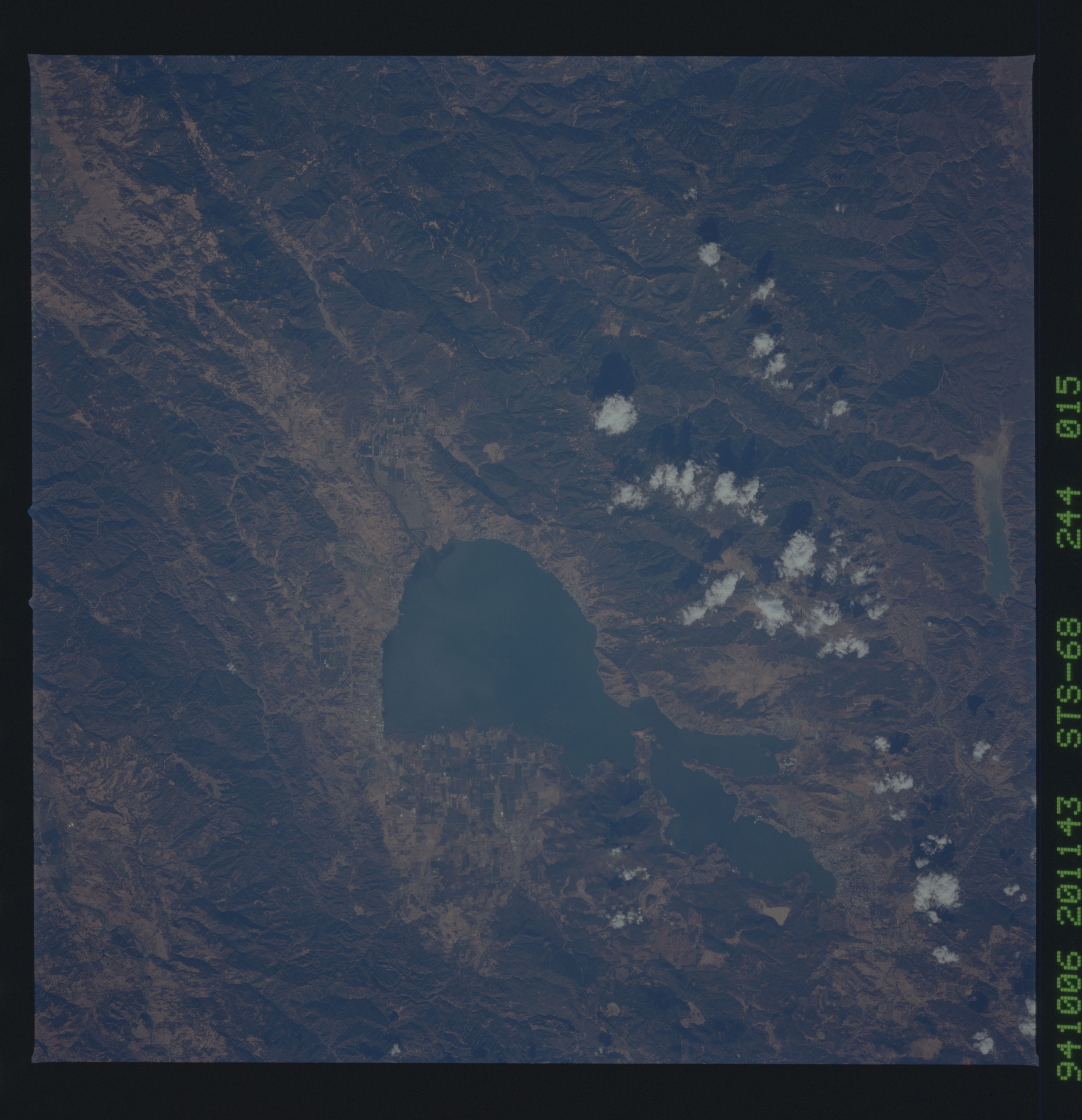
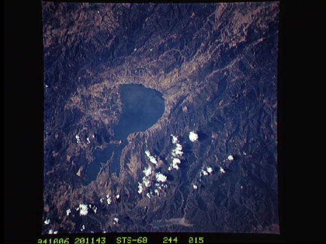
Image Caption: STS068-244-015 Clear Lake and Coast Range, California, U.S.A. October 1994
Clear Lake, the largest freshwater lake entirely within the state of California [65 square miles (168 square kilometers)], nestles among the rugged Coast Range in this low-oblique, south-looking photograph. A popular tourist and fishing resort, Clear Lake is 25 miles (40 kilometers) long and 2 to 10 miles (3 to 16 kilometers) wide. The lake is fed at its north end by three small creeks that originate nearby in the humid Coast Range and is drained at its south end by Cache Creek, which flows southeast and empties into the Sacramento River. Mendocino National Forest is discernible in the bottom half of the photograph.
Clear Lake, the largest freshwater lake entirely within the state of California [65 square miles (168 square kilometers)], nestles among the rugged Coast Range in this low-oblique, south-looking photograph. A popular tourist and fishing resort, Clear Lake is 25 miles (40 kilometers) long and 2 to 10 miles (3 to 16 kilometers) wide. The lake is fed at its north end by three small creeks that originate nearby in the humid Coast Range and is drained at its south end by Cache Creek, which flows southeast and empties into the Sacramento River. Mendocino National Forest is discernible in the bottom half of the photograph.
