STS066-119-94
| NASA Photo ID | STS066-119-94 |
| Focal Length | 100mm |
| Date taken | 1994.11.05 |
| Time taken | 23:08:41 GMT |
Resolutions offered for this image:
3904 x 3904 pixels 639 x 639 pixels 5700 x 5900 pixels 500 x 518 pixels 640 x 480 pixels
3904 x 3904 pixels 639 x 639 pixels 5700 x 5900 pixels 500 x 518 pixels 640 x 480 pixels

Cloud masks available for this image:
Spacecraft nadir point: 21.7° S, 140.4° E
Photo center point: 23.0° S, 140.0° E
Photo center point by machine learning:
Photo center point: 23.0° S, 140.0° E
Photo center point by machine learning:
Nadir to Photo Center: South
Spacecraft Altitude: 161 nautical miles (298km)
Country or Geographic Name: | AUSTRALIA-Q |
Features: | HAMILTON RIVER, BURKE R. |
| Features Found Using Machine Learning: | |
Cloud Cover Percentage: | 0 (no clouds present) |
Sun Elevation Angle: | 44° |
Sun Azimuth: | 91° |
Camera: | Hasselblad |
Focal Length: | 100mm |
Camera Tilt: | 27 degrees |
Format: | 5046: Kodak, natural color positive, Lumiere 100/5046, ASA 100, standard base |
Film Exposure: | Normal |
| Additional Information | |
| Width | Height | Annotated | Cropped | Purpose | Links |
|---|---|---|---|---|---|
| 3904 pixels | 3904 pixels | No | No | Earth From Space collection | Download Image |
| 639 pixels | 639 pixels | No | No | Earth From Space collection | Download Image |
| 5700 pixels | 5900 pixels | No | No | Download Image | |
| 500 pixels | 518 pixels | No | No | Download Image | |
| 640 pixels | 480 pixels | No | No | Download Image |
Download Packaged File
Download a Google Earth KML for this Image
View photo footprint information
Download a GeoTIFF for this photo
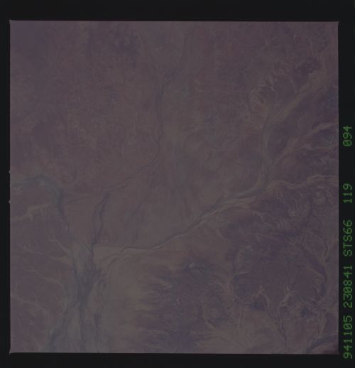
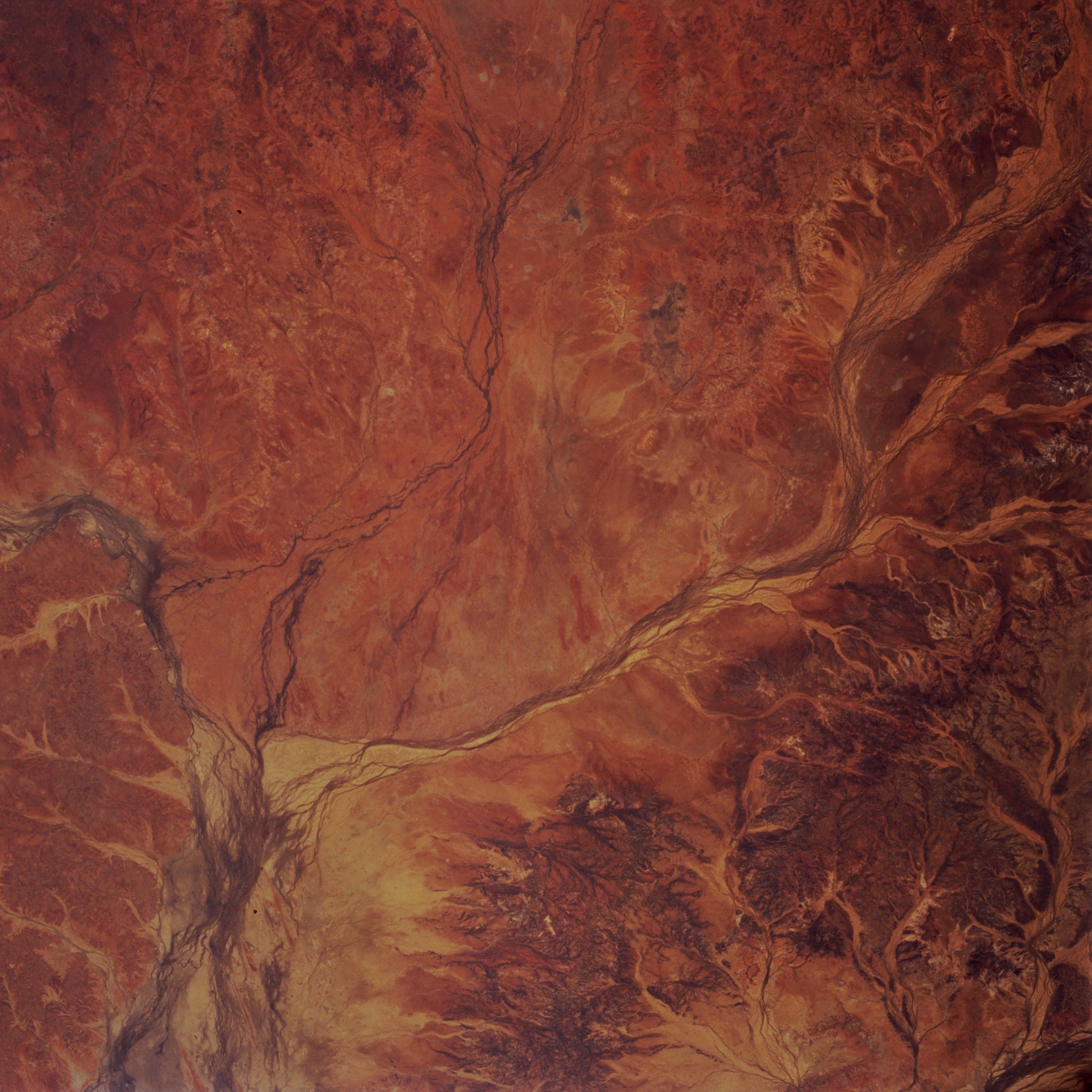
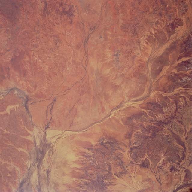
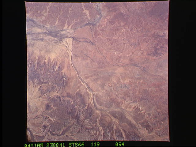
Image Caption: STS066-119-094 Hamilton River, Queensland, Australia November 1994
Three ephemeral rivers converge (lower left) in the area of southwestern Queensland seen here. The winding, multi-channeled Hamilton River (right middle) flows southwestward and the Burke River (upper middle), with its less developed floodplain, flows southward to join the Georgina River. South of the confluence the floodplain of the Georgina River widens dramatically. The headwaters of the Georgina River are about 190 miles (300 kilometers) west of the Selwyn Range in the Barkly Tableland; while the headwaters of the Burke River and Willis Creek (the western stream in the confluence in upper center of picture) are in the Cloncurry Plateau, just south of the Mount Isa silver mines. The Finucane Range (lower right one-third of view) forms the divide between the major Georgina (west) and Diamantina (east) drainages. The drainage patterns of these rivers are easily recognized and differentiated from the arid, desert landscape due to their darker features--caused either by increased vegetation or traces of moisture in the numerous channels.
Three ephemeral rivers converge (lower left) in the area of southwestern Queensland seen here. The winding, multi-channeled Hamilton River (right middle) flows southwestward and the Burke River (upper middle), with its less developed floodplain, flows southward to join the Georgina River. South of the confluence the floodplain of the Georgina River widens dramatically. The headwaters of the Georgina River are about 190 miles (300 kilometers) west of the Selwyn Range in the Barkly Tableland; while the headwaters of the Burke River and Willis Creek (the western stream in the confluence in upper center of picture) are in the Cloncurry Plateau, just south of the Mount Isa silver mines. The Finucane Range (lower right one-third of view) forms the divide between the major Georgina (west) and Diamantina (east) drainages. The drainage patterns of these rivers are easily recognized and differentiated from the arid, desert landscape due to their darker features--caused either by increased vegetation or traces of moisture in the numerous channels.
