STS065-96-9

| NASA Photo ID | STS065-96-9 |
| Focal Length | 250mm |
| Date taken | 1994.07.13 |
| Time taken | 21:57:15 GMT |
Resolutions offered for this image:
3904 x 3904 pixels 639 x 639 pixels 5700 x 5900 pixels 500 x 518 pixels 640 x 480 pixels 4501 x 4729 pixels
3904 x 3904 pixels 639 x 639 pixels 5700 x 5900 pixels 500 x 518 pixels 640 x 480 pixels 4501 x 4729 pixels


Cloud masks available for this image:
Spacecraft nadir point: 21.3° N, 157.8° W
Photo center point: 21.0° N, 157.0° W
Photo center point by machine learning:
Photo center point: 21.0° N, 157.0° W
Photo center point by machine learning:
Nadir to Photo Center: East
Spacecraft Altitude: 160 nautical miles (296km)
Country or Geographic Name: | USA-HAWAII |
Features: | MOLOKAI, LANAI ISLANDS |
| Features Found Using Machine Learning: | |
Cloud Cover Percentage: | 10 (1-10)% |
Sun Elevation Angle: | 81° |
Sun Azimuth: | 85° |
Camera: | Hasselblad |
Focal Length: | 250mm |
Camera Tilt: | 18 degrees |
Format: | 5048: Kodak, natural color positive, Lumiere 100x/5048, ASA 100x, standard base |
Film Exposure: | Normal |
| Additional Information | |
| Width | Height | Annotated | Cropped | Purpose | Links |
|---|---|---|---|---|---|
| 3904 pixels | 3904 pixels | No | No | Earth From Space collection | Download Image |
| 639 pixels | 639 pixels | No | No | Earth From Space collection | Download Image |
| 5700 pixels | 5900 pixels | No | No | Download Image | |
| 500 pixels | 518 pixels | No | No | Download Image | |
| 640 pixels | 480 pixels | No | No | Download Image | |
| 4501 pixels | 4729 pixels | Yes | Reef RS | Download Image |
Download Packaged File
Download a Google Earth KML for this Image
View photo footprint information
Download a GeoTIFF for this photo
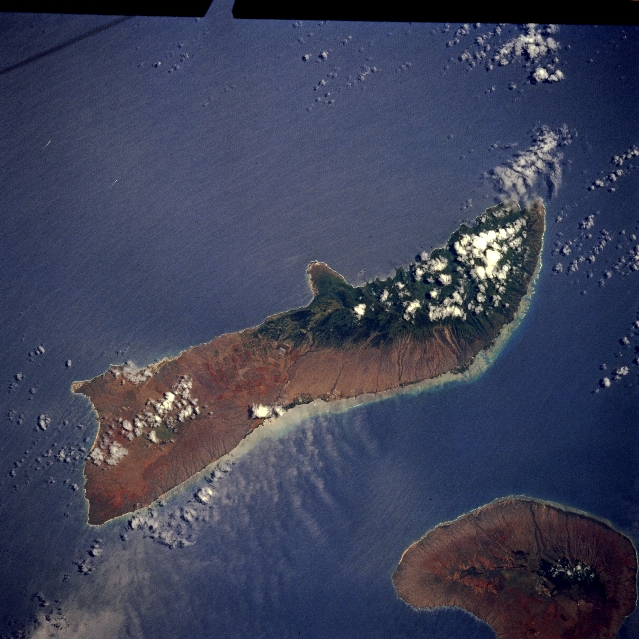
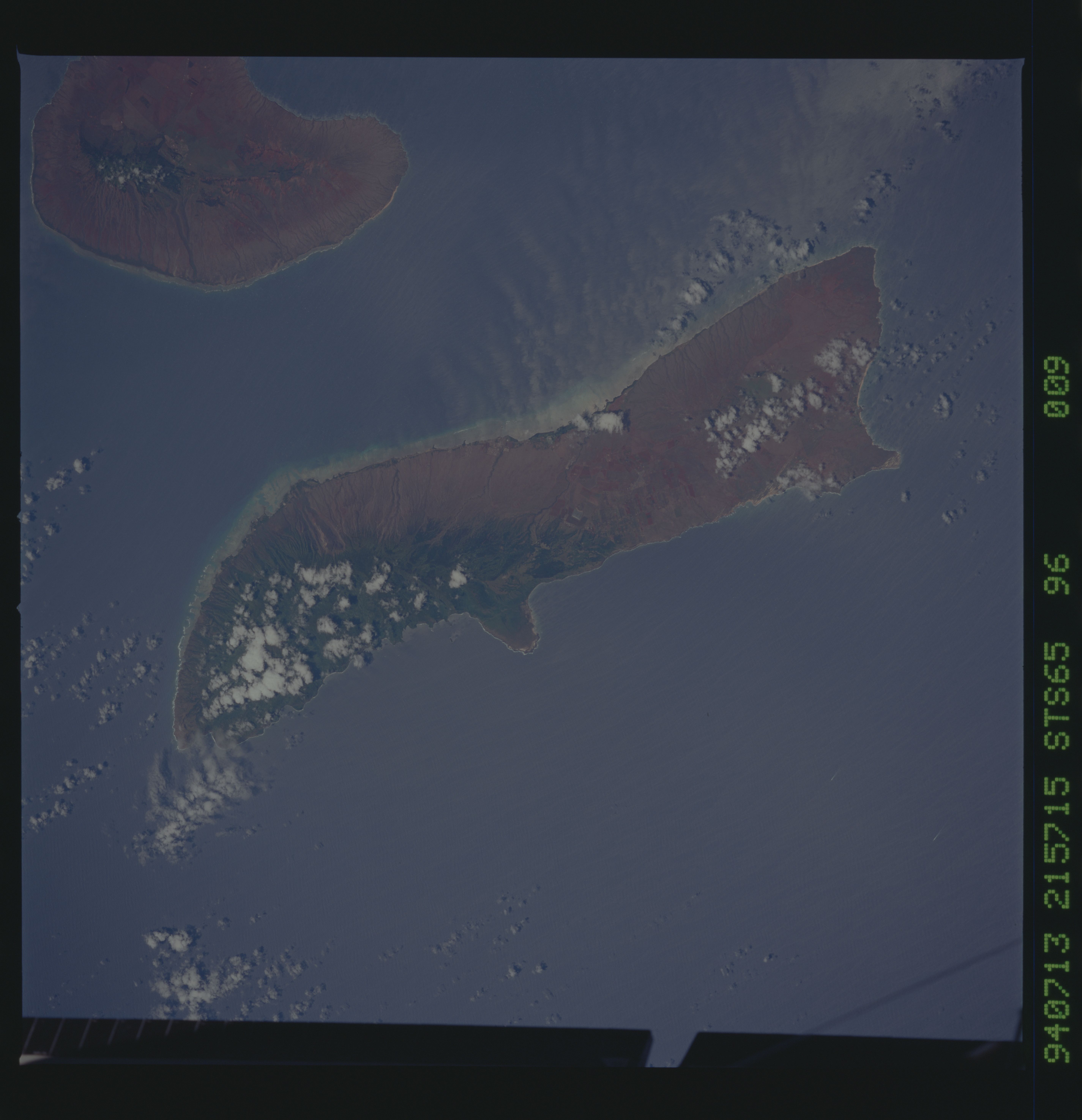
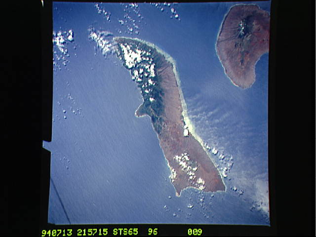
Image Caption: STS065-096-009 Molokai, Hawaii, U.S.A. July 1994
The higher elevations along the northeastern third of Molokai, some at 4970 feet (1515 meters), have a dramatic impact on the amount of precipitation that falls from one island to another and on different parts of the same island. The rain shadow effect--drier conditions in the west (signified by lighter colors)--is the result of the northeast trade winds hitting the higher elevations in the east and dropping most of the moisture along the northeastern end of the island (darker colors indicate vegetation). The remote peninsula that juts northward in the middle of the north coast is the site of Kalaupapa National Historical Park. A leper colony was established in 1866 on this remote peninsula. A well-established coral reef system is visible along the south and southeastern shorelines of Molokai, south of which lies Lanai.
The higher elevations along the northeastern third of Molokai, some at 4970 feet (1515 meters), have a dramatic impact on the amount of precipitation that falls from one island to another and on different parts of the same island. The rain shadow effect--drier conditions in the west (signified by lighter colors)--is the result of the northeast trade winds hitting the higher elevations in the east and dropping most of the moisture along the northeastern end of the island (darker colors indicate vegetation). The remote peninsula that juts northward in the middle of the north coast is the site of Kalaupapa National Historical Park. A leper colony was established in 1866 on this remote peninsula. A well-established coral reef system is visible along the south and southeastern shorelines of Molokai, south of which lies Lanai.
