STS061-86-4
| NASA Photo ID | STS061-86-4 |
| Focal Length | 40mm |
| Date taken | 1993.12.05 |
| Time taken | 01:36:51 GMT |

Cloud masks available for this image:
Spacecraft nadir point: 15.3° N, 94.5° E
Photo center point: 16.0° N, 95.0° E
Photo center point by machine learning:
Photo center point: 16.0° N, 95.0° E
Photo center point by machine learning:
Nadir to Photo Center: Northeast
Spacecraft Altitude: 316 nautical miles (585km)
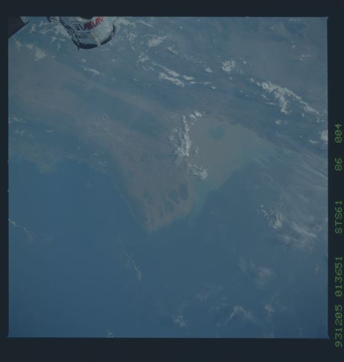
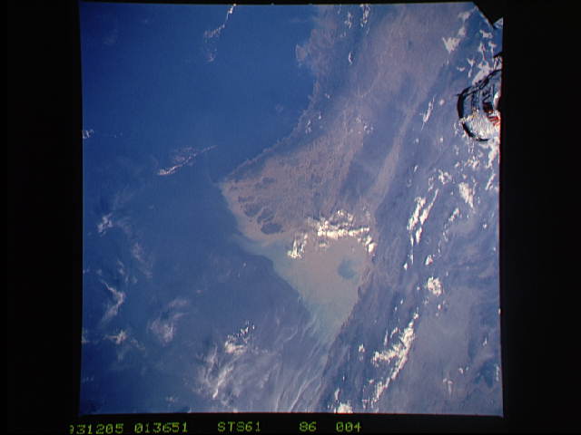
Country or Geographic Name: | MYANMAR (BURMA) |
Features: | MOUTHS OF THE IRRAWADDY |
| Features Found Using Machine Learning: | |
Cloud Cover Percentage: | 5 (1-10)% |
Sun Elevation Angle: | 21° |
Sun Azimuth: | 122° |
Camera: | Hasselblad |
Focal Length: | 40mm |
Camera Tilt: | 9 degrees |
Format: | 5017: Kodak, natural color positive, Ektachrome, X Professional, ASA 64, standard base |
Film Exposure: | Normal |
| Additional Information | |
| Width | Height | Annotated | Cropped | Purpose | Links |
|---|---|---|---|---|---|
| 5700 pixels | 6000 pixels | No | No | Download Image | |
| 500 pixels | 526 pixels | No | No | Download Image | |
| 640 pixels | 480 pixels | No | No | Download Image |
Download Packaged File
Download a Google Earth KML for this Image
View photo footprint information
Download a GeoTIFF for this photo
Image Caption: Irawaddy Delta, Burma. The Irawaddy is one of several large rivers (Indus, Ganges, Brahmaputra, Salween, Mekong, Red) that head in the Tibetan Highlands. The central basin of the Irawaddy is paralleled by steep mountains more than 3000 meters high; the ends of these mountain chains conduct the river to the Bay of Bengal and Andaman Sea. Rangoon, Burma lies on a distributary channel in the middle of the delta. Thailand and the valley of the Salween River lie at the upper edge of the photograph. The deltas and alluvial plains were once forest, but were cleared for rice cultivation during the nineteenth century. Some mangrove swamps remain in tidewater at the ends of distributary fingers.
