STS058-88-82
| NASA Photo ID | STS058-88-82 |
| Focal Length | 250mm |
| Date taken | 1993.10.22 |
| Time taken | 16:45:58 GMT |
Resolutions offered for this image:
3904 x 3904 pixels 639 x 639 pixels 5700 x 5900 pixels 500 x 518 pixels 640 x 480 pixels
3904 x 3904 pixels 639 x 639 pixels 5700 x 5900 pixels 500 x 518 pixels 640 x 480 pixels
Cloud masks available for this image:
Spacecraft nadir point: 38.5° N, 78.8° W
Photo center point: 39.0° N, 79.5° W
Photo center point by machine learning:
Photo center point: 39.0° N, 79.5° W
Photo center point by machine learning:
Nadir to Photo Center: Northwest
Spacecraft Altitude: 155 nautical miles (287km)
Country or Geographic Name: | USA-WEST VIRGINIA |
Features: | OTTER CREEK WILDERNESS |
| Features Found Using Machine Learning: | |
Cloud Cover Percentage: | 5 (1-10)% |
Sun Elevation Angle: | 40° |
Sun Azimuth: | 175° |
Camera: | Hasselblad |
Focal Length: | 250mm |
Camera Tilt: | 18 degrees |
Format: | 5017: Kodak, natural color positive, Ektachrome, X Professional, ASA 64, standard base |
Film Exposure: | Normal |
| Additional Information | |
| Width | Height | Annotated | Cropped | Purpose | Links |
|---|---|---|---|---|---|
| 3904 pixels | 3904 pixels | No | No | Earth From Space collection | Download Image |
| 639 pixels | 639 pixels | No | No | Earth From Space collection | Download Image |
| 5700 pixels | 5900 pixels | No | No | Download Image | |
| 500 pixels | 518 pixels | No | No | Download Image | |
| 640 pixels | 480 pixels | No | No | Download Image |
Download Packaged File
Download a Google Earth KML for this Image
View photo footprint information
Download a GeoTIFF for this photo
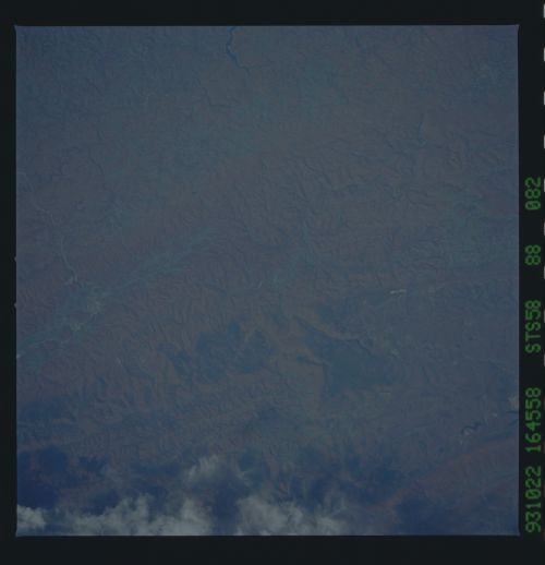
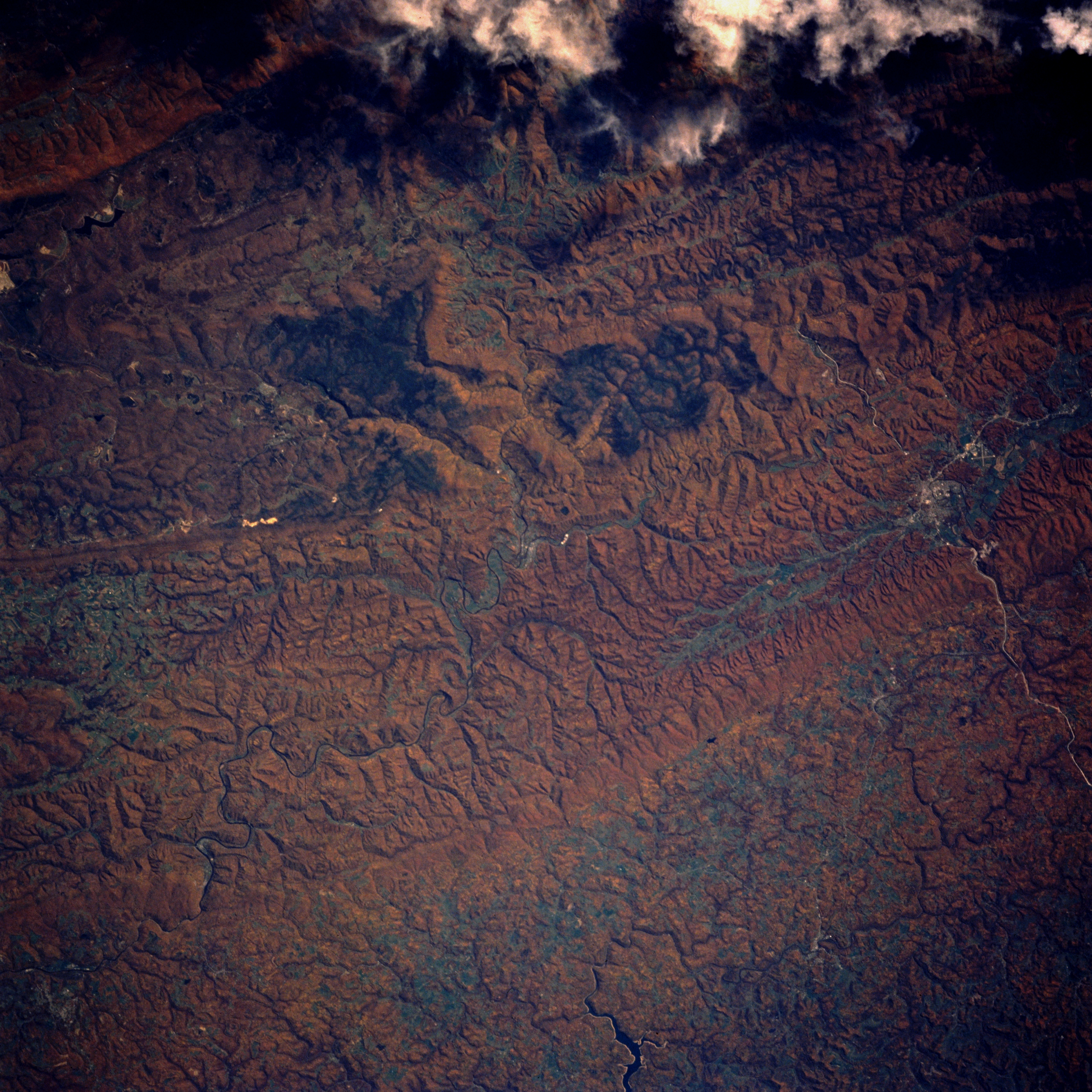
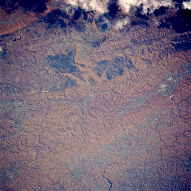
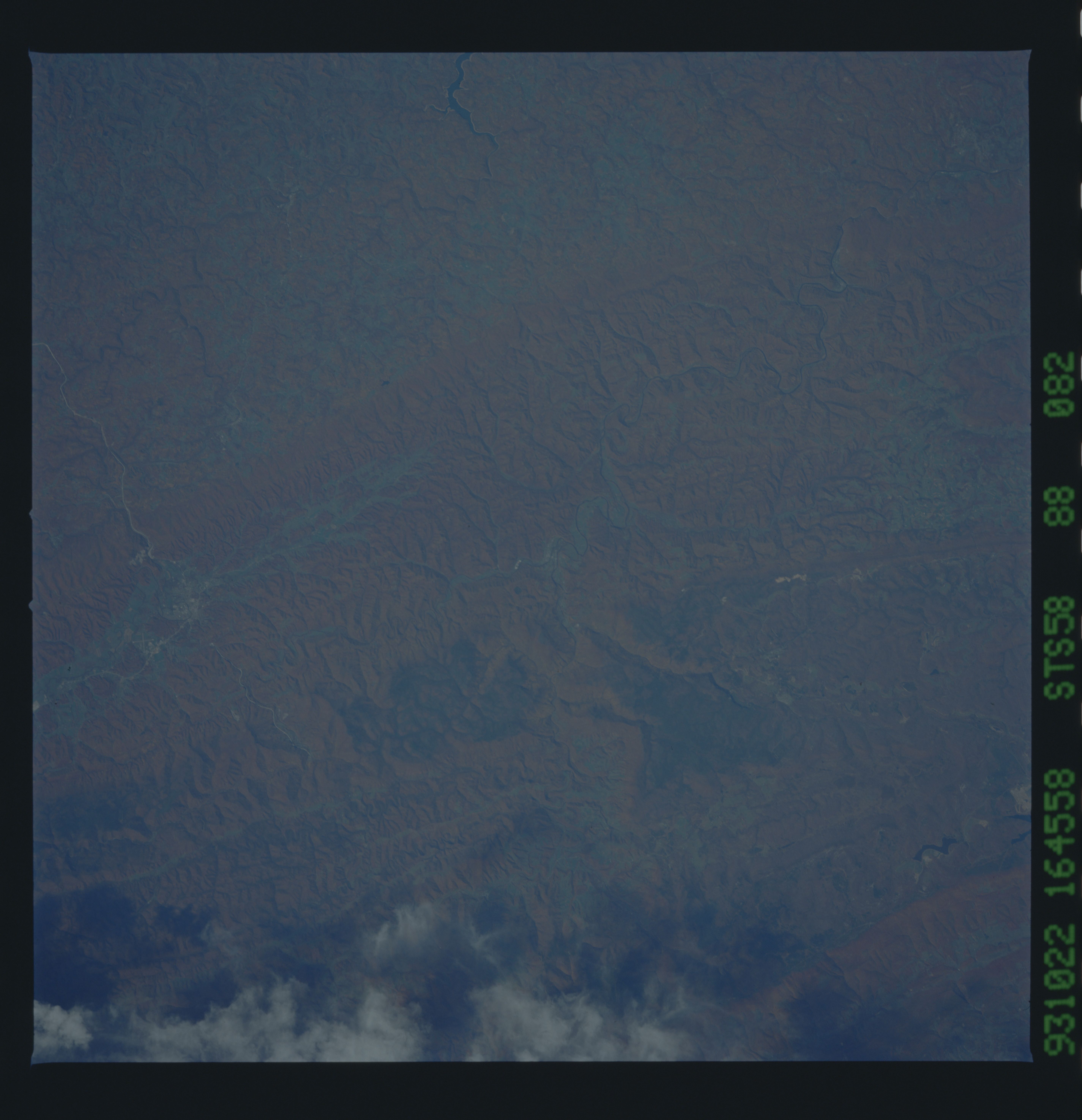
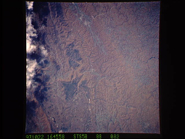
Image Caption: STS058-088-082 Appalachian Mountains, Elkins, West Virginia October 1993
The fall foliage of the tree-covered Appalachian Mountains is visible in this southeast-looking view. The Appalachian Mountains are an eroded remnant of a great mountain mass that was formed by the collision of the North American and African continents millions of years ago. The mountains are heavily wooded and are covered with the most richly varied deciduous forest in North America. Fire scars from a previous forest fire appear as a dark blue or black area slightly above the center of the image. The city of Elkins, located near the left-center of the image, is situated on the Tygart River. Elkins is the center of a timber and mining region. The eastern portion of Tygart Lake can be seen near the bottom-center of the image.
The fall foliage of the tree-covered Appalachian Mountains is visible in this southeast-looking view. The Appalachian Mountains are an eroded remnant of a great mountain mass that was formed by the collision of the North American and African continents millions of years ago. The mountains are heavily wooded and are covered with the most richly varied deciduous forest in North America. Fire scars from a previous forest fire appear as a dark blue or black area slightly above the center of the image. The city of Elkins, located near the left-center of the image, is situated on the Tygart River. Elkins is the center of a timber and mining region. The eastern portion of Tygart Lake can be seen near the bottom-center of the image.
