STS056-77-37
| NASA Photo ID | STS056-77-37 |
| Focal Length | 100mm |
| Date taken | 1993.04.10 |
| Time taken | 15:14:50 GMT |
Resolutions offered for this image:
3898 x 3868 pixels 639 x 635 pixels 5700 x 6000 pixels 500 x 526 pixels 640 x 480 pixels
3898 x 3868 pixels 639 x 635 pixels 5700 x 6000 pixels 500 x 526 pixels 640 x 480 pixels

Cloud masks available for this image:
Spacecraft nadir point: 33.8° N, 105.4° W
Photo center point: 33.5° N, 106.0° W
Photo center point by machine learning:
Photo center point: 33.5° N, 106.0° W
Photo center point by machine learning:
Nadir to Photo Center: Southwest
Spacecraft Altitude: 162 nautical miles (300km)
Country or Geographic Name: | USA-NEW MEXICO |
Features: | SIERRA BLANCA, LAVA FIELD |
| Features Found Using Machine Learning: | |
Cloud Cover Percentage: | 0 (no clouds present) |
Sun Elevation Angle: | 32° |
Sun Azimuth: | 102° |
Camera: | Hasselblad |
Focal Length: | 100mm |
Camera Tilt: | 14 degrees |
Format: | 5017: Kodak, natural color positive, Ektachrome, X Professional, ASA 64, standard base |
Film Exposure: | Normal |
| Additional Information | |
| Width | Height | Annotated | Cropped | Purpose | Links |
|---|---|---|---|---|---|
| 3898 pixels | 3868 pixels | No | No | Earth From Space collection | Download Image |
| 639 pixels | 635 pixels | No | No | Earth From Space collection | Download Image |
| 5700 pixels | 6000 pixels | No | No | Download Image | |
| 500 pixels | 526 pixels | No | No | Download Image | |
| 640 pixels | 480 pixels | No | No | Download Image |
Download Packaged File
Download a Google Earth KML for this Image
View photo footprint information
Download a GeoTIFF for this photo
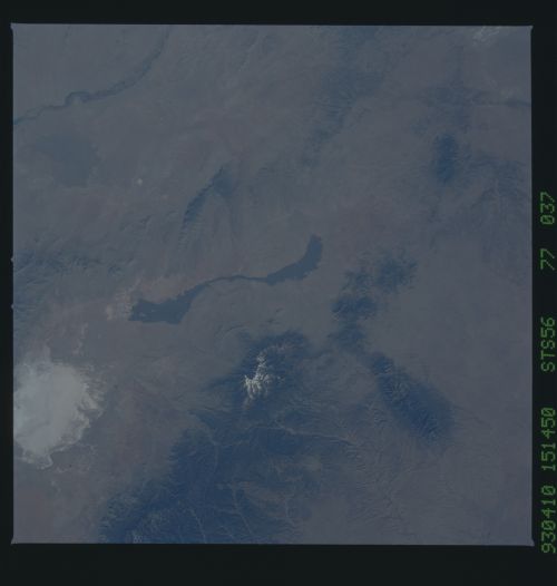
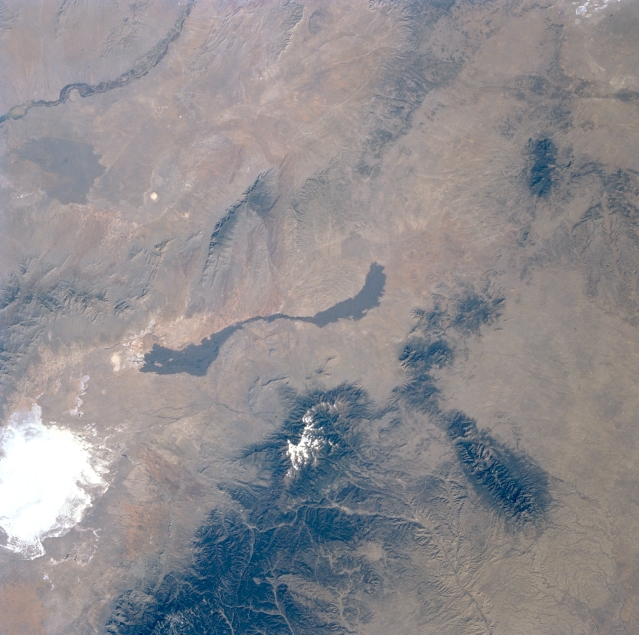
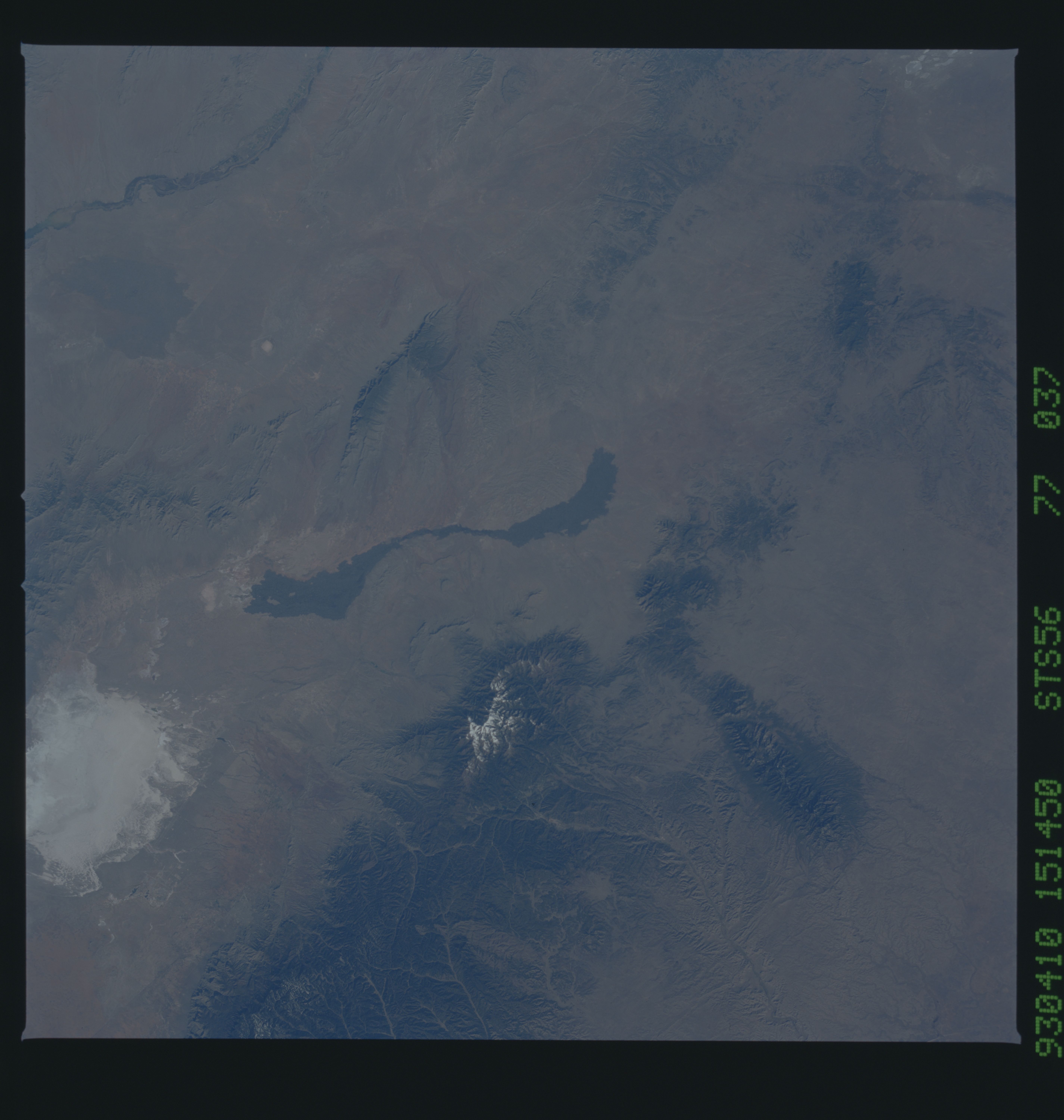
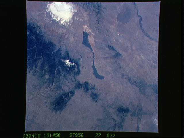
Image Caption: STS056-077-037 Tularosa Valley, New Mexico, U.S.A. April 1993
A large section of the Tularosa Valley, sandwiched between the north-south-trending San Andres Mountains to the west and the heavily forested Sacramento and Sierra Blanca Mountains to the east, is featured in this northwest-looking, low-oblique photograph of south-central New Mexico. Visible in the valley are White Sands National Monument, the highly reflective gypsum desert; a black, ribbonlike youthful lava flow, which originated from a small volcanic center (Little Black Peak) at the north end of the flow that erupted fewer than 1000 years ago; and snowcapped Sierra Blanca Peak [12 003 feet (3659 meters)]. Visible is a drainage basin created by the Hondo River as it erodes the eastern slopes of the Sacramento Mountains and the southern slopes of the east-west-oriented Capitan Mountains (lower right edge of the photograph). A small section of the Rio Grande is apparent (upper left corner), and an older lava flow is barely discernible to its east.
A large section of the Tularosa Valley, sandwiched between the north-south-trending San Andres Mountains to the west and the heavily forested Sacramento and Sierra Blanca Mountains to the east, is featured in this northwest-looking, low-oblique photograph of south-central New Mexico. Visible in the valley are White Sands National Monument, the highly reflective gypsum desert; a black, ribbonlike youthful lava flow, which originated from a small volcanic center (Little Black Peak) at the north end of the flow that erupted fewer than 1000 years ago; and snowcapped Sierra Blanca Peak [12 003 feet (3659 meters)]. Visible is a drainage basin created by the Hondo River as it erodes the eastern slopes of the Sacramento Mountains and the southern slopes of the east-west-oriented Capitan Mountains (lower right edge of the photograph). A small section of the Rio Grande is apparent (upper left corner), and an older lava flow is barely discernible to its east.
