STS039-609-10
| NASA Photo ID | STS039-609-10 |
| Focal Length | 250mm |
| Date taken | 1991.05.05 |
| Time taken | 03:47:00 GMT |
Resolutions offered for this image:
4096 x 4096 pixels 640 x 640 pixels 5700 x 6000 pixels 500 x 526 pixels 640 x 480 pixels
4096 x 4096 pixels 640 x 640 pixels 5700 x 6000 pixels 500 x 526 pixels 640 x 480 pixels

Cloud masks available for this image:
Spacecraft nadir point: 37.0° N, 129.5° E
Photo center point: 34.0° N, 132.5° E
Photo center point by machine learning:
Photo center point: 34.0° N, 132.5° E
Photo center point by machine learning:
Nadir to Photo Center: Southeast
Spacecraft Altitude: 141 nautical miles (261km)
Camera: | Rolleiflex |
Focal Length: | 250mm |
Camera Tilt: | Low Oblique |
Format: | 5017: Kodak, natural color positive, Ektachrome, X Professional, ASA 64, standard base |
Film Exposure: | Normal |
| Additional Information | |
| Width | Height | Annotated | Cropped | Purpose | Links |
|---|---|---|---|---|---|
| 4096 pixels | 4096 pixels | No | No | Earth From Space collection | Download Image |
| 640 pixels | 640 pixels | No | No | Earth From Space collection | Download Image |
| 5700 pixels | 6000 pixels | No | No | Download Image | |
| 500 pixels | 526 pixels | No | No | Download Image | |
| 640 pixels | 480 pixels | No | No | Download Image |
Download Packaged File
Download a Google Earth KML for this Image
View photo footprint information
Download a GeoTIFF for this photo
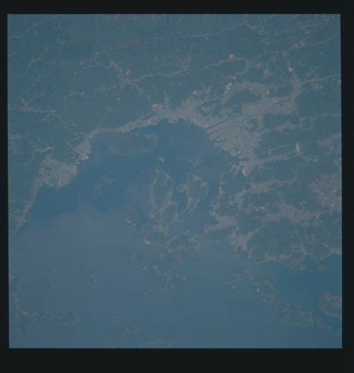
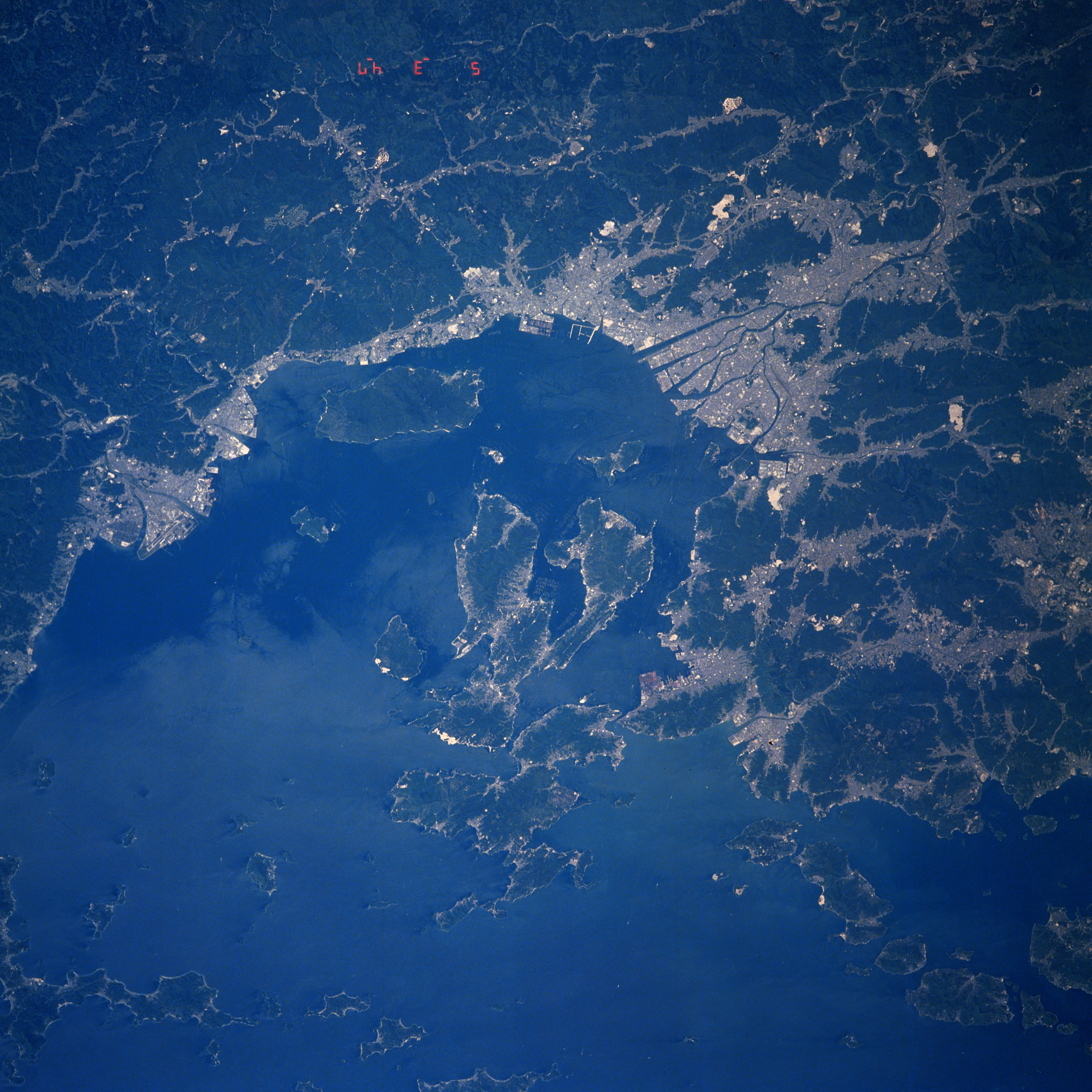
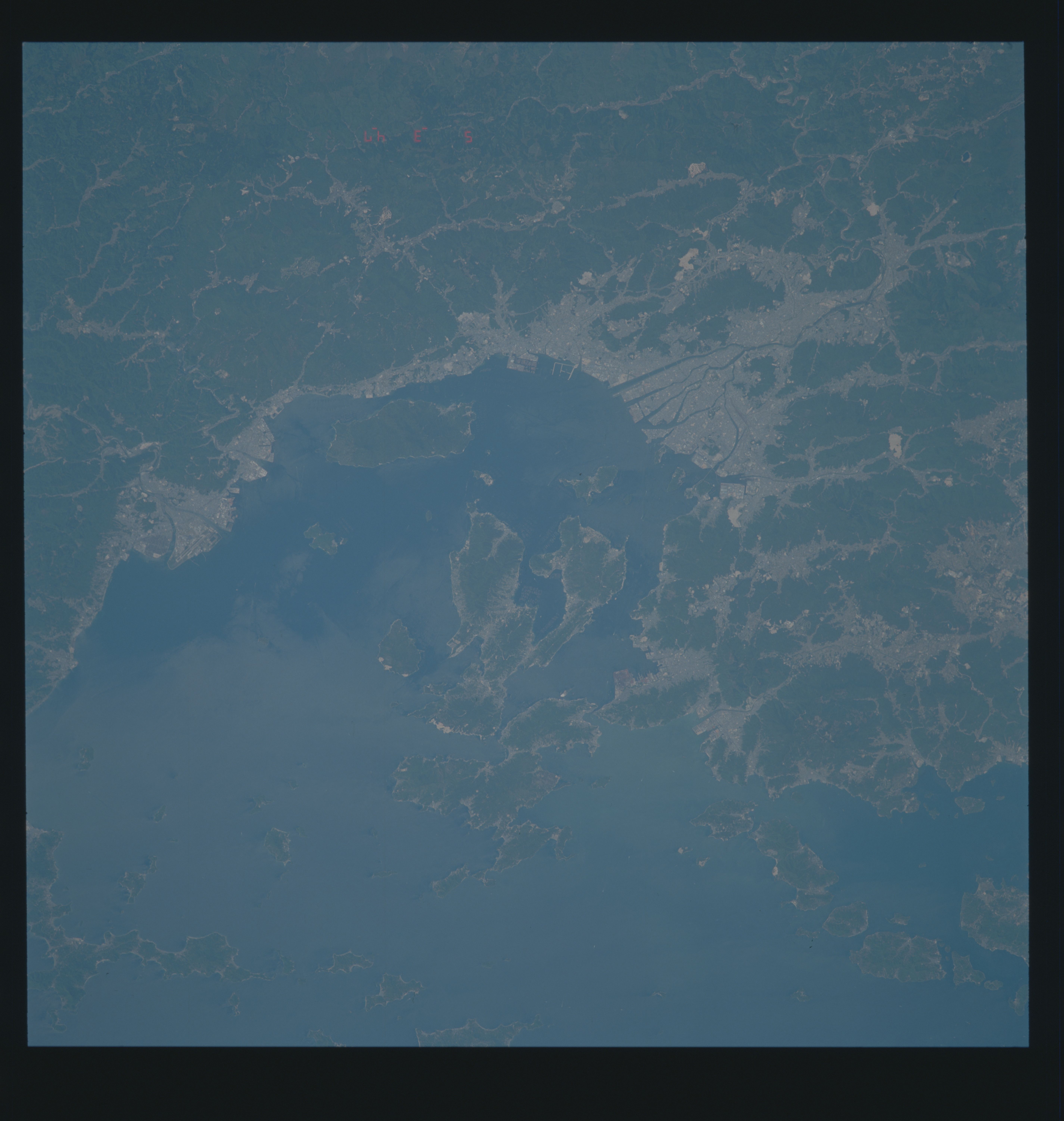
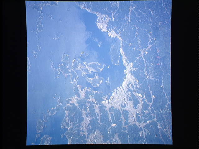
Image Caption: STS039-609-010 Hiroshima Area, Honshu, Japan May 1991
The Japanese city of Hiroshima, known as the "City of Peace" or the "City of Water," can be located on the image (lighter-looking landscape) where six distributary channels (dark, linear features) of the Ota River has formed a large delta upon which the city has developed (slightly above the right of center). The light-colored areas show where human development has taken place, either in the form of towns and cities or as limited agricultural areas. In this particular scene human presence is mainly found along the periphery of the Inland Sea and in the mountain valleys. The dominating terrain in this image consists of rugged, forested mountains (darker areas). Note that the Inland Sea has a myriad of islands of varying shapes and sizes.
The Japanese city of Hiroshima, known as the "City of Peace" or the "City of Water," can be located on the image (lighter-looking landscape) where six distributary channels (dark, linear features) of the Ota River has formed a large delta upon which the city has developed (slightly above the right of center). The light-colored areas show where human development has taken place, either in the form of towns and cities or as limited agricultural areas. In this particular scene human presence is mainly found along the periphery of the Inland Sea and in the mountain valleys. The dominating terrain in this image consists of rugged, forested mountains (darker areas). Note that the Inland Sea has a myriad of islands of varying shapes and sizes.
