STS036-73-56
| NASA Photo ID | STS036-73-56 |
| Focal Length | 100mm |
| Date taken | 1990.03.02 |
| Time taken | 11:14:39 GMT |
Resolutions offered for this image:
5266 x 5266 pixels 639 x 639 pixels 5700 x 5900 pixels 500 x 518 pixels 640 x 480 pixels
5266 x 5266 pixels 639 x 639 pixels 5700 x 5900 pixels 500 x 518 pixels 640 x 480 pixels

Cloud masks available for this image:
Spacecraft nadir point: 22.6° S, 34.8° E
Photo center point: 22.0° S, 35.5° E
Photo center point by machine learning:
Photo center point: 22.0° S, 35.5° E
Photo center point by machine learning:
Nadir to Photo Center: Northeast
Spacecraft Altitude: 132 nautical miles (244km)
Country or Geographic Name: | MOZAMBIQUE |
Features: | ILHA DO BAZARUTO |
| Features Found Using Machine Learning: | |
Cloud Cover Percentage: | 10 (1-10)% |
Sun Elevation Angle: | 65° |
Sun Azimuth: | 305° |
Camera: | Hasselblad |
Focal Length: | 100mm |
Camera Tilt: | 23 degrees |
Format: | 5017: Kodak, natural color positive, Ektachrome, X Professional, ASA 64, standard base |
Film Exposure: | Normal |
| Additional Information | |
| Width | Height | Annotated | Cropped | Purpose | Links |
|---|---|---|---|---|---|
| 5266 pixels | 5266 pixels | No | No | Earth From Space collection | Download Image |
| 639 pixels | 639 pixels | No | No | Earth From Space collection | Download Image |
| 5700 pixels | 5900 pixels | No | No | Download Image | |
| 500 pixels | 518 pixels | No | No | Download Image | |
| 640 pixels | 480 pixels | No | No | Download Image |
Download Packaged File
Download a Google Earth KML for this Image
View photo footprint information
Download a GeoTIFF for this photo
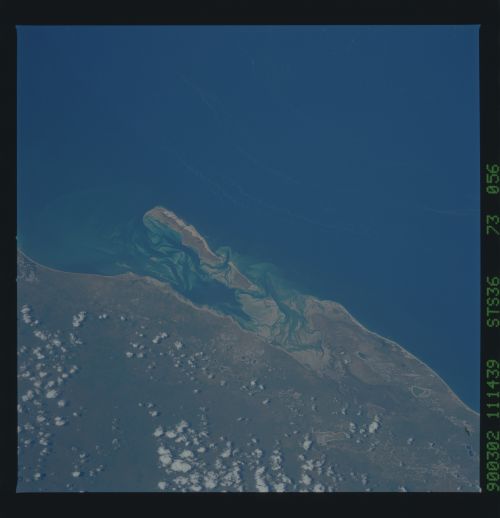
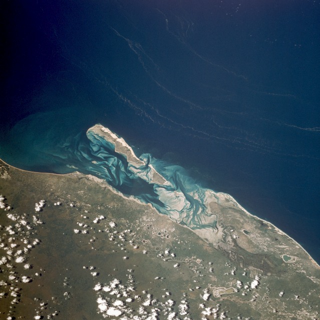
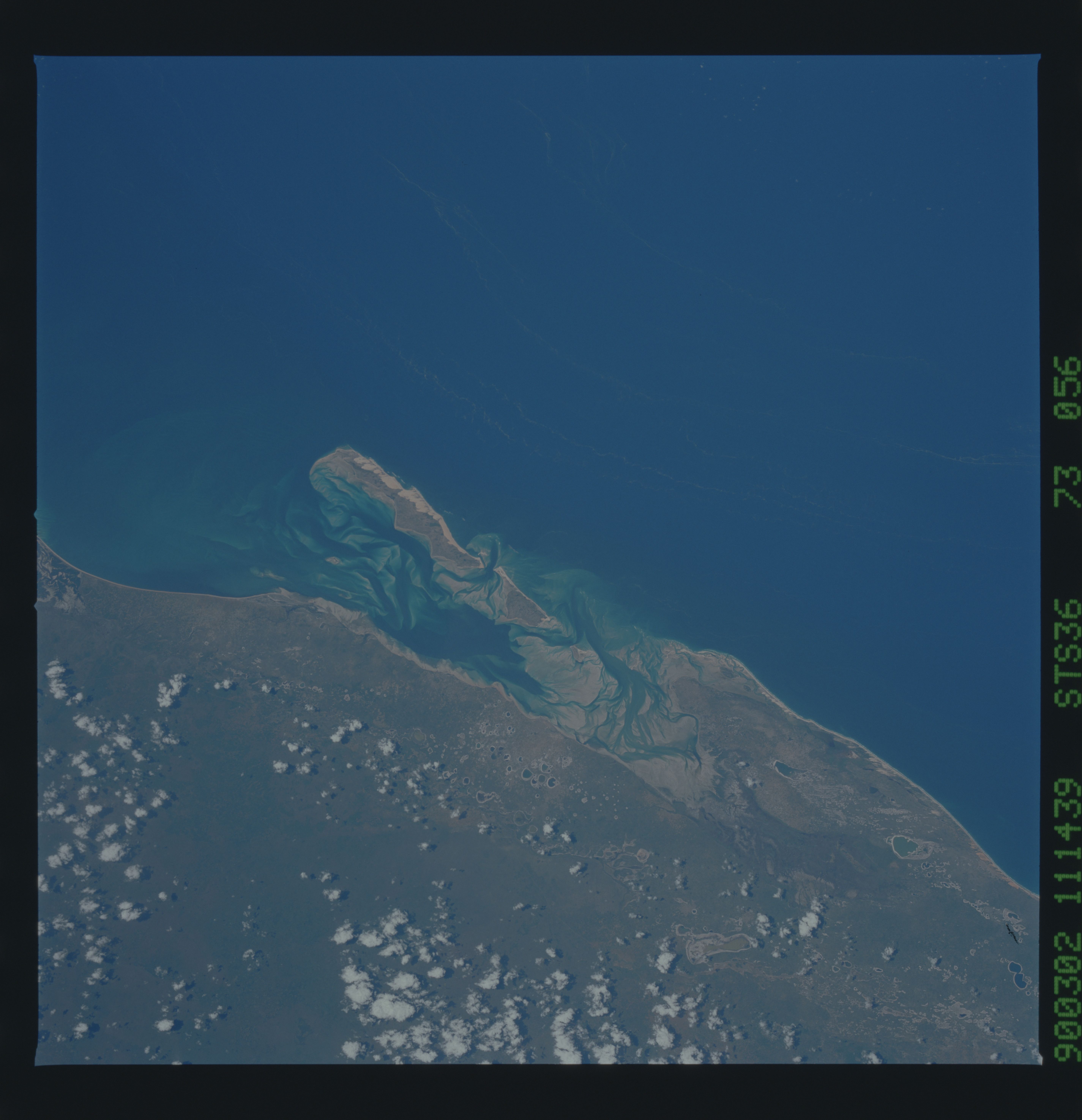
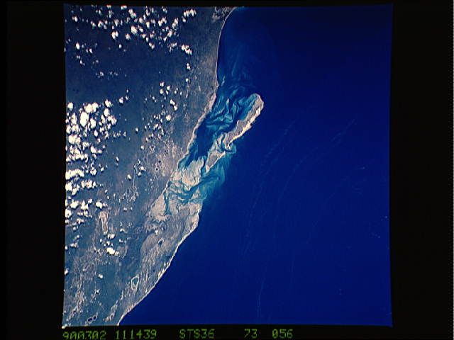
Image Caption: STS036-073-056 Bazaruto Island, Mozambique March 1990
The sandy island of Bazaruto, Mozambique, is located approximately 50 miles (80 kilometers) southeast of the mouth of the Save River. The warm, southward-flowing Mozambique Current seems to contribute to the increasing buildup of the sandy coastline. Because the water along this coastal area is very clear, much of the subsurface channel pattern around the island is discernible. Several narrow lines of plankton bloom (barely visible in the photograph) parallel the shoreline. The coastal plains show numerous lakes and a swampy environment that appears to be karst topography. Underlying the area is limestone rock that has eroded into a pockmarked landscape, creating water-filled sinkholes. Rainfall amounts in this humid equatorial climate range between 20 and 40 inches (50 and 100 centimeters) annually.
The sandy island of Bazaruto, Mozambique, is located approximately 50 miles (80 kilometers) southeast of the mouth of the Save River. The warm, southward-flowing Mozambique Current seems to contribute to the increasing buildup of the sandy coastline. Because the water along this coastal area is very clear, much of the subsurface channel pattern around the island is discernible. Several narrow lines of plankton bloom (barely visible in the photograph) parallel the shoreline. The coastal plains show numerous lakes and a swampy environment that appears to be karst topography. Underlying the area is limestone rock that has eroded into a pockmarked landscape, creating water-filled sinkholes. Rainfall amounts in this humid equatorial climate range between 20 and 40 inches (50 and 100 centimeters) annually.
