STS031-78-C

| NASA Photo ID | STS031-78-C |
| Focal Length | 40mm |
| Date taken | 1990.04.__ |
| Time taken | GMT |
Resolutions offered for this image:
5700 x 5900 pixels 4961 x 4961 pixels 4961 x 4961 pixels 500 x 518 pixels 640 x 480 pixels
5700 x 5900 pixels 4961 x 4961 pixels 4961 x 4961 pixels 500 x 518 pixels 640 x 480 pixels

Cloud masks available for this image:
Spacecraft nadir point:
Photo center point: 30.0° N, 81.5° W
Photo center point by machine learning:
Photo center point: 30.0° N, 81.5° W
Photo center point by machine learning:
Nadir to Photo Center:
Spacecraft Altitude: nautical miles (0km)
Country or Geographic Name: | USA-FLORIDA |
Features: | PANORAMA-ENTIRE PEN, SGLT |
| Features Found Using Machine Learning: | |
Cloud Cover Percentage: | 60 (51-75)% |
Sun Elevation Angle: | ° |
Sun Azimuth: | ° |
Camera: | Hasselblad |
Focal Length: | 40mm |
Camera Tilt: | High Oblique |
Format: | 5017: Kodak, natural color positive, Ektachrome, X Professional, ASA 64, standard base |
Film Exposure: | Under Exposed |
| Additional Information | |
| Width | Height | Annotated | Cropped | Purpose | Links |
|---|---|---|---|---|---|
| 5700 pixels | 5900 pixels | No | No | Download Image | |
| 4961 pixels | 4961 pixels | No | No | Publisher Request | Download Image |
| 4961 pixels | 4961 pixels | No | No | Publisher Request | Download Image |
| 500 pixels | 518 pixels | No | No | Download Image | |
| 640 pixels | 480 pixels | No | No | Download Image |
Download Packaged File
Download a Google Earth KML for this Image
View photo footprint information
Download a GeoTIFF for this photo
Image Caption:
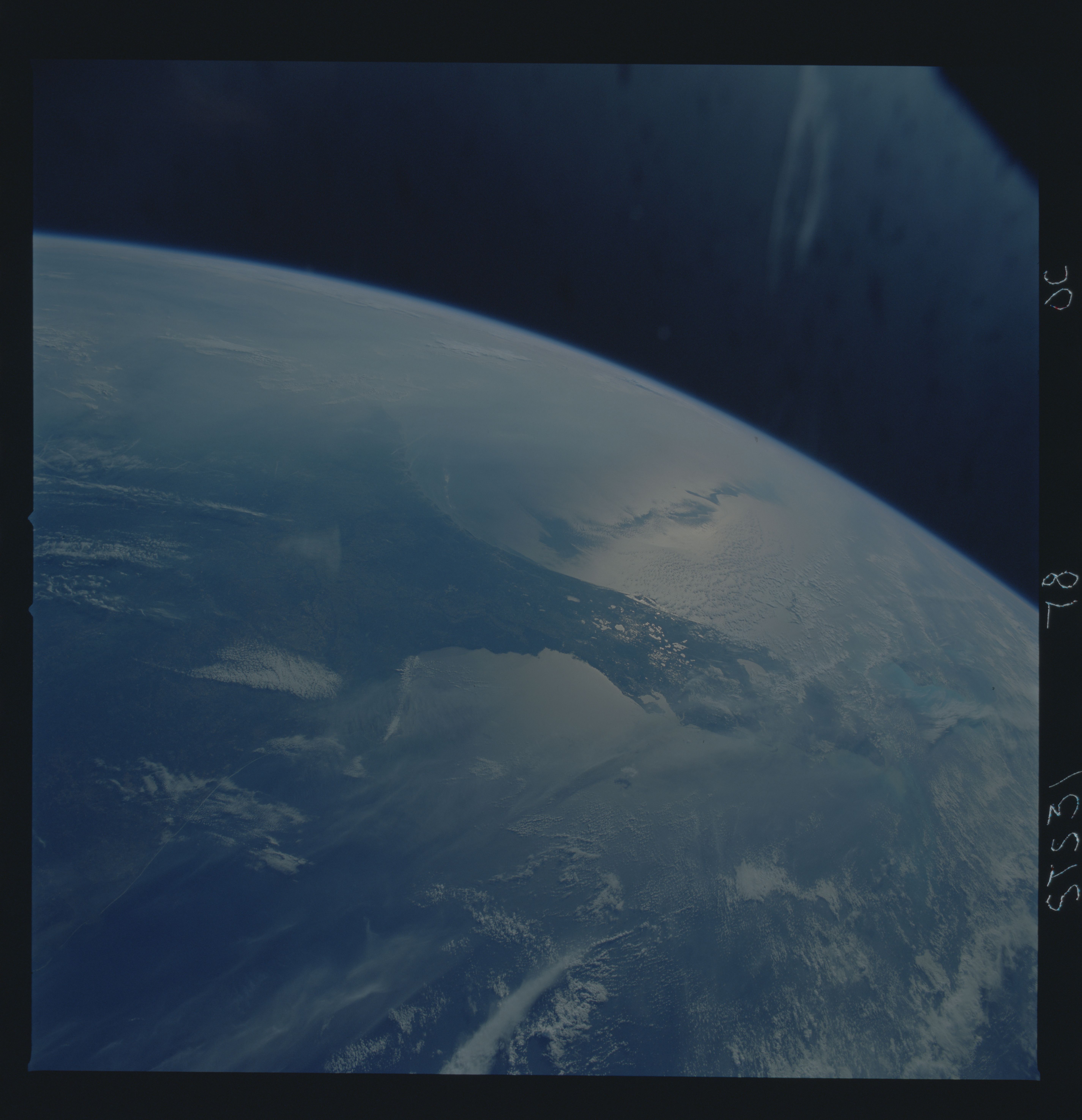
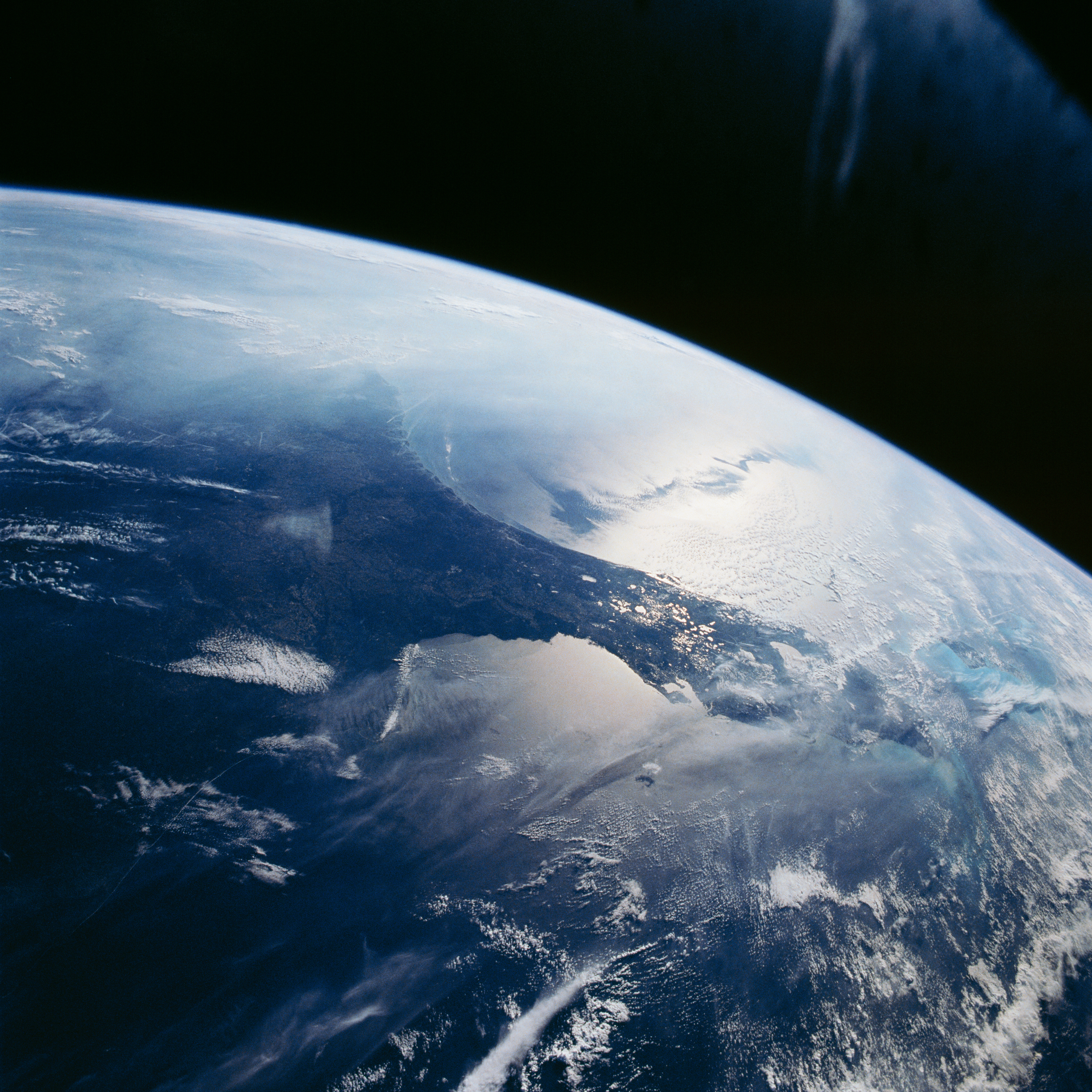
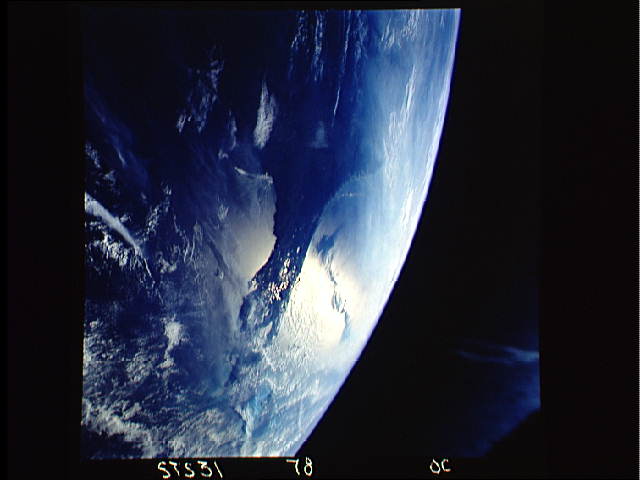
Oblique view of the Florida Peninsula (S31-78-00C). The central
lakes of Florida are highlighted in the sunglint. Also, the sig-
nature of an area of high pressure is graphically depicted in
this image. The Shuttle was located over the central Gulf of
Mexico looking northeast. An area of high pressure was ridging
into the Southeastern U.S. The dark areas in the sunglint run-
ning east-west located to the east of Florida indicate areas of
calm seas which result from the light winds of the high pressure
center. Haze and contrails cover the eastern seaboard of the US
and extend offshore over the Atlantic ocean. The haze and smog
was moving southeast into the Atlantic on the north side of the
high pressure.
The Gulf coast and the Florida peninsula (30.0N, 81.5W) seen in sunglint. The lakes of central Florida are highlighted in reflected light in this scene. The view extends up along the Georgia and South Carolina Coast and clouds cast shadows in the sunglint. The sunglint off the east coast also highlights shears in the Atlantic related to the Gulf Stream. To the south, Andros Island and the Grand Bahama Bank are visible.
