ISS058-E-13490
| NASA Photo ID | ISS058-E-13490 |
| Focal Length | 24mm |
| Date taken | 2019.02.14 |
| Time taken | 23:47:11 GMT |
5011 x 3341 pixels 720 x 480 pixels 5568 x 3712 pixels 640 x 427 pixels
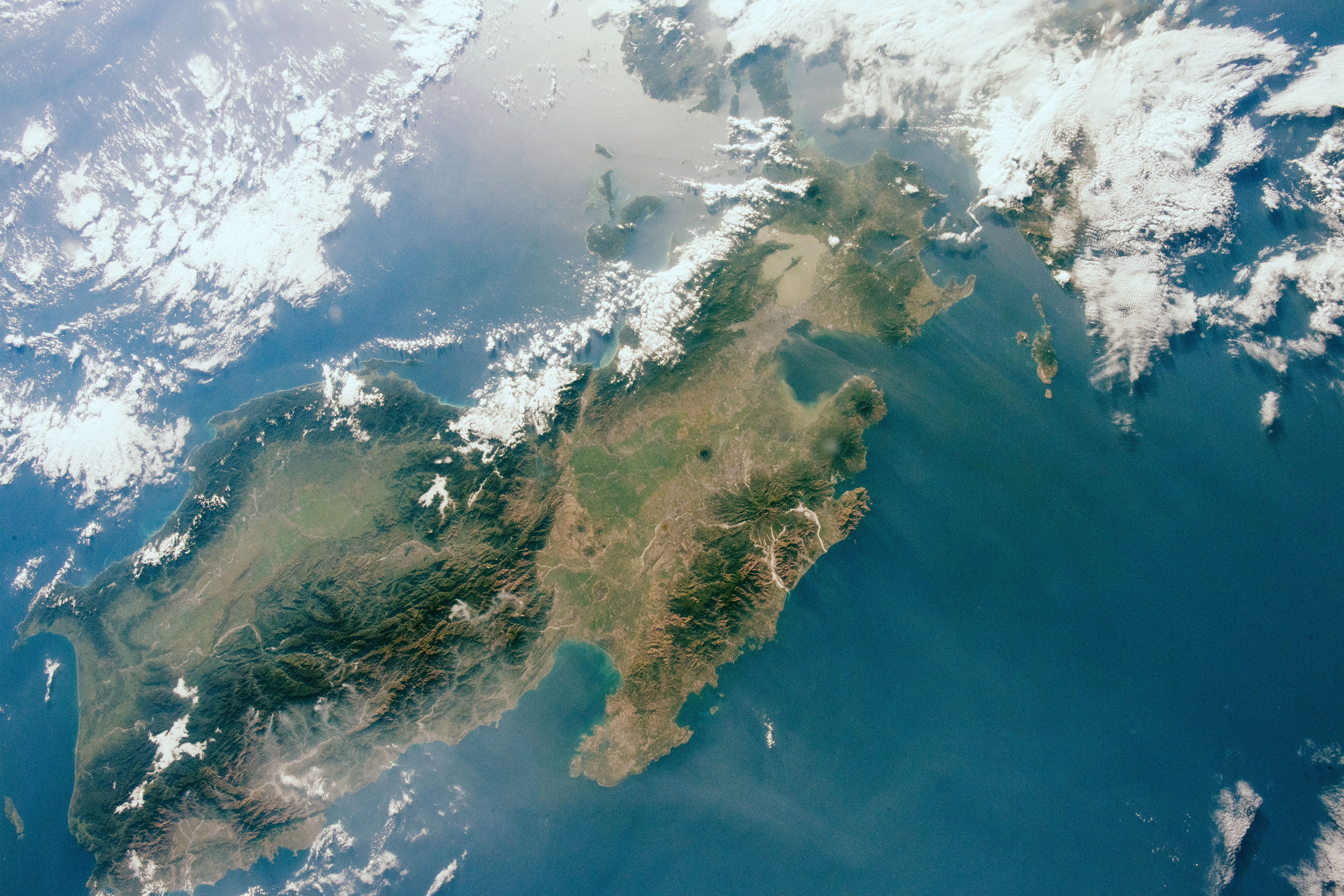
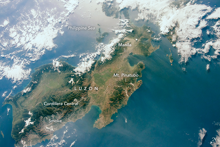
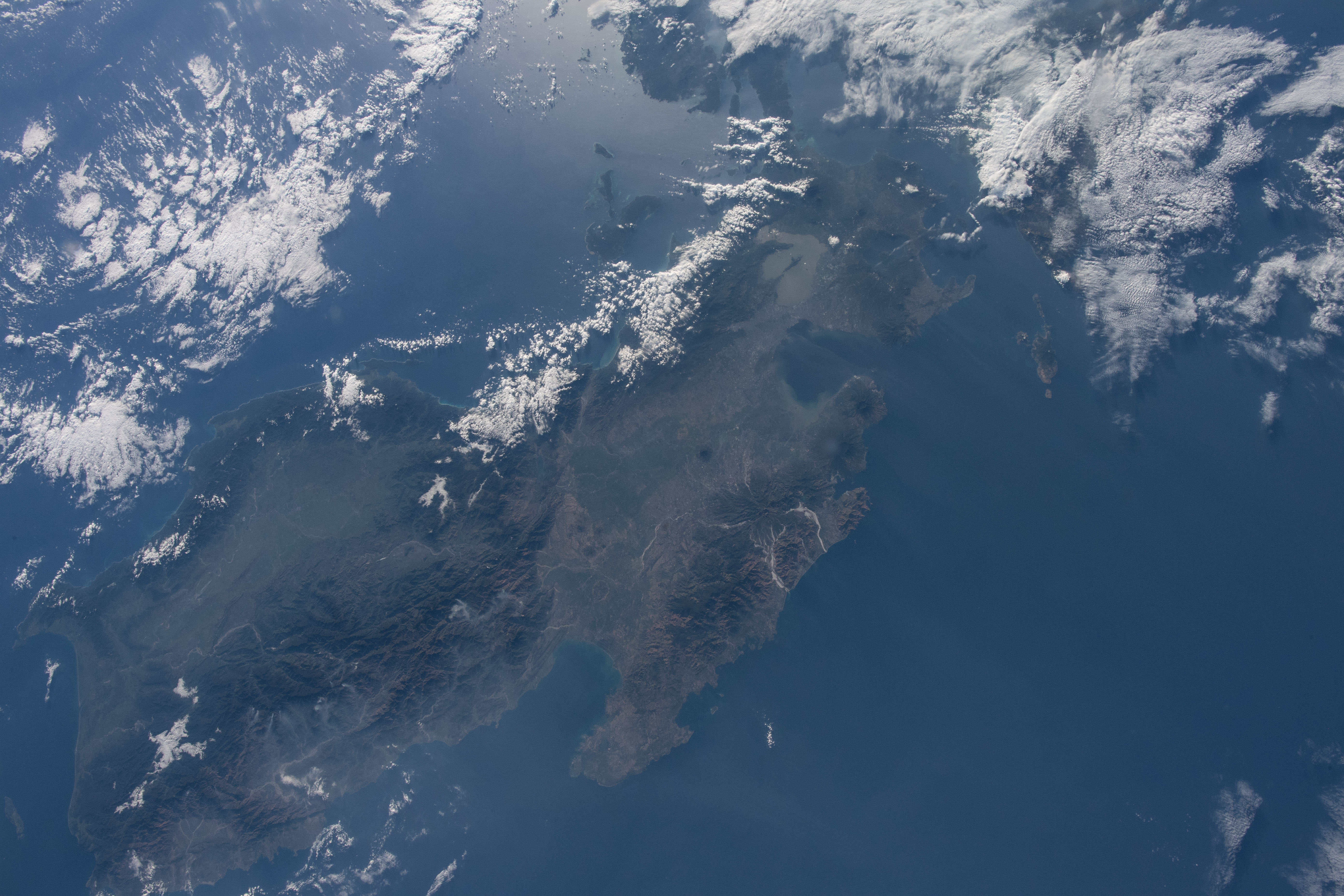
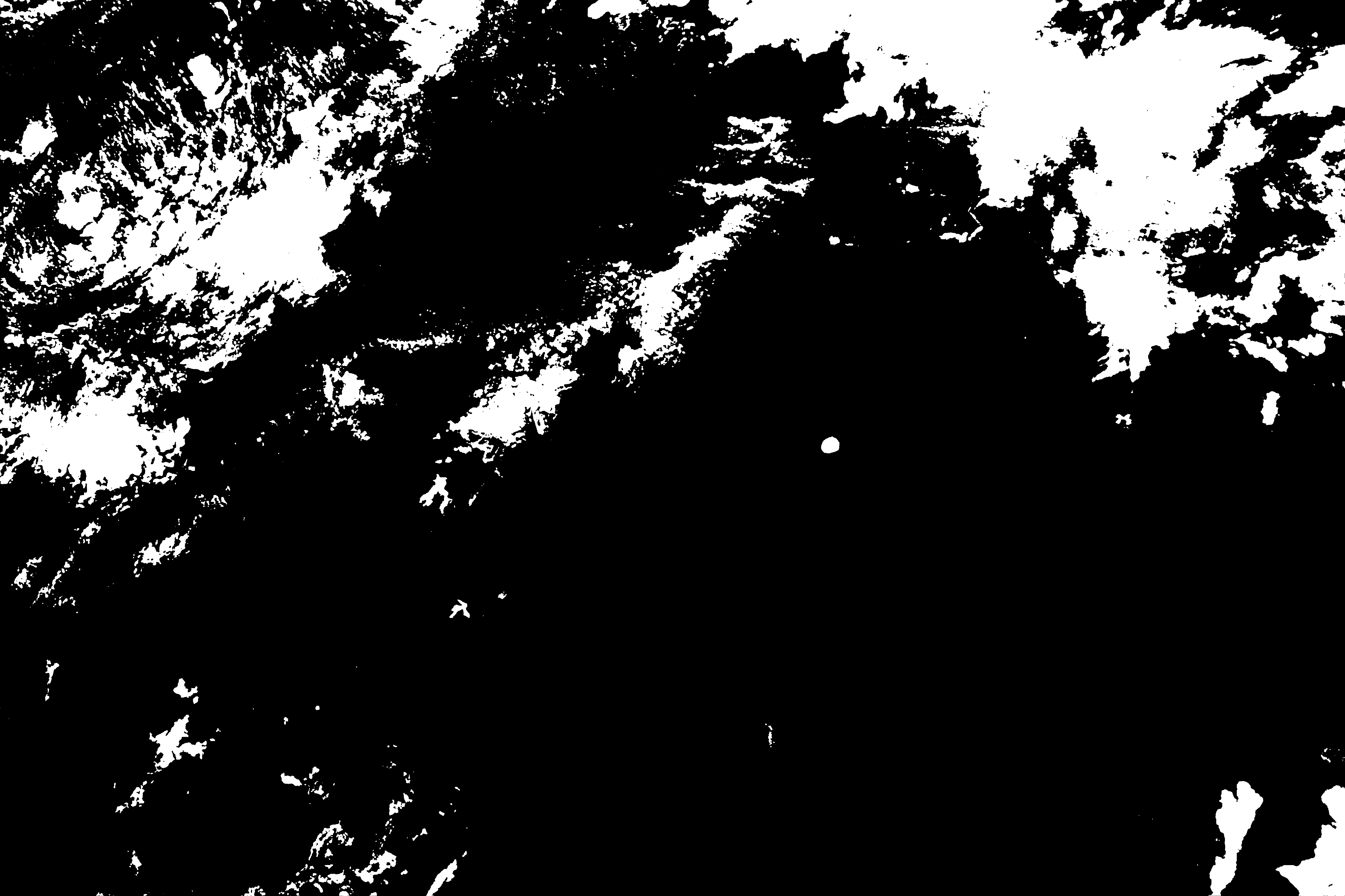
Photo center point: 15.5° N, 120.5° E
Photo center point by machine learning:
Country or Geographic Name: | PHILIPPINES |
Features: | MANILA, LINGAYEN GULF |
| Features Found Using Machine Learning: | |
Cloud Cover Percentage: | 50 (26-50)% |
Sun Elevation Angle: | 18° |
Sun Azimuth: | 109° |
Camera: | Nikon D5 Electronic Still Camera |
Focal Length: | 24mm |
Camera Tilt: | 31 degrees |
Format: | 5568E: 5568 x 3712 pixel CMOS sensor, 35.9 x 23.9 mm, total pixels: 21.33 million, Nikon FX format |
Film Exposure: | |
| Additional Information | |
| Width | Height | Annotated | Cropped | Purpose | Links |
|---|---|---|---|---|---|
| 5011 pixels | 3341 pixels | No | No | NASA's Earth Observatory web site | Download Image |
| 720 pixels | 480 pixels | Yes | Yes | NASA's Earth Observatory web site | Download Image |
| 5568 pixels | 3712 pixels | No | No | Download Image | |
| 640 pixels | 427 pixels | No | No | Download Image |
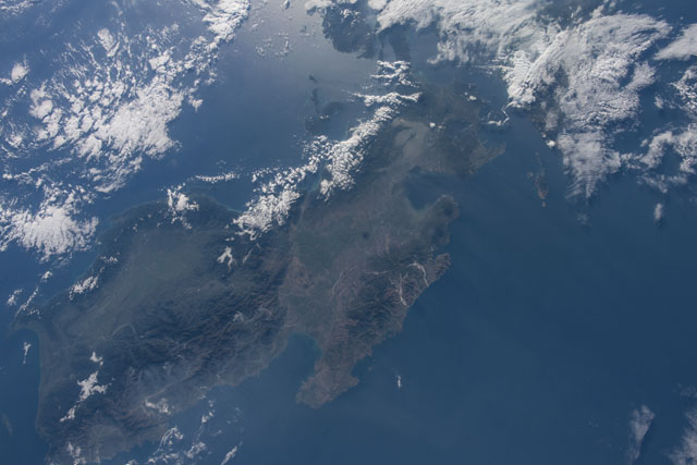
An astronaut onboard the International Space Station took this photograph of Luzon, the largest island in the Philippines. The Republic of the Philippines is comprised of thousands of islands. Most of the country’s population (about 100 million people) live on just eleven of those islands, with more than half living on Luzon.
Mountain ranges and valleys trend north-south across the island. (Note that north is to the lower left in this photo.) The Cordillera Central is Luzon’s tallest and longest range, with broad river valleys on either side.
Mount Pinatubo is one of many volcanoes making up the Zambales Volcanic Range in western Luzon. Lahars from Pinatubo’s famous 1991 eruption extend down in a pinwheel-like pattern from the volcano’s peak. Subduction zones located on either side of the Philippine island chain put large populations of people at risk from earthquakes and volcanic hazards. The islands are also battered by typhoons nearly every year.
In the photo, smoke is blowing west (to the right in this view) off the Cordillera Central. Thermal anomalies detected by the Suomi NPP satellite indicate the presence of fires nearby. According to government sources, most of the fires in the Cordillera can be attributed to slash-and-burn farming, as well as other human causes.
