ISS040-E-138973

| NASA Photo ID | ISS040-E-138973 |
| Focal Length | 125mm |
| Date taken | 2014.09.06 |
| Time taken | 20:25:57 GMT |
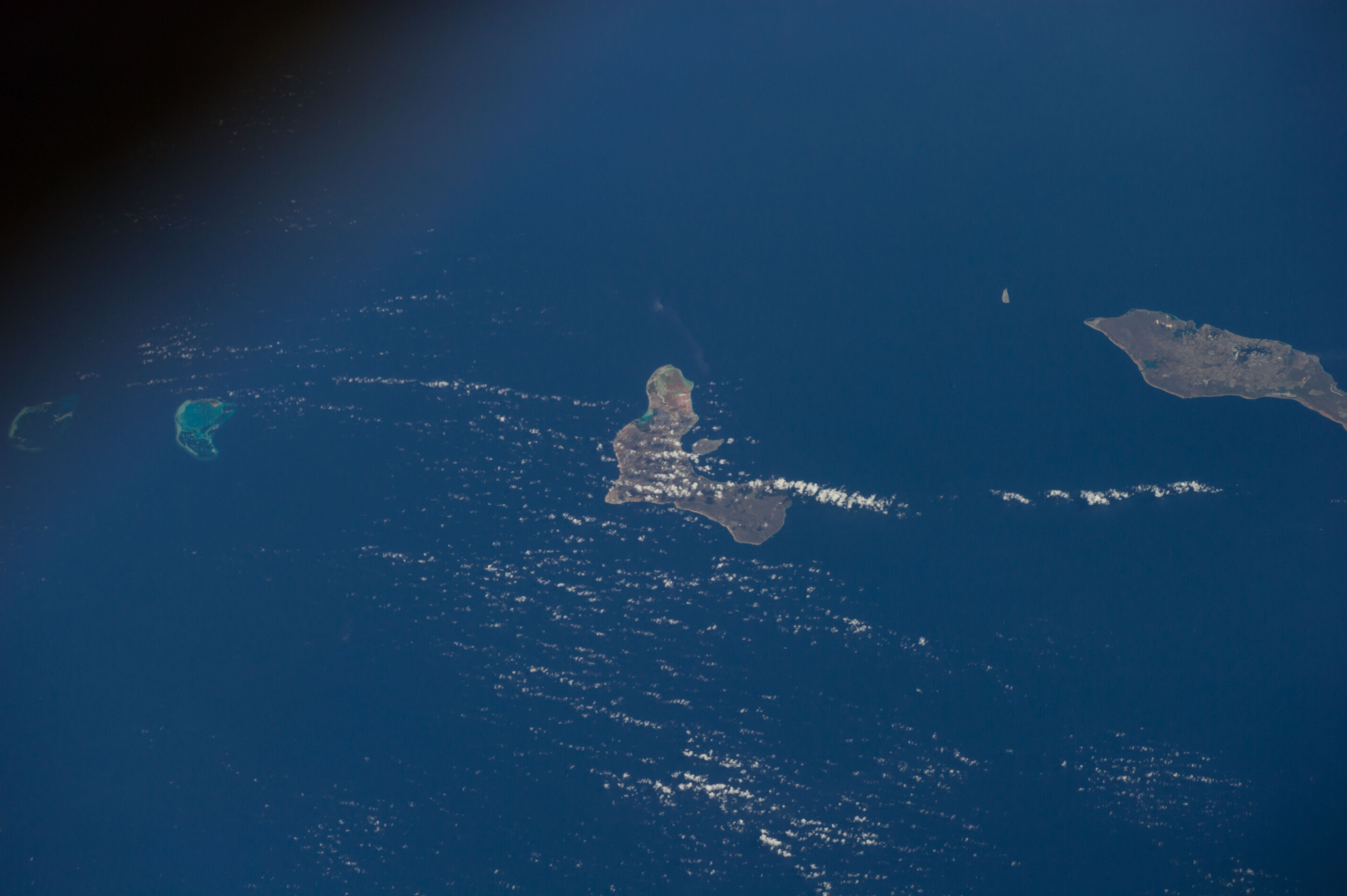
Spacecraft nadir point: 13.8° N, 68.7° W
Photo center point: 12.2° N, 68.3° W
Photo center point by machine learning:
Photo center point: 12.2° N, 68.3° W
Photo center point by machine learning:
Nadir to Photo Center: South
Spacecraft Altitude: 224 nautical miles (415km)
Country or Geographic Name: | NETHERLANDS_ANTILLES |
Features: | CURAZAO ISLAND, BONAIRE ISLAND, LAS AVES ISLAND, CARIBBEAN SEA |
| Features Found Using Machine Learning: | |
Cloud Cover Percentage: | 10 (1-10)% |
Sun Elevation Angle: | 32° |
Sun Azimuth: | 269° |
Camera: | Nikon D3S Electronic Still Camera |
Focal Length: | 125mm |
Camera Tilt: | Low Oblique |
Format: | 4256E: 4256 x 2832 pixel CMOS sensor, 36.0mm x 23.9mm, total pixels: 12.87 million, Nikon FX format |
Film Exposure: | |
| Additional Information | |
| Width | Height | Annotated | Cropped | Purpose | Links |
|---|---|---|---|---|---|
| 4256 pixels | 2832 pixels | No | No | Download Image | |
| 640 pixels | 426 pixels | No | No | Download Image |
Download Packaged File
Download a Google Earth KML for this Image
View photo footprint information
Download a GeoTIFF for this photo
Image Caption: CATALOGED BY UT-BROWNSVILLE/STARGATE
