ISS018-E-8065
| NASA Photo ID | ISS018-E-8065 |
| Focal Length | 180mm |
| Date taken | 2008.11.09 |
| Time taken | 13:23:33 GMT |
Cloud masks available for this image:
Spacecraft nadir point: 19.9° S, 62.2° W
Photo center point: 19.8° S, 63.0° W
Photo center point by machine learning:
Photo center point: 19.8° S, 63.0° W
Photo center point by machine learning:
Nadir to Photo Center: West
Spacecraft Altitude: 192 nautical miles (356km)
Country or Geographic Name: | BOLIVIA |
Features: | PARAPETI RIVER, AGRICULTURE, FOR. |
| Features Found Using Machine Learning: | |
Cloud Cover Percentage: | 25 (11-25)% |
Sun Elevation Angle: | 55° |
Sun Azimuth: | 92° |
Camera: | Nikon D2Xs Electronic Still Camera |
Focal Length: | 180mm |
Camera Tilt: | 14 degrees |
Format: | 4288E: 4288 x 2848 pixel CMOS sensor, RGBG imager color filter |
Film Exposure: | |
| Additional Information | |
| Width | Height | Annotated | Cropped | Purpose | Links |
|---|---|---|---|---|---|
| 3072 pixels | 2098 pixels | No | No | Download Image | |
| 640 pixels | 437 pixels | No | No | Download Image |
Download Packaged File
Download a Google Earth KML for this Image
View photo footprint information
Download a GeoTIFF for this photo
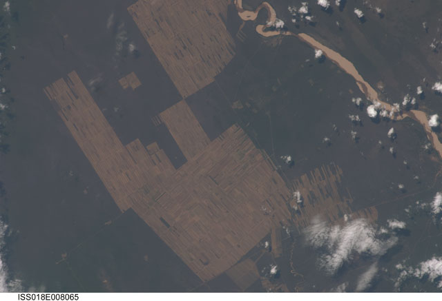
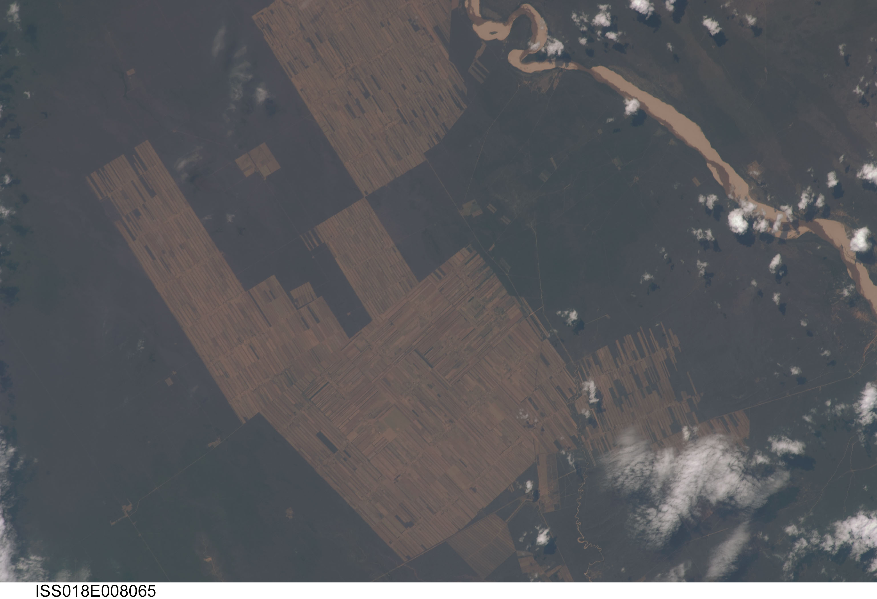
Image Caption: Progressive Forest Clearing, Bolivia
The eastern half of Bolivia is covered with tropical rainforest. In the 1990s, Bolivia initiated a large-scale effort to increase the rate of logging and create tracts of land for commercial agriculture (primarily soy and sugar cane, but also coca) on the Amazon Basin side of the Andean highlands. Today, the commercial fields are well-established and easily mapped from space as large, rectangular clearings in the forest. The agricultural developments are still growing today. The clearings start off as small rectangles arranged perpendicular to an access road; early clearings take on a herring-bone pattern when viewed from above. The uncleared (dark forest) areas are gradually logged and cultivated, filling in the pattern to make a larger cleared area.
Astronauts aboard the International Space Station (ISS) routinely observe intensive land use and document their observations through imagery so that changes can be identified. This image provides a detailed view of today's landscape, showing completely cleared regions that stretch for more than 10 km.
