ISS018-E-8064
| NASA Photo ID | ISS018-E-8064 |
| Focal Length | 180mm |
| Date taken | 2008.11.09 |
| Time taken | 13:23:32 GMT |
Resolutions offered for this image:
1440 x 1440 pixels 720 x 720 pixels 3072 x 2098 pixels 640 x 437 pixels
1440 x 1440 pixels 720 x 720 pixels 3072 x 2098 pixels 640 x 437 pixels
Cloud masks available for this image:
Spacecraft nadir point: 19.9° S, 62.3° W
Photo center point: 19.9° S, 62.9° W
Photo center point by machine learning:
Photo center point: 19.9° S, 62.9° W
Photo center point by machine learning:
Nadir to Photo Center: West
Spacecraft Altitude: 192 nautical miles (356km)
Country or Geographic Name: | BOLIVIA |
Features: | PARAPETI RIVER, AGRICULTURAL FIELDS |
| Features Found Using Machine Learning: | |
Cloud Cover Percentage: | 10 (1-10)% |
Sun Elevation Angle: | 55° |
Sun Azimuth: | 92° |
Camera: | Nikon D2Xs Electronic Still Camera |
Focal Length: | 180mm |
Camera Tilt: | 11 degrees |
Format: | 4288E: 4288 x 2848 pixel CMOS sensor, RGBG imager color filter |
Film Exposure: | |
| Additional Information | |
| Width | Height | Annotated | Cropped | Purpose | Links |
|---|---|---|---|---|---|
| 1440 pixels | 1440 pixels | No | Yes | Earth From Space collection | Download Image |
| 720 pixels | 720 pixels | Yes | Yes | Earth From Space collection | Download Image |
| 3072 pixels | 2098 pixels | No | No | Download Image | |
| 640 pixels | 437 pixels | No | No | Download Image |
Download Packaged File
Download a Google Earth KML for this Image
View photo footprint information
Download a GeoTIFF for this photo
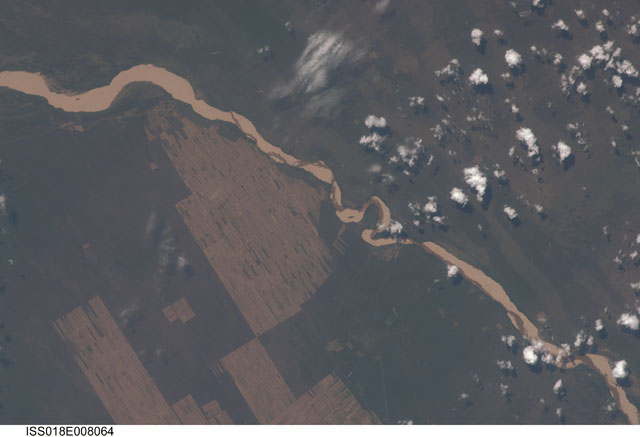
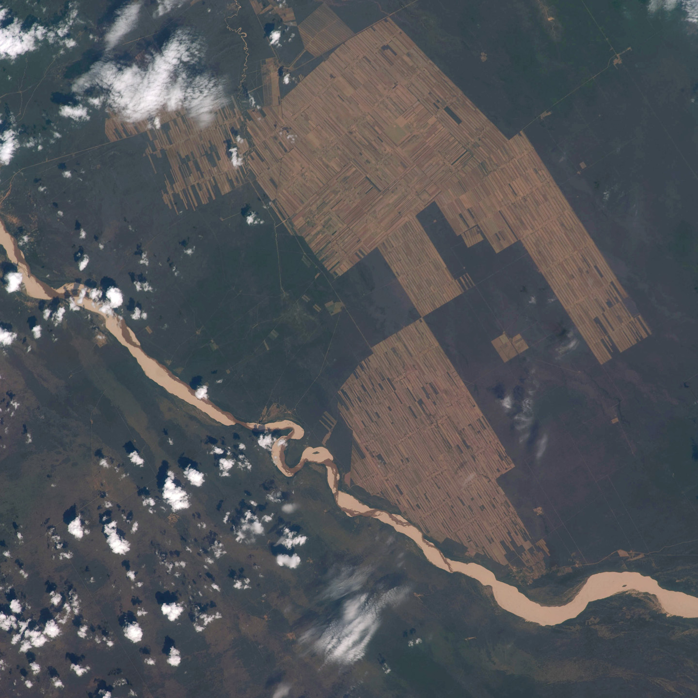
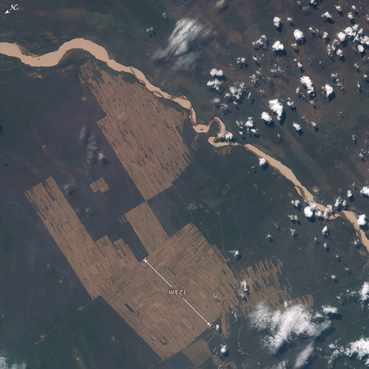
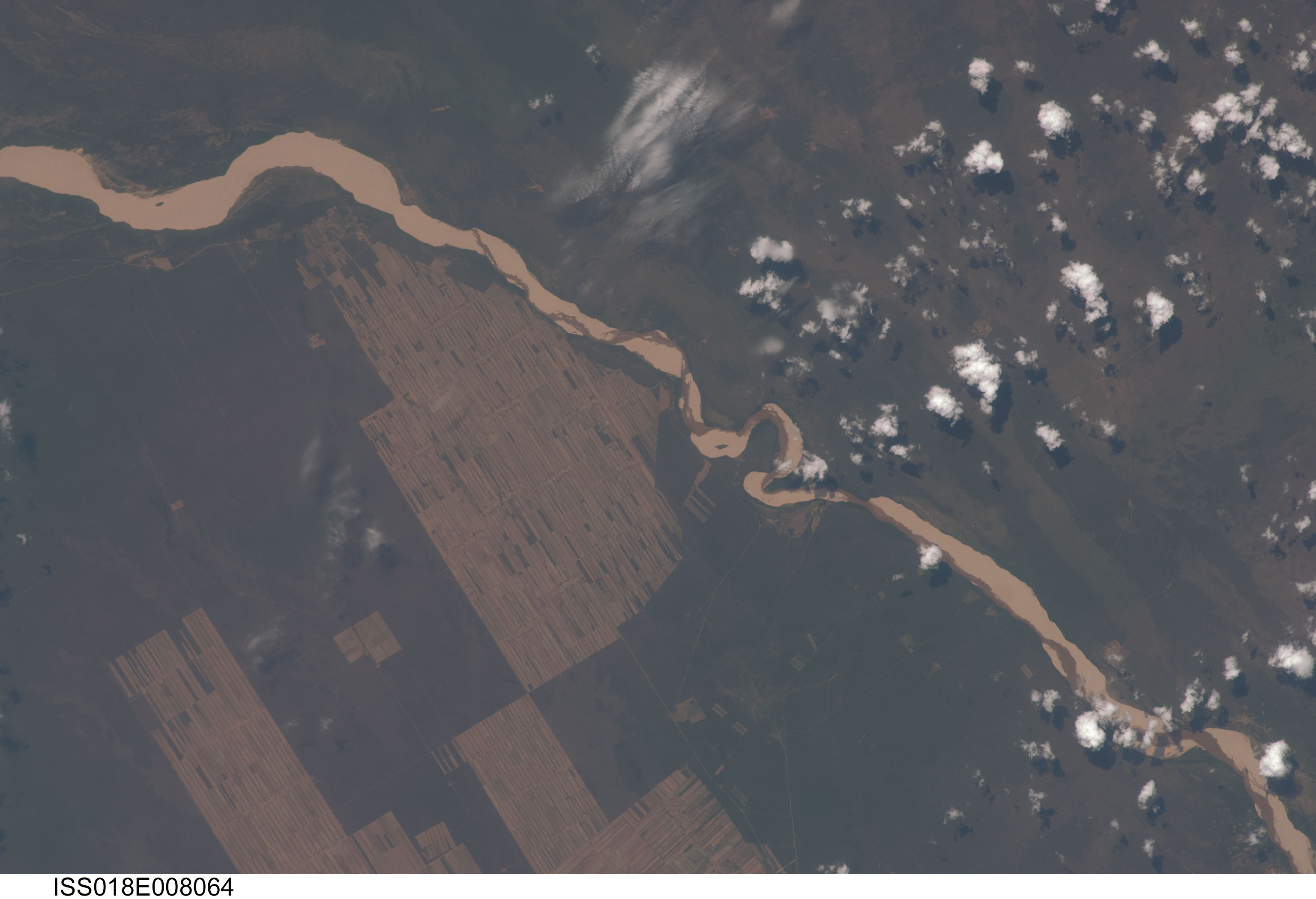
Image Caption: Progressive Forest Clearing, Bolivia
The eastern half of Bolivia is covered with tropical rainforest. In the 1990s, Bolivia initiated a large-scale effort to increase the rate of logging and create tracts of land for commercial agriculture (primarily soy and sugar cane, but also cocoa) on the Amazon Basin side of the Andean highlands. Today, the commercial fields are well established and easily mapped from space as large, rectangular clearings in the forest. The agricultural developments are still growing today. The clearings start off as small rectangles arranged perpendicular to an access road; early clearings take on a herringbone pattern when viewed from above. The intact areas (dark forest) are gradually logged and then cultivated, filling in the pattern to make a larger cleared area.
Astronauts aboard the International Space Station (ISS) routinely observe intensive land use and document their observations through imagery so that changes can be identified. These two photographs of the Bolivian forest along the Rio Parapeti in Bolivia (south of Santa Cruz, not shown) show different stages of the clearing process and agricultural field development. The top image, a wide panoramic view looking toward the west and the Andean foothills, was taken from the Space Shuttle in November 1995. The clearing efforts were just getting underway, evidenced by the crosshatched and herringbone pattern of clearing north of the river. On the south side of the river, old, abandoned stream channels show up as lighter regions with lesser forest cover.
The bottom view, a composite of two images taken from the ISS, provides a more detailed view of today's landscape, showing completely cleared regions that stretch for more than 10 kilometers. For scale, the white line is about 12 kilometers (7.5 miles). The geographic area covered in the 2008 view is approximated on the top image by the white box.
