ISS011-E-9913
| NASA Photo ID | ISS011-E-9913 |
| Focal Length | 800mm |
| Date taken | 2005.05.24 |
| Time taken | 09:59:07 GMT |
1000 x 651 pixels 540 x 352 pixels 540 x 405 pixels 3008 x 1960 pixels 640 x 428 pixels
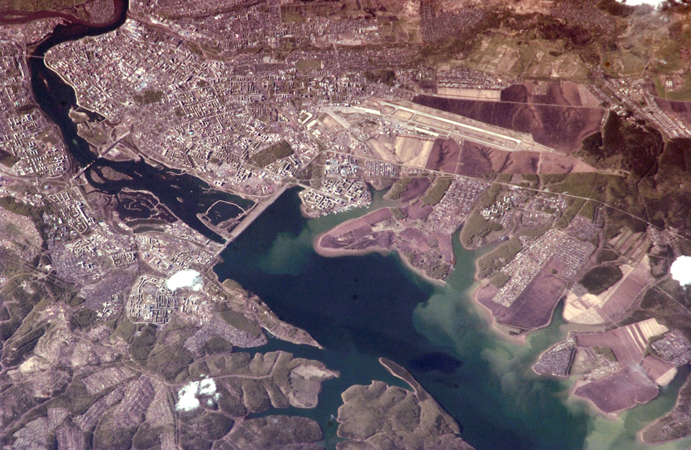

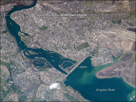
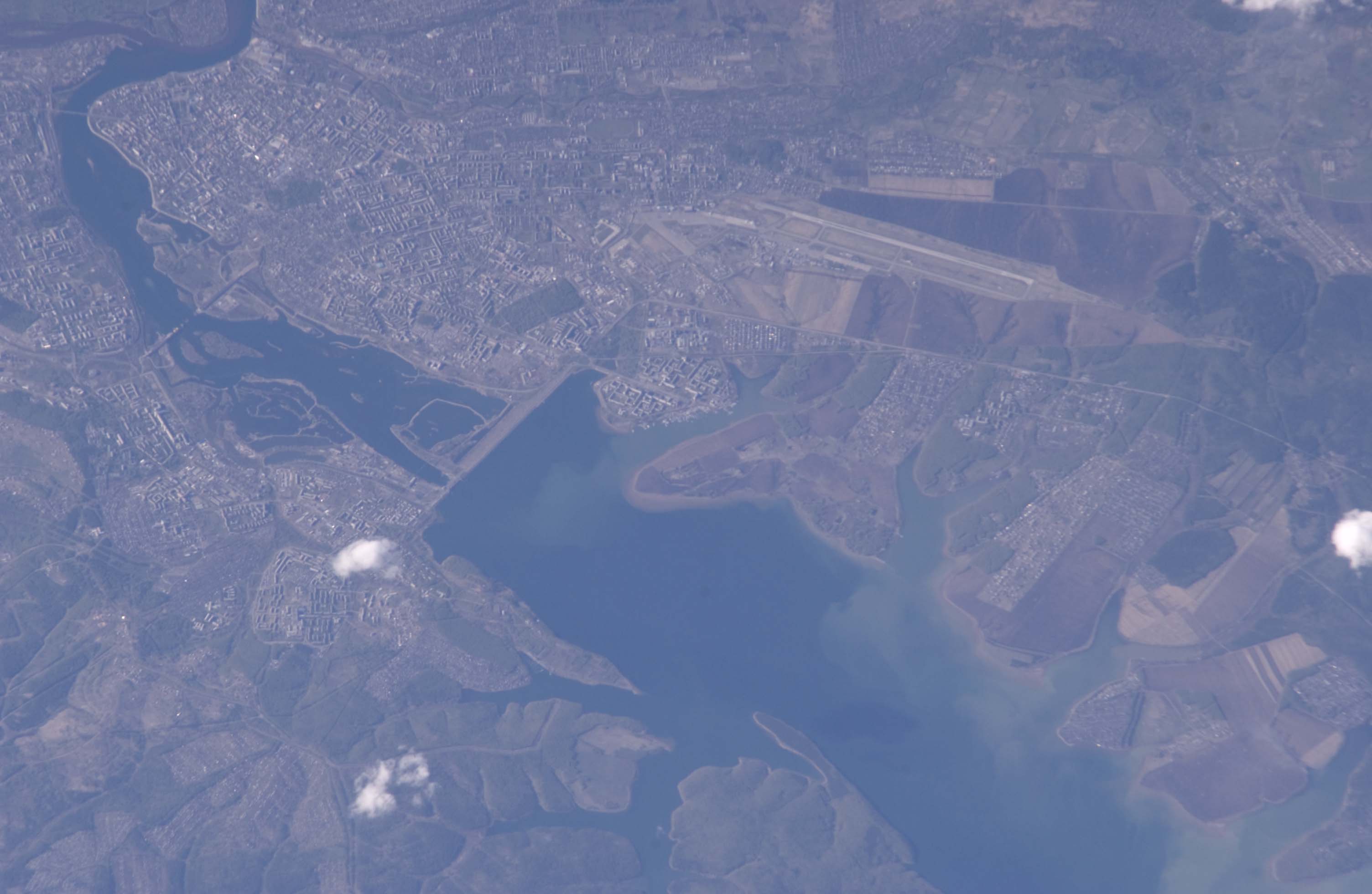
Photo center point: 52.2° N, 104.4° E
Photo center point by machine learning:
Camera: | Nikon D1 Electronic Still Camera |
Focal Length: | 800mm |
Camera Tilt: | 43 degrees |
Format: | 2000E: 2000 x 1312 pixel CCD, RGBG imager color filter |
Film Exposure: | |
| Additional Information | |
| Width | Height | Annotated | Cropped | Purpose | Links |
|---|---|---|---|---|---|
| 1000 pixels | 651 pixels | No | Yes | Earth From Space collection | Download Image |
| 540 pixels | 352 pixels | Yes | Yes | Earth From Space collection | Download Image |
| 540 pixels | 405 pixels | Yes | Yes | NASA's Earth Observatory web site | Download Image |
| 3008 pixels | 1960 pixels | No | No | Not enhanced | Download Image |
| 640 pixels | 428 pixels | No | No | Download Image |
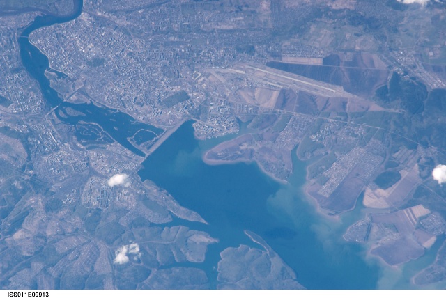
Located about 55 kilometers (34 miles) to the northwest of Lake Baikal, Irkutsk is also the chief city of Irkutsk Oblast (province) in Siberia. The city is located on the Angara River and was originally a tax collection outpost for local fur trappers. Irkutsk formally became a town in 1686. Following a revolt against Tsar Nicholas I in 1825, the city became a center for revolutionaries exiled to Siberia. The relocation of many artists, Imperial army officers, and nobles was an important factor in the establishment of the cultural and architectural character of the city. Following the Bolshevik Revolution of 1917, Irkutsk was the site of many battles during the civil war between the White and Red armies. Today Irkutsk is a major economic, academic, and cultural center in Siberia.
This astronaut photograph shows the central downtown area of the city, as well as the Akademgorodok district around the State University (left of image along the southern bank of the Angara River). The oblique (non-vertical) perspective of this photograph imparts a three dimension perspective to the scene, with shadows accentuating the blockiness of Soviet-era building projects to the east of the downtown area. The Irkutsk Dam (image center), built for hydroelectric power, dramatically widened the river and drowned several stream outlet channels along the north and south banks. The Angara River is the only outlet from Lake Baikal to the southeast, and impoundment of water behind the dam has raised the Lake Baikal by 6 meters (20 feet).
