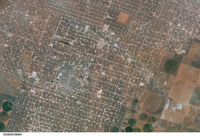
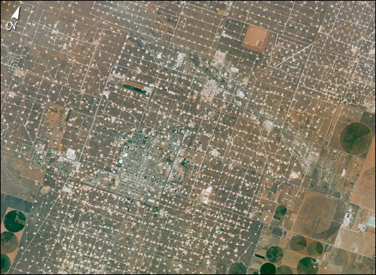
ISS005-E-9984
| NASA Photo ID | ISS005-E-9984 |
| Focal Length | 800mm |
| Date taken | 2002.08.17 |
| Time taken | 18:12:50 GMT |

Cloud masks available for this image:
Spacecraft nadir point: 33.3° N, 104.1° W
Photo center point: 33.0° N, 103.0° W
Photo center point by machine learning:
Photo center point: 33.0° N, 103.0° W
Photo center point by machine learning:
Nadir to Photo Center: East
Spacecraft Altitude: 212 nautical miles (393km)
Country or Geographic Name: | USA-TEXAS |
Features: | DENVER CITY, WASSON OIL FIELD |
| Features Found Using Machine Learning: | |
Cloud Cover Percentage: | 10 (1-10)% |
Sun Elevation Angle: | 67° |
Sun Azimuth: | 149° |
Camera: | Kodak DCS760c Electronic Still Camera |
Focal Length: | 800mm |
Camera Tilt: | 18 degrees |
Format: | 3060E: 3060 x 2036 pixel CCD, RGBG array |
Film Exposure: | |
| Additional Information | |
| Width | Height | Annotated | Cropped | Purpose | Links |
|---|---|---|---|---|---|
| 540 pixels | 395 pixels | Yes | Yes | Earth From Space collection | Download Image |
| 3032 pixels | 2064 pixels | No | No | Download Image | |
| 639 pixels | 435 pixels | No | No | Download Image |
Download Packaged File
Download a Google Earth KML for this Image
View photo footprint information
Download a GeoTIFF for this photo
Image Caption: Agriculture and the petroleum industry compete for land use near Denver City, Texas, southwest of Lubbock near the New Mexico border. The economy of this region is almost completely dependent on its underground resources of petroleum and water. Both resources result in distinctive land use patterns visible from space. Historically this area has produced vast quantities of oil and gas since development began in the 1930's. Note the fine, light-colored grid of roads and pipelines connecting well sites over this portion of the Wasson Oil Field, one of the state's most productive. Since the 1940s, agricultural land use has shifted from grazing to irrigated cultivation of cotton, sorghum, wheat, hay, and corn. The water supply is drawn from wells tapping the vast, but failing, Ogallala Aquifer. Note the large, circular center-pivot irrigation systems in the lower corners of the image. The largest is nearly a mile in diameter.
