ISS005-E-7002

| NASA Photo ID | ISS005-E-7002 |
| Focal Length | 800mm |
| Date taken | 2002.07.06 |
| Time taken | 23:18:55 GMT |
Resolutions offered for this image:
539 x 668 pixels 540 x 671 pixels 1000 x 1513 pixels 3032 x 2064 pixels 639 x 435 pixels
539 x 668 pixels 540 x 671 pixels 1000 x 1513 pixels 3032 x 2064 pixels 639 x 435 pixels
Cloud masks available for this image:
Spacecraft nadir point: 17.7° N, 155.4° W
Photo center point: 19.5° N, 155.5° W
Photo center point by machine learning:
Photo center point: 19.5° N, 155.5° W
Photo center point by machine learning:
Nadir to Photo Center: North
Spacecraft Altitude: 213 nautical miles (394km)
Country or Geographic Name: | USA-HAWAII |
Features: | MAUNA LOA, MOKUAWEOWEO CALDERA |
| Features Found Using Machine Learning: | |
Cloud Cover Percentage: | 10 (1-10)% |
Sun Elevation Angle: | 77° |
Sun Azimuth: | 294° |
Camera: | Kodak DCS760c Electronic Still Camera |
Focal Length: | 800mm |
Camera Tilt: | 27 degrees |
Format: | 3060E: 3060 x 2036 pixel CCD, RGBG array |
Film Exposure: | |
| Additional Information | |
| Width | Height | Annotated | Cropped | Purpose | Links |
|---|---|---|---|---|---|
| 539 pixels | 668 pixels | Photographic Highlights | Download Image | ||
| 540 pixels | 671 pixels | Yes | Yes | Earth From Space collection | Download Image |
| 1000 pixels | 1513 pixels | No | No | NASA's Earth Observatory web site | Download Image |
| 3032 pixels | 2064 pixels | No | No | Public Affairs Office (PAO) | Download Image |
| 639 pixels | 435 pixels | No | No | Download Image |
Download Packaged File
Download a Google Earth KML for this Image
View photo footprint information
Download a GeoTIFF for this photo
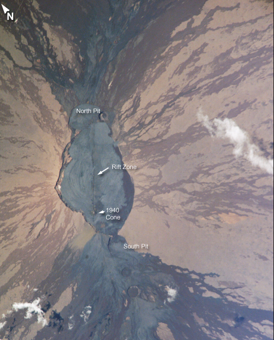
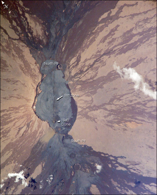
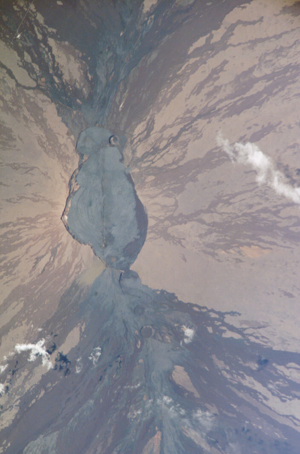
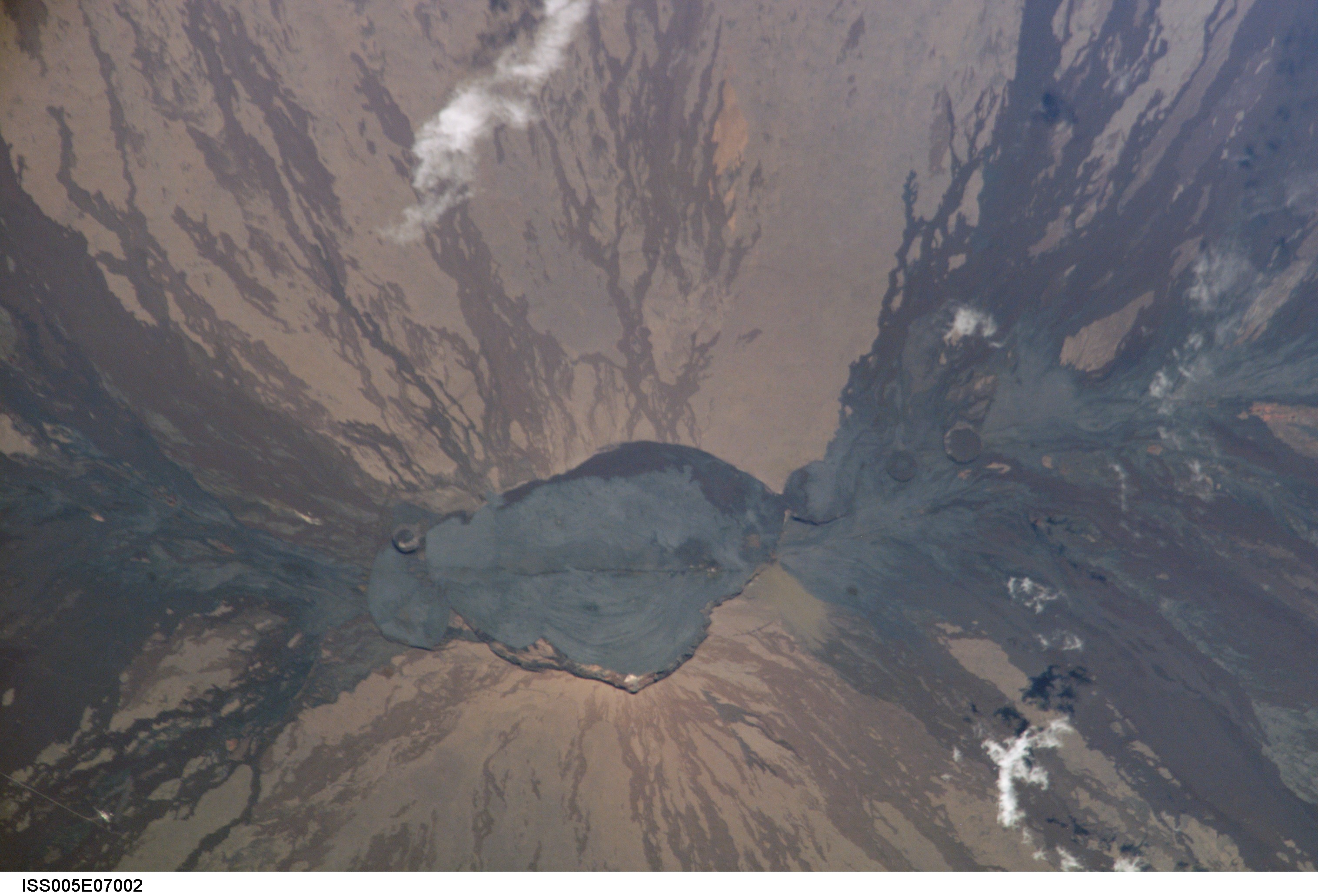
Image Caption: Astronauts obtained this detailed image of the summit caldera of Mauna Loa volcano, called Mokuaweoweo Caldera. Mauna Loa is the largest volcano on our planet--the summit elevation is 4,170 m (over 13,600 ft), but the volcano's summit rises 9 km above the sea floor. The sharp features of the summit caldera and lava flows that drain outward from the summit are tribute to the fact that Mauna Loa is one of the Earth's most active volcanoes. The most recent eruption was in 1984. The straight line that cuts through the center of the crater from top to bottom is a rift zone--an area that pulls apart as magma reaches the surface.
A weather observatory run by NOAA's Climate Monitoring & Diagnostics Lab is on the volcano's north slope at 11,000 ft (3397 m). This facility, known as the Mauna Loa Observatory, is the site where scientists have documented the constantly increasing concentrations of global atmospheric carbon dioxide.
Other resources about Mauna Loa:
https://www.cmdl.noaa.gov/obop/mlo/
