AS09-22-3429
| NASA Photo ID | AS09-22-3429 |
| Focal Length | 80mm |
| Date taken | 1969.03.09 |
| Time taken | 16:51:00 GMT |
Cloud masks available for this image:
Spacecraft nadir point:
Photo center point: 15.3° N, 23.3° W
Photo center point by machine learning:
Photo center point: 15.3° N, 23.3° W
Photo center point by machine learning:
Nadir to Photo Center:
Spacecraft Altitude: 101 nautical miles (187km)
Camera: | Hasselblad |
Focal Length: | 80mm |
Camera Tilt: | Near Vertical |
Format: | SO368: Kodak Ektachrome MS, equivalent to 2448 Kodak Aerochrome, ASA64, thin base, fine grain |
Film Exposure: | Normal |
| Additional Information | |
| Width | Height | Annotated | Cropped | Purpose | Links |
|---|---|---|---|---|---|
| 4400 pixels | 4600 pixels | No | No | Download Image | |
| 492 pixels | 515 pixels | No | No | Download Image |
Download Packaged File
Download a Google Earth KML for this Image
View photo footprint information
Download a GeoTIFF for this photo
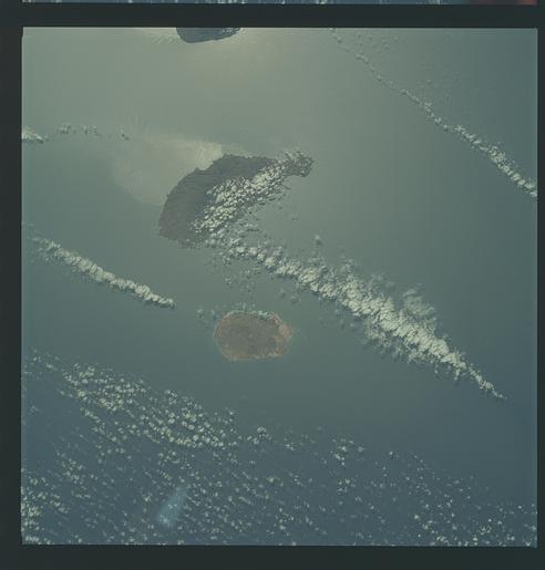
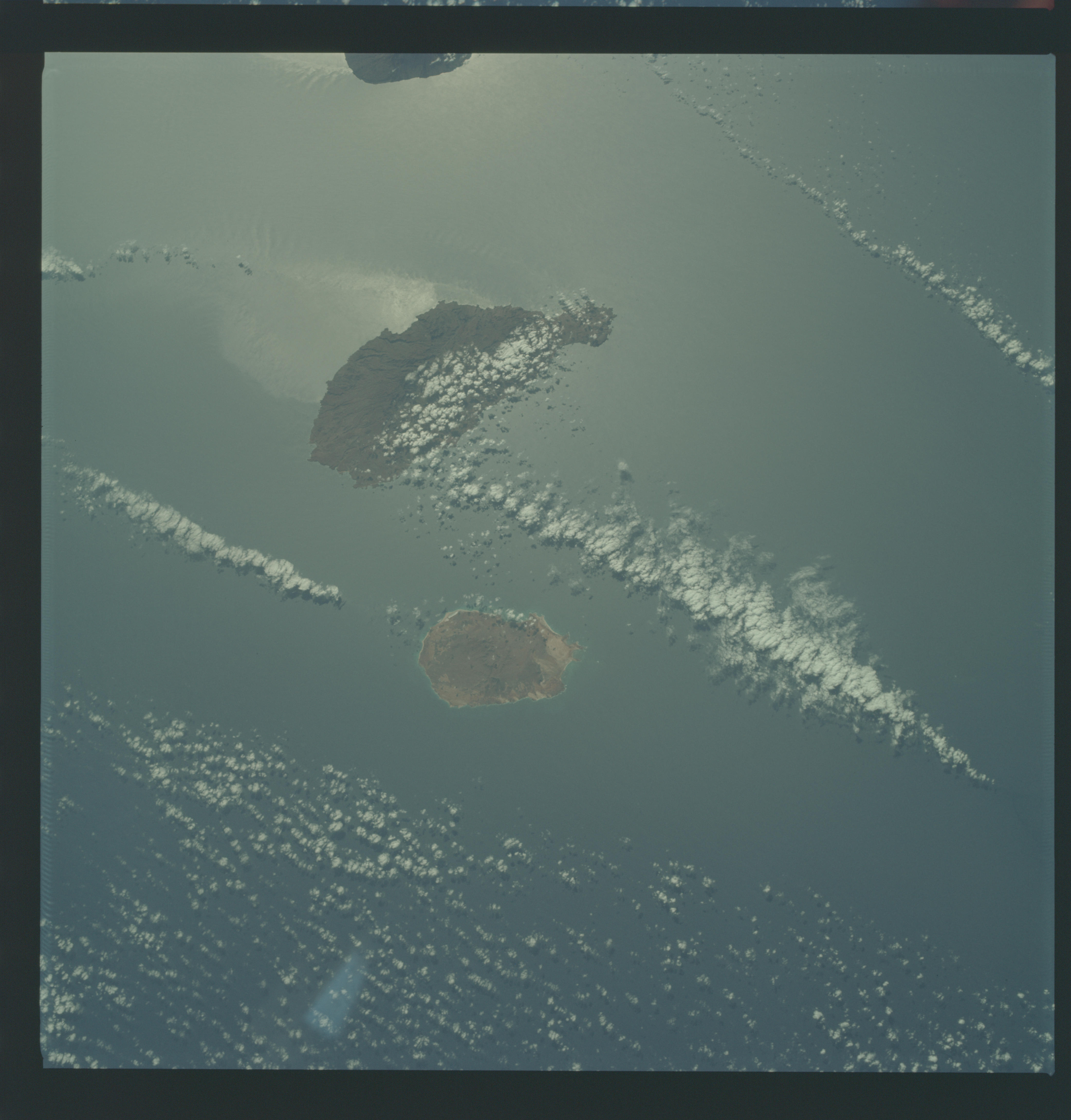
Image Caption: GEOGRAPHY/CARTOGRAPHY: CAPE VERDE ISLANDS, SAO TIAGO, MAIO, AND FOGO ISLANDS, VILLAGES OF SANTO ANTONIO, PORTO INGLES, SAO TIAGO, AND PRAIA.
GEOLOGY/HYDROLOGY: VOLCANIC ISLANDS.
METEOROLOGY: ALTO-CUMULUS.
OCEANOGRAPHY: ATLANTIC OCEAN, SOME STRONG CURRENT PATTERNS VISIBLE IN THE SUN GLINT AREA.
GEOLOGY/HYDROLOGY: VOLCANIC ISLANDS.
METEOROLOGY: ALTO-CUMULUS.
OCEANOGRAPHY: ATLANTIC OCEAN, SOME STRONG CURRENT PATTERNS VISIBLE IN THE SUN GLINT AREA.
