< STS61A-48-77 >
| NASA Photo ID | STS61A-48-77 |
| Focal Length | 250mm |
| Date taken | 1985.11.03 |
| Time taken | 16:41:04 GMT |
Resolutions offered for this image:
3872 x 3869 pixels 639 x 639 pixels 5700 x 5900 pixels 500 x 518 pixels 640 x 480 pixels
3872 x 3869 pixels 639 x 639 pixels 5700 x 5900 pixels 500 x 518 pixels 640 x 480 pixels

Cloud masks available for this image:
Spacecraft nadir point: 31.0° N, 94.2° W
Photo center point: 29.5° N, 94.5° W
Photo center point by machine learning:
Photo center point: 29.5° N, 94.5° W
Photo center point by machine learning:
Nadir to Photo Center: South
Spacecraft Altitude: 177 nautical miles (328km)
Country or Geographic Name: | USA-TEXAS |
Features: | GALVESTON BAY |
| Features Found Using Machine Learning: | |
Cloud Cover Percentage: | 0 (no clouds present) |
Sun Elevation Angle: | 40° |
Sun Azimuth: | 154° |
Camera: | Hasselblad |
Focal Length: | 250mm |
Camera Tilt: | 27 degrees |
Format: | 5017: Kodak, natural color positive, Ektachrome, X Professional, ASA 64, standard base |
Film Exposure: | Normal |
| Additional Information | |
| Width | Height | Annotated | Cropped | Purpose | Links |
|---|---|---|---|---|---|
| 3872 pixels | 3869 pixels | No | No | Earth From Space collection | Download Image |
| 639 pixels | 639 pixels | No | No | Earth From Space collection | Download Image |
| 5700 pixels | 5900 pixels | No | No | Download Image | |
| 500 pixels | 518 pixels | No | No | Download Image | |
| 640 pixels | 480 pixels | No | No | Download Image |
Download Packaged File
Download a Google Earth KML for this Image
View photo footprint information
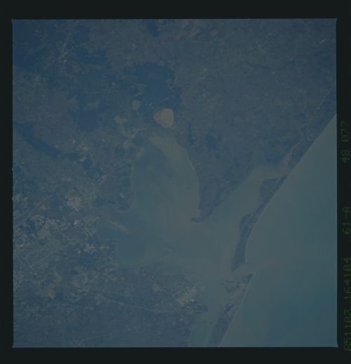
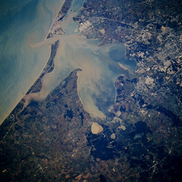
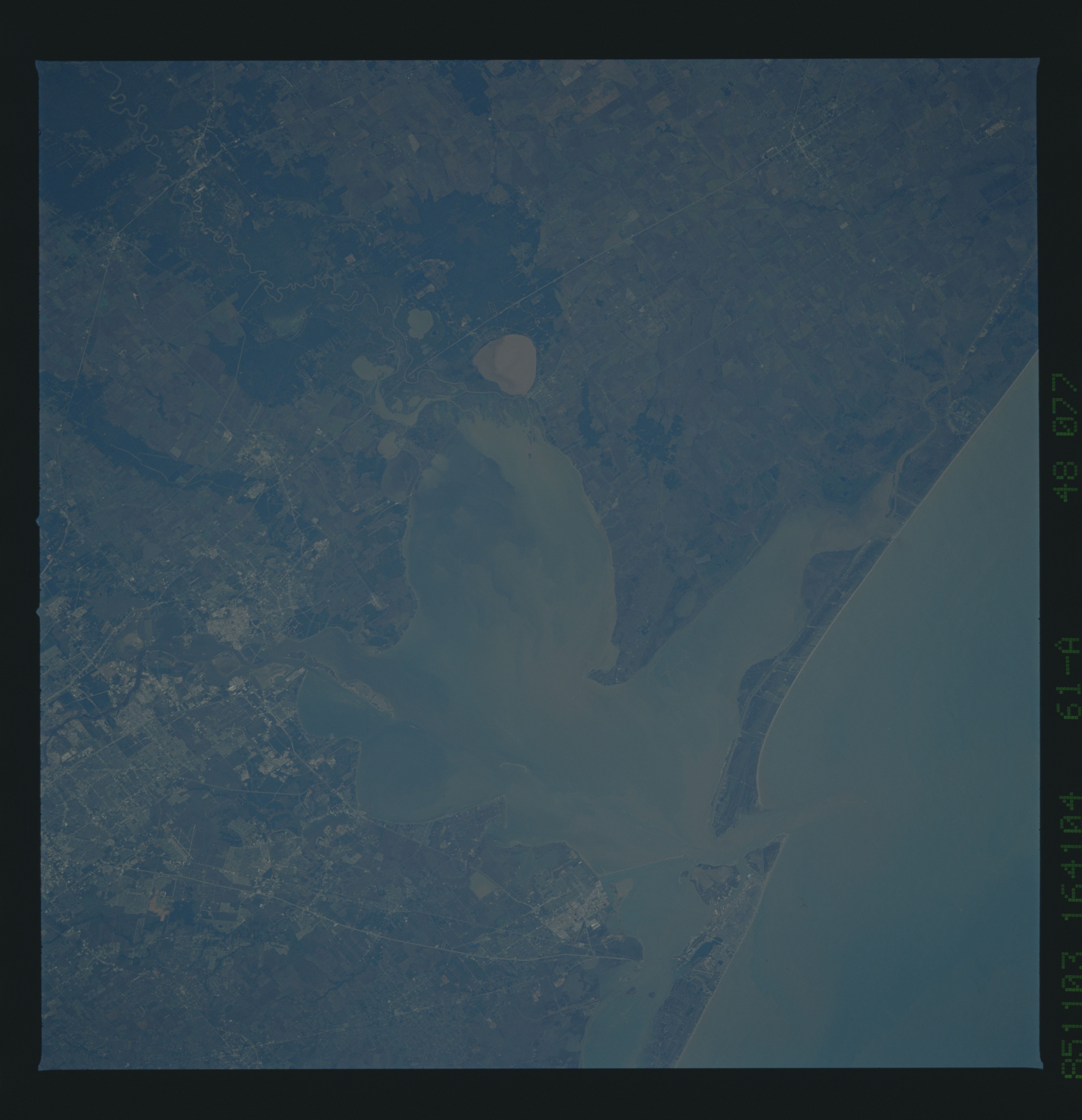
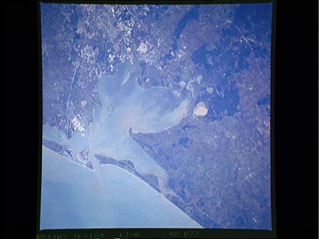
No GeoTIFF is available for this photo.Image Caption: STS61A-048-0077 Galveston Bay, Texas, U.S.A. November 1985
Sediment-laden Galveston Bay, which occupies the drowned mouths of the Trinity River and the San Jacinto River, is featured in this south-southwest-looking, low-oblique photograph. The bay presently averages 12 feet (4 meters) in depth; however, at the end of the last ice age, melting glaciers caused the sea level to rise approximately 400 feet (122 meters). A ship channel allows large merchant ships into the Port of Houston, the third-busiest port in the United States. Apparent are Trinity Bay (center of the photograph); the mouth of the Trinity River (bottom left) with its vast load of sediment at the north end of the bay; sediment-filled, circular Lake Anahuac east of the Trinity River mouth; southeast Houston and the small port city of Baytown; and Galveston near the southern portion of Galveston Bay (top center).
Sediment-laden Galveston Bay, which occupies the drowned mouths of the Trinity River and the San Jacinto River, is featured in this south-southwest-looking, low-oblique photograph. The bay presently averages 12 feet (4 meters) in depth; however, at the end of the last ice age, melting glaciers caused the sea level to rise approximately 400 feet (122 meters). A ship channel allows large merchant ships into the Port of Houston, the third-busiest port in the United States. Apparent are Trinity Bay (center of the photograph); the mouth of the Trinity River (bottom left) with its vast load of sediment at the north end of the bay; sediment-filled, circular Lake Anahuac east of the Trinity River mouth; southeast Houston and the small port city of Baytown; and Galveston near the southern portion of Galveston Bay (top center).
