< STS61A-50-70 >

| NASA Photo ID | STS61A-50-70 |
| Focal Length | 250mm |
| Date taken | 1985.11.01 |
| Time taken | 21:51:09 GMT |
Resolutions offered for this image:
3902 x 3899 pixels 640 x 639 pixels 5700 x 5900 pixels 500 x 518 pixels 640 x 480 pixels
3902 x 3899 pixels 640 x 639 pixels 5700 x 5900 pixels 500 x 518 pixels 640 x 480 pixels
Cloud masks available for this image:
Spacecraft nadir point: 35.9° S, 147.2° E
Photo center point: 37.0° S, 146.5° E
Photo center point by machine learning:
Photo center point: 37.0° S, 146.5° E
Photo center point by machine learning:
Nadir to Photo Center: Southwest
Spacecraft Altitude: 180 nautical miles (333km)
Country or Geographic Name: | AUSTRALIA-V |
Features: | LAKE EILDON |
| Features Found Using Machine Learning: | |
Cloud Cover Percentage: | 20 (11-25)% |
Sun Elevation Angle: | 32° |
Sun Azimuth: | 85° |
Camera: | Hasselblad |
Focal Length: | 250mm |
Camera Tilt: | 23 degrees |
Format: | 5017: Kodak, natural color positive, Ektachrome, X Professional, ASA 64, standard base |
Film Exposure: | Normal |
| Additional Information | |
| Width | Height | Annotated | Cropped | Purpose | Links |
|---|---|---|---|---|---|
| 3902 pixels | 3899 pixels | No | No | Earth From Space collection | Download Image |
| 640 pixels | 639 pixels | No | No | Earth From Space collection | Download Image |
| 5700 pixels | 5900 pixels | No | No | Download Image | |
| 500 pixels | 518 pixels | No | No | Download Image | |
| 640 pixels | 480 pixels | No | No | Download Image |
Download Packaged File
Download a Google Earth KML for this Image
View photo footprint information
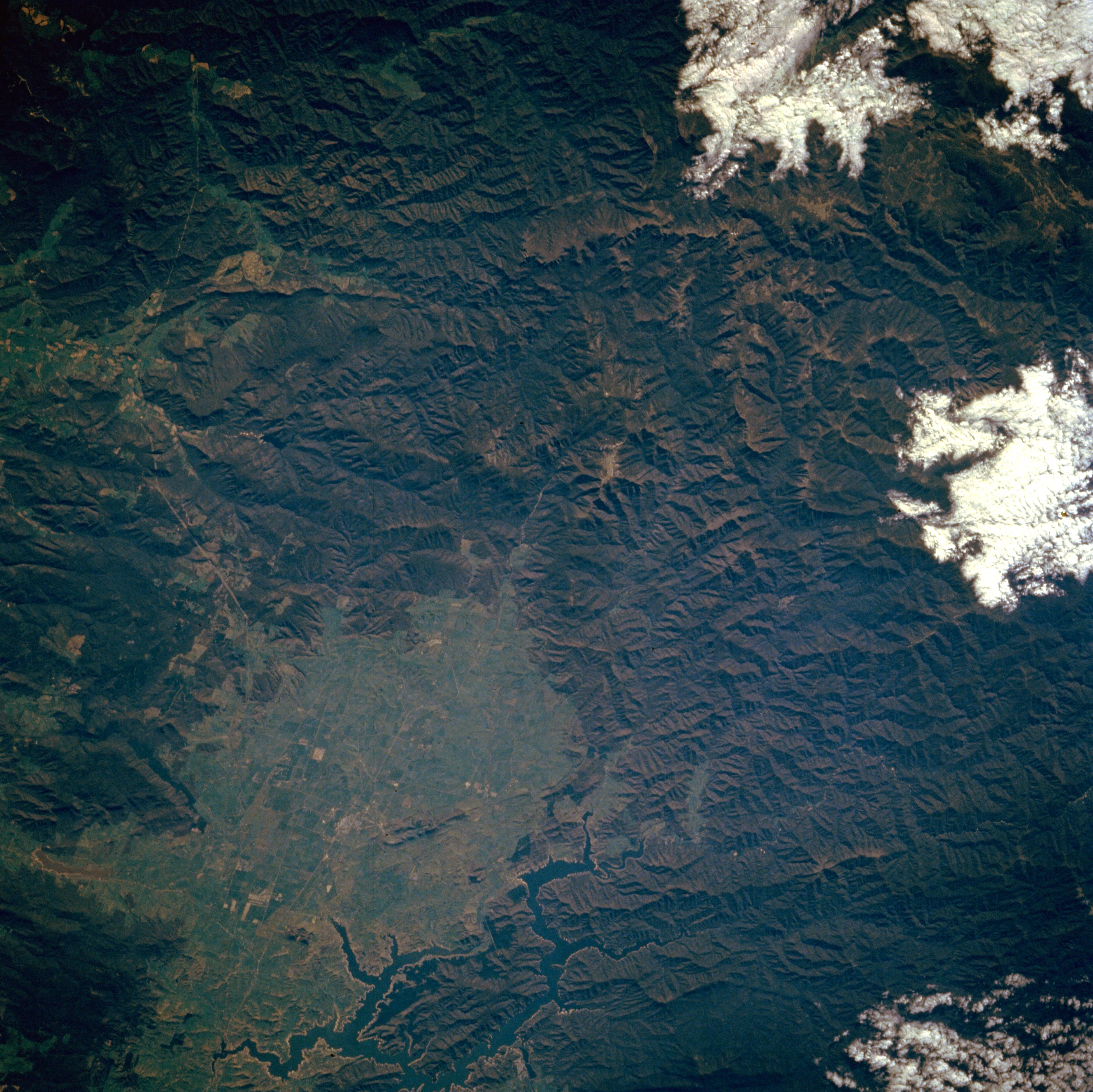
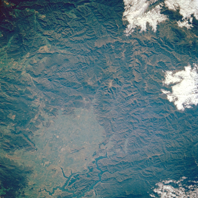
No GeoTIFF is available for this photo.Image Caption: STS61A-50-70 Lake Eildon, Victoria, Australia November 1985
The ruggedness of the Great Dividing Range of east central Victoria is captured in this northeast looking view. A key identifying landmark of this photograph is Lake Eildon (the dark colored, crooked, and branched feature, bottom center). The light, greenish region is a plateau of low alpine meadows or rolling hills surrounded by a heavily forested, mountainous landscape (darker, rougher, green terrain). While the plateau area averages about 2000 feet (610 meters) above sea level, the taller peaks in this region, including Mount Buller (5922 feet--1805 meters above sea level) visible near the center of the image, vary from 4000 feet (1220 meters) to almost 6000 feet (1829 meters) above sea level. These higher elevations have a brownish tint and appear to have less vegetation (forest). STS61A-50-069 is an overlapping image that offers additional coverage of the Eildon Lake area. Clouds (white features) are visible along the right side of the picture.
The ruggedness of the Great Dividing Range of east central Victoria is captured in this northeast looking view. A key identifying landmark of this photograph is Lake Eildon (the dark colored, crooked, and branched feature, bottom center). The light, greenish region is a plateau of low alpine meadows or rolling hills surrounded by a heavily forested, mountainous landscape (darker, rougher, green terrain). While the plateau area averages about 2000 feet (610 meters) above sea level, the taller peaks in this region, including Mount Buller (5922 feet--1805 meters above sea level) visible near the center of the image, vary from 4000 feet (1220 meters) to almost 6000 feet (1829 meters) above sea level. These higher elevations have a brownish tint and appear to have less vegetation (forest). STS61A-50-069 is an overlapping image that offers additional coverage of the Eildon Lake area. Clouds (white features) are visible along the right side of the picture.
