STS110-332-7
| NASA Photo ID | STS110-332-7 |
| Focal Length | mm |
| Date taken | 2002.04.18 |
| Time taken | 20:37:02 GMT |
Resolutions offered for this image:
3070 x 2044 pixels 515 x 342 pixels 2964 x 1984 pixels 640 x 428 pixels
3070 x 2044 pixels 515 x 342 pixels 2964 x 1984 pixels 640 x 428 pixels

Cloud masks available for this image:
Spacecraft nadir point: 51.7° N, 78.8° W
Photo center point: 51.5° N, 69.0° W
Photo center point by machine learning:
Photo center point: 51.5° N, 69.0° W
Photo center point by machine learning:
Nadir to Photo Center: East
Spacecraft Altitude: 180 nautical miles (333km)
Country or Geographic Name: | CANADA-Q |
Features: | MANICOUAGAN RESERVOIR |
| Features Found Using Machine Learning: | |
Cloud Cover Percentage: | 25 (11-25)% |
Sun Elevation Angle: | 32° |
Sun Azimuth: | 244° |
Camera: | |
Focal Length: | mm |
Camera Tilt: | High Oblique |
Format: | |
Film Exposure: | |
| Additional Information | |
| Width | Height | Annotated | Cropped | Purpose | Links |
|---|---|---|---|---|---|
| 3070 pixels | 2044 pixels | No | No | Download Image | |
| 515 pixels | 342 pixels | No | No | Download Image | |
| 2964 pixels | 1984 pixels | Public Affairs Office (PAO) | Download Image | ||
| 640 pixels | 428 pixels | Photographic Highlights | Download Image |
Download Packaged File
Download a Google Earth KML for this Image
View photo footprint information
Download a GeoTIFF for this photo
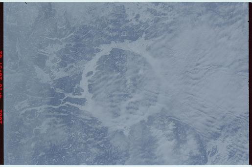
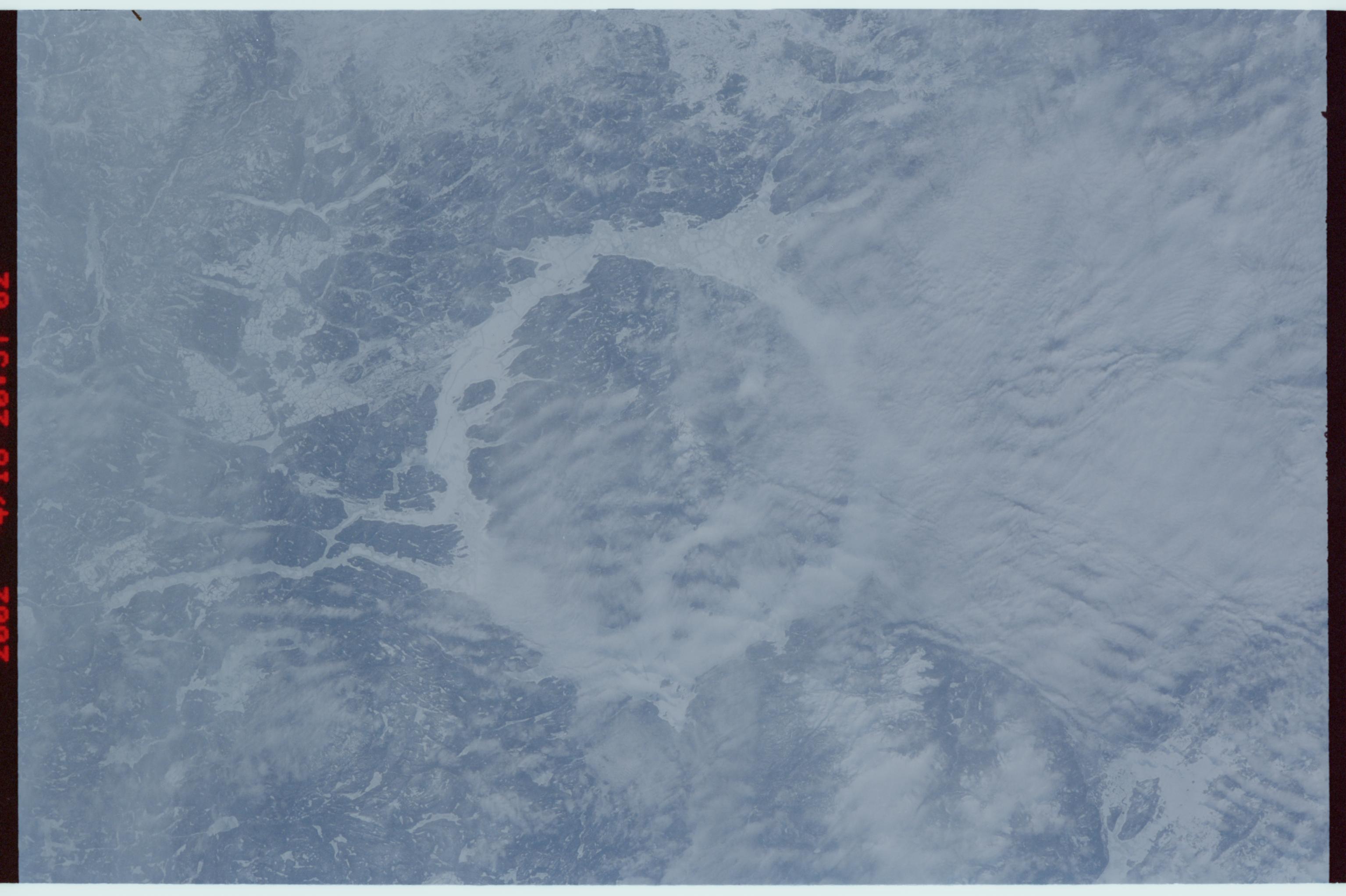
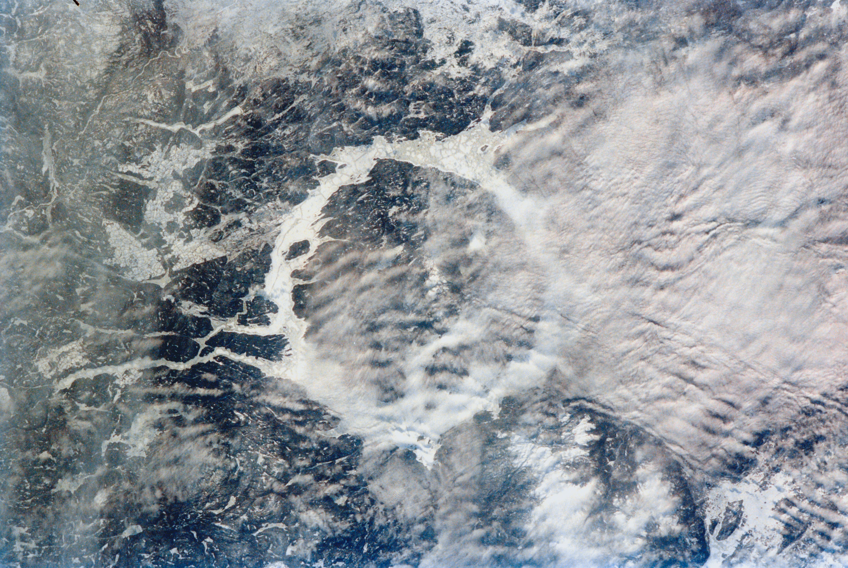
Image Caption: Manacouagan Reservoir, Quebec, Canada April 2002
Low clouds (center right) partially obscure a portion of the ice-covered Manacouagan Reservoir located in the Canadian Shield of Quebec Province in eastern Canada. Manacouagan Reservoir marks the site of an impact crater, 60 miles (100 km) wide, that was formed 212 million years when a meteorite crashed into this area. Over millions of years, the crater has been worn down by the many advancing and retreating glaciers and other erosional processes. Manacouagan Reservoir is drained to the south (left center) by the Manacouagan River.
Low clouds (center right) partially obscure a portion of the ice-covered Manacouagan Reservoir located in the Canadian Shield of Quebec Province in eastern Canada. Manacouagan Reservoir marks the site of an impact crater, 60 miles (100 km) wide, that was formed 212 million years when a meteorite crashed into this area. Over millions of years, the crater has been worn down by the many advancing and retreating glaciers and other erosional processes. Manacouagan Reservoir is drained to the south (left center) by the Manacouagan River.
