< STS073-722-6 >
| NASA Photo ID | STS073-722-6 |
| Focal Length | 40mm |
| Date taken | 1995.10.20 |
| Time taken | 18:36:41 GMT |
Resolutions offered for this image:
3904 x 3904 pixels 639 x 639 pixels 5700 x 5900 pixels 500 x 518 pixels 640 x 480 pixels
3904 x 3904 pixels 639 x 639 pixels 5700 x 5900 pixels 500 x 518 pixels 640 x 480 pixels


Cloud masks available for this image:
Spacecraft nadir point: 39.1° N, 108.1° W
Photo center point: 38.0° N, 107.0° W
Photo center point by machine learning:
Photo center point: 38.0° N, 107.0° W
Photo center point by machine learning:
Nadir to Photo Center: Southeast
Spacecraft Altitude: 147 nautical miles (272km)
Camera: | Hasselblad |
Focal Length: | 40mm |
Camera Tilt: | High Oblique |
Format: | 5046: Kodak, natural color positive, Lumiere 100/5046, ASA 100, standard base |
Film Exposure: | Normal |
| Additional Information | |
| Width | Height | Annotated | Cropped | Purpose | Links |
|---|---|---|---|---|---|
| 3904 pixels | 3904 pixels | No | No | Earth From Space collection | Download Image |
| 639 pixels | 639 pixels | No | No | Earth From Space collection | Download Image |
| 5700 pixels | 5900 pixels | No | No | Download Image Download Color Calibration Image for this Image |
|
| 500 pixels | 518 pixels | No | No | Download Image Download Color Calibration Image for this Image |
|
| 640 pixels | 480 pixels | No | No | Download Image |
Download Packaged File
Download a Google Earth KML for this Image
View photo footprint information
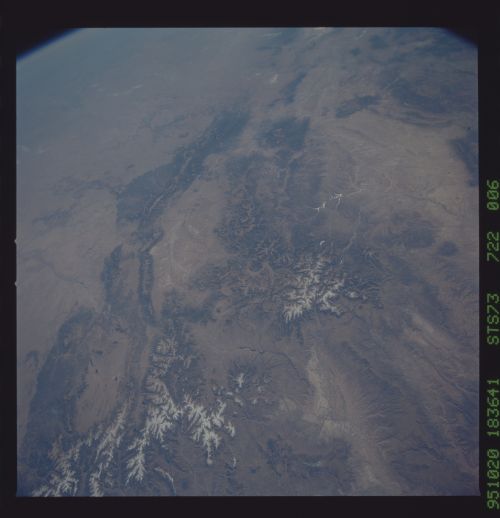
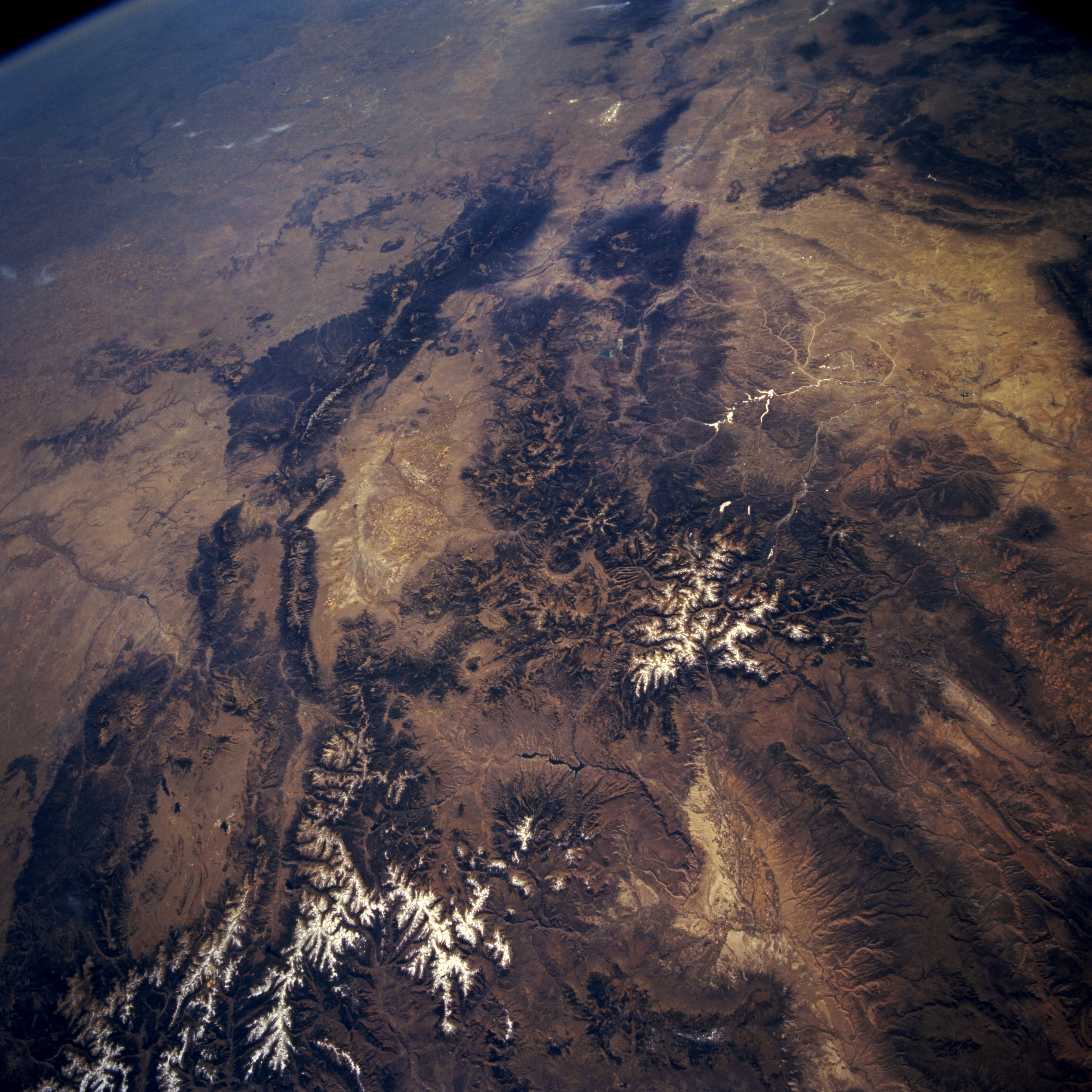
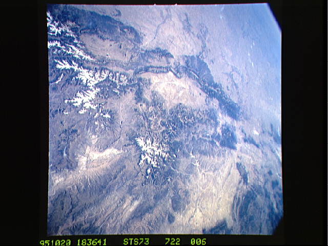
No GeoTIFF is available for this photo.Image Caption: STS073-722-006 Rocky Mountains, Southern Colorado and Northern New Mexico, U.S.A. October 1995
Physiographic maps or atlases will help discern the following landforms in this southeast-looking, synoptic photograph of the Rocky Mountains of southwest Colorado and north-central New Mexico. Viewing counterclockwise are the Front Range of the Rocky Mountains, Sangre de Cristo Mountains, Sawatch Range with the San Luis Valley to its south, San Juan Mountains, San Juan River Basin with sunlight reflected off the Navajo Reservoir, and the Uncompahgre Plateau and Gunnison River Valley with the Blue Mesa Reservoir to their east. Visible are snow cover on some of the higher elevations of the Rocky Mountains; the headwater areas for the Arkansas River and the Rio Grande; and a small section of the Great Plains (upper left corner).
Physiographic maps or atlases will help discern the following landforms in this southeast-looking, synoptic photograph of the Rocky Mountains of southwest Colorado and north-central New Mexico. Viewing counterclockwise are the Front Range of the Rocky Mountains, Sangre de Cristo Mountains, Sawatch Range with the San Luis Valley to its south, San Juan Mountains, San Juan River Basin with sunlight reflected off the Navajo Reservoir, and the Uncompahgre Plateau and Gunnison River Valley with the Blue Mesa Reservoir to their east. Visible are snow cover on some of the higher elevations of the Rocky Mountains; the headwater areas for the Arkansas River and the Rio Grande; and a small section of the Great Plains (upper left corner).
