< STS033-90-6 >
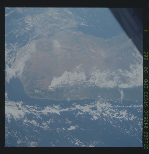
| NASA Photo ID | STS033-90-6 |
| Focal Length | 40mm |
| Date taken | 1989.11.26 |
| Time taken | 04:35:16 GMT |
Cloud masks available for this image:
Spacecraft nadir point: 24.1° S, 48.0° E
Photo center point: 22.5° S, 46.5° E
Photo center point by machine learning:
Photo center point: 22.5° S, 46.5° E
Photo center point by machine learning:
Nadir to Photo Center: Northwest
Spacecraft Altitude: 280 nautical miles (519km)Body: Earth
Country or Geographic Name: | MADAGASCAR |
Features: | MOUNTAIN RANGE |
| Features Found Using Machine Learning: | |
Cloud Cover Percentage: | 45 (26-50)% |
Sun Elevation Angle: | 35° |
Sun Azimuth: | 100° |
Camera: | Hasselblad |
Focal Length: | 40mm |
Camera Tilt: | 25 degrees |
Format: | 5036: Kodak, natural color positive, Ektachrome 5036,200 Professional, ASA 200, stand |
Film Exposure: | Normal |
| Additional Information | |
| Width | Height | Annotated | Cropped | Purpose | Links |
|---|---|---|---|---|---|
| 5700 pixels | 5900 pixels | No | No | Download Image | |
| 500 pixels | 518 pixels | No | No | Download Image | |
| 640 pixels | 480 pixels | No | No | Download Image |
Download Packaged File
Download a Google Earth KML for this Image
View photo footprint information
No GeoTIFF is available for this photo.Image Caption:
Southern Madagascar
Compare this view taken in November 1989, with the S14-35-83 view
in this section taken in early September 1984. This view clearly
shows additional deforestation of tropical hardwoods (1) along
the western and southern coasts in a little over five years time.
Photographs such as this allow scientists to monitor changing
landscapes of this region of the world. (S33-90-006)
Southern Madagascar
Compare this view taken in November 1989, with the S14-35-83 view
in this section taken in early September 1984. This view clearly
shows additional deforestation of tropical hardwoods (1) along
the western and southern coasts in a little over five years time.
Photographs such as this allow scientists to monitor changing
landscapes of this region of the world. (S33-90-006)

