< STS078-736-41 >
| NASA Photo ID | STS078-736-41 |
| Focal Length | 250mm |
| Date taken | 1996.06.26 |
| Time taken | 16:19:37 GMT |
Resolutions offered for this image:
3060 x 3060 pixels 1200 x 1200 pixels 4060 x 4060 pixels 639 x 639 pixels 5700 x 5900 pixels 483 x 500 pixels 653 x 651 pixels 480 x 479 pixels
3060 x 3060 pixels 1200 x 1200 pixels 4060 x 4060 pixels 639 x 639 pixels 5700 x 5900 pixels 483 x 500 pixels 653 x 651 pixels 480 x 479 pixels
Cloud masks available for this image:
Spacecraft nadir point: 36.5° N, 76.0° W
Photo center point: 37.5° N, 77.5° W
Photo center point by machine learning:
Photo center point: 37.5° N, 77.5° W
Photo center point by machine learning:
Nadir to Photo Center: Northwest
Spacecraft Altitude: 144 nautical miles (267km)
Country or Geographic Name: | USA-VIRGINIA |
Features: | RICHMOND, JAMES RIVER |
| Features Found Using Machine Learning: | |
Cloud Cover Percentage: | 5 (1-10)% |
Sun Elevation Angle: | 73° |
Sun Azimuth: | 139° |
Camera: | Hasselblad |
Focal Length: | 250mm |
Camera Tilt: | 37 degrees |
Format: | 5046: Kodak, natural color positive, Lumiere 100/5046, ASA 100, standard base |
Film Exposure: | Normal |
| Additional Information | |
| Width | Height | Annotated | Cropped | Purpose | Links |
|---|---|---|---|---|---|
| 3060 pixels | 3060 pixels | No | No | Cities collection | Download Image |
| 1200 pixels | 1200 pixels | No | No | Cities collection | Download Image |
| 4060 pixels | 4060 pixels | No | No | Earth From Space collection | Download Image |
| 639 pixels | 639 pixels | No | No | Earth From Space collection | Download Image |
| 5700 pixels | 5900 pixels | No | No | Download Image Download Color Calibration Image for this Image |
|
| 483 pixels | 500 pixels | No | No | Download Image Download Color Calibration Image for this Image |
|
| 653 pixels | 651 pixels | No | No | Download Image | |
| 480 pixels | 479 pixels | Download Image |
Download Packaged File
Download a Google Earth KML for this Image
View photo footprint information
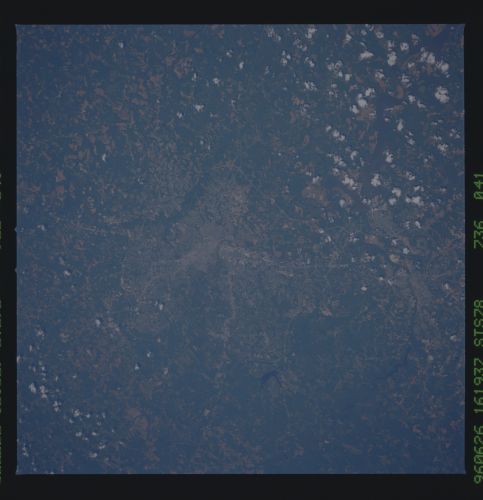
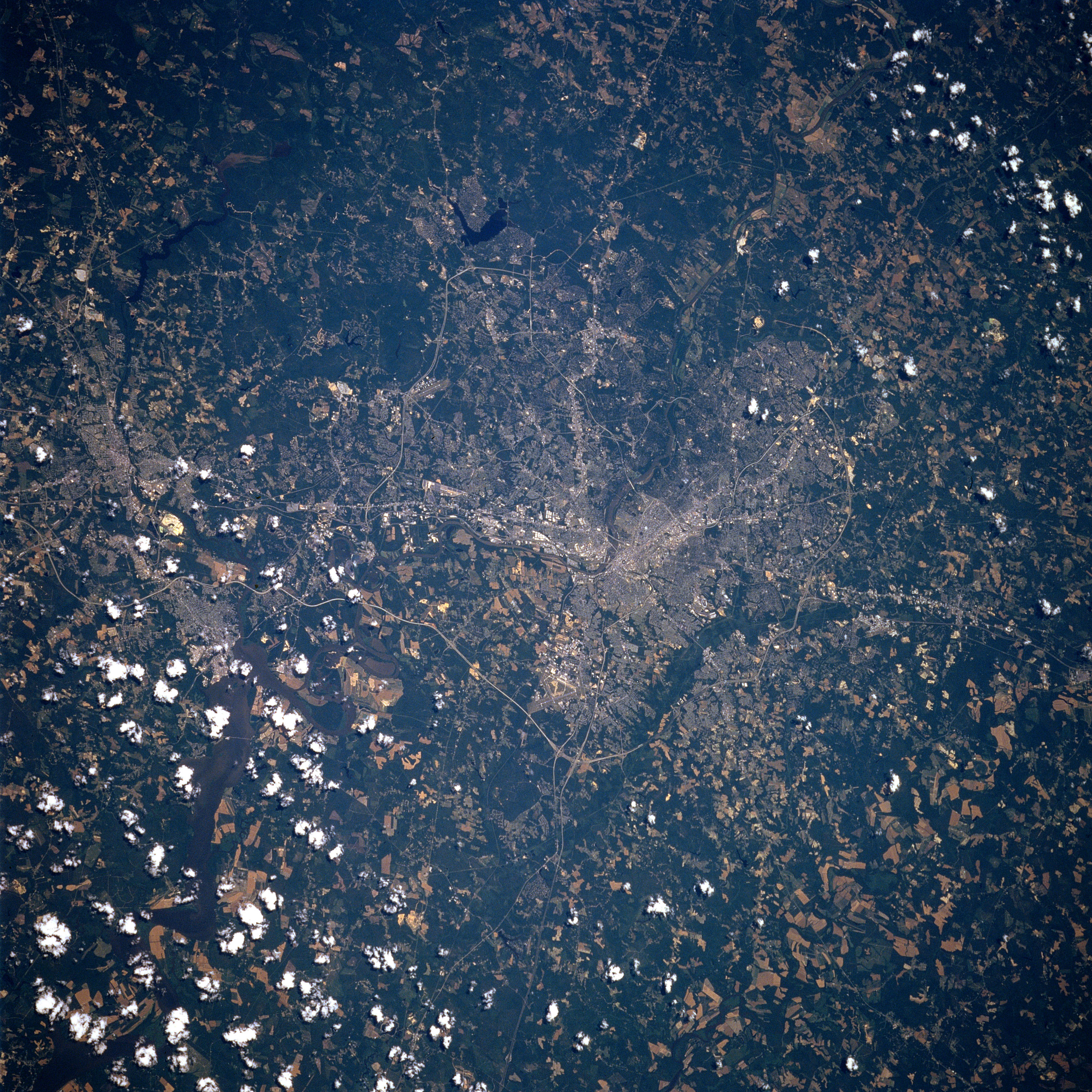
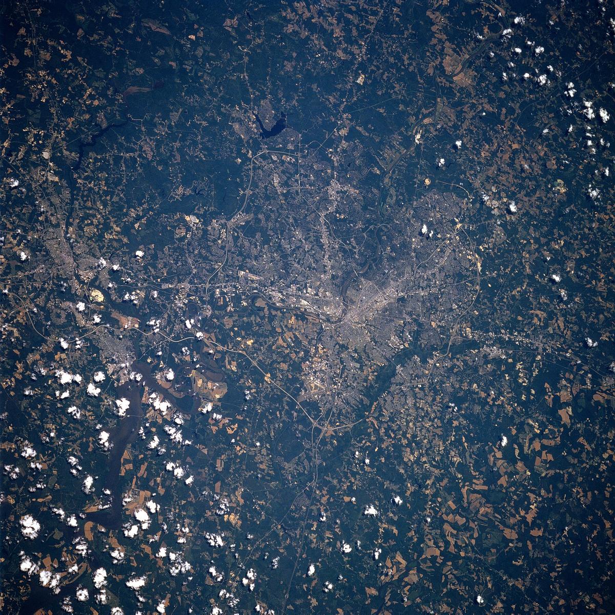
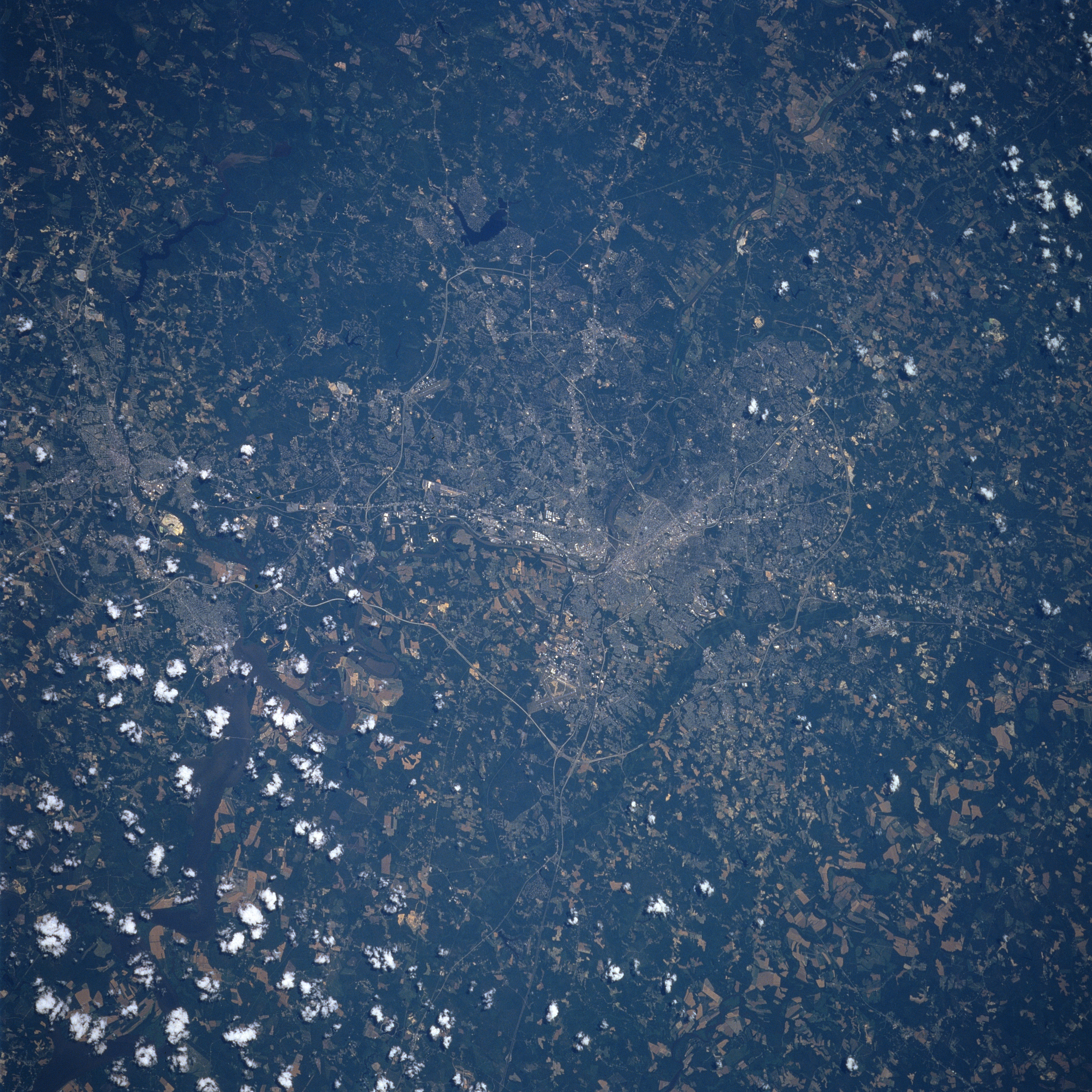
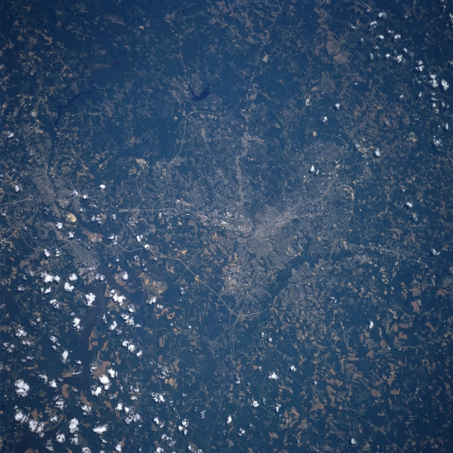
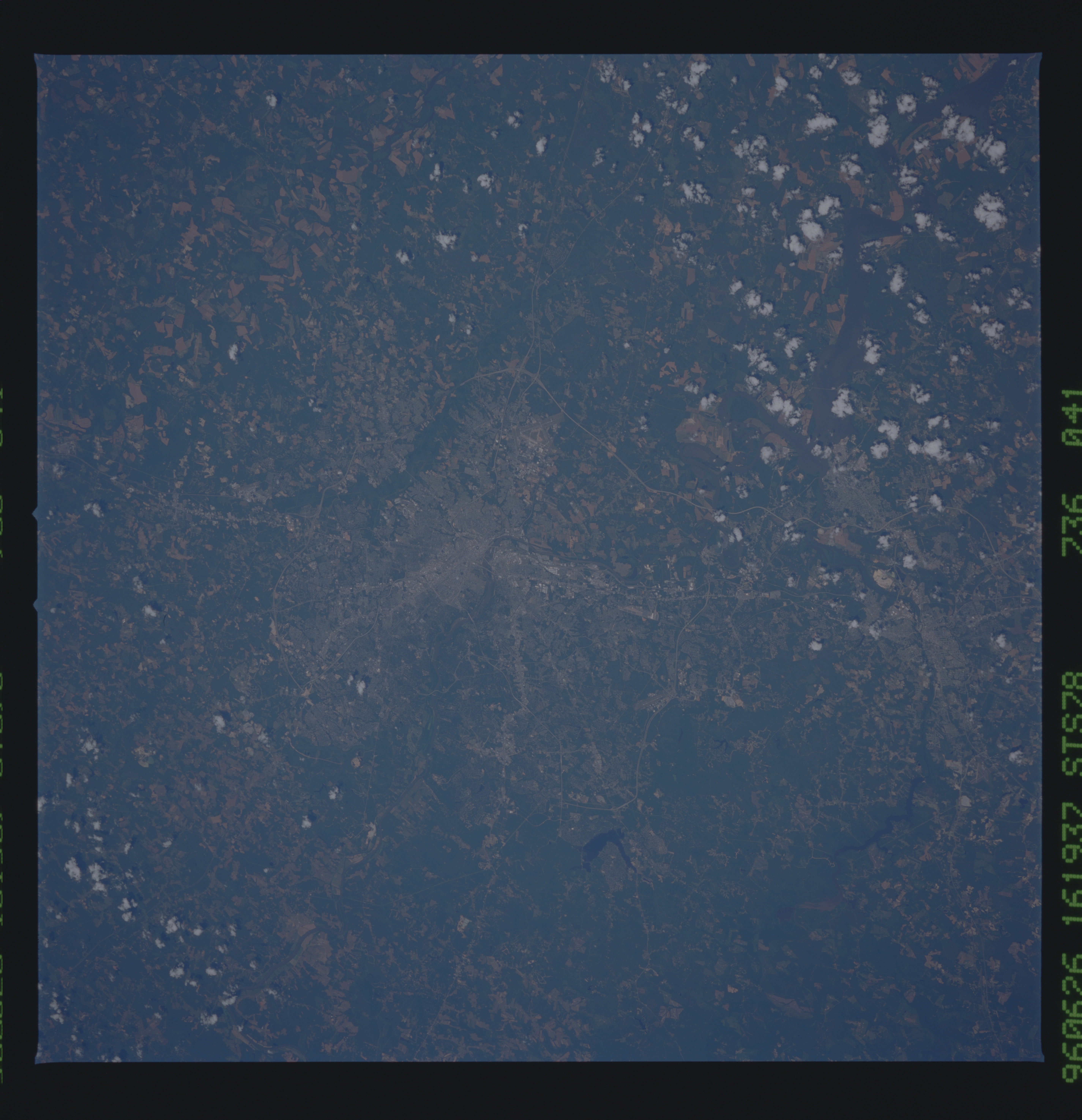
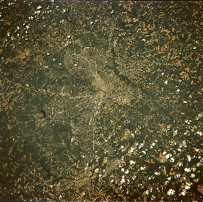
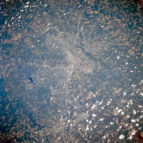
No GeoTIFF is available for this photo.Image Caption: STS078-736-041 Richmond, Virginia, USA June 1996
The capital city of Virginia, Richmond, is located in the center of the image. Segments of Interstate Highway 95 are visible cutting directly north-south through downtown Richmond. Sections of the James River, especially as it flows through mid-city and even the estuary can be seen further southeast (although the broader estuary is partially obscured by cumulus clouds). The Appomattox River flowing into the James River estuary is visible near the southern edge of the picture, as the river passes two smaller Virginia cities of Petersburg and Hopewell. In rural areas, darker features are mainly forested lands and the lighter colored terrain is either cultivated fields or pasture lands.
The capital city of Virginia, Richmond, is located in the center of the image. Segments of Interstate Highway 95 are visible cutting directly north-south through downtown Richmond. Sections of the James River, especially as it flows through mid-city and even the estuary can be seen further southeast (although the broader estuary is partially obscured by cumulus clouds). The Appomattox River flowing into the James River estuary is visible near the southern edge of the picture, as the river passes two smaller Virginia cities of Petersburg and Hopewell. In rural areas, darker features are mainly forested lands and the lighter colored terrain is either cultivated fields or pasture lands.
