STS078-736-42
| NASA Photo ID | STS078-736-42 |
| Focal Length | 250mm |
| Date taken | 1996.06.26 |
| Time taken | 16:19:50 GMT |
Resolutions offered for this image:
4078 x 4078 pixels 639 x 639 pixels 5700 x 5900 pixels 483 x 500 pixels 635 x 652 pixels 479 x 480 pixels
4078 x 4078 pixels 639 x 639 pixels 5700 x 5900 pixels 483 x 500 pixels 635 x 652 pixels 479 x 480 pixels


Cloud masks available for this image:
Spacecraft nadir point: 36.3° N, 75.0° W
Photo center point: 36.5° N, 76.5° W
Photo center point by machine learning:
Photo center point: 36.5° N, 76.5° W
Photo center point by machine learning:
Nadir to Photo Center: West
Spacecraft Altitude: 144 nautical miles (267km)
Country or Geographic Name: | USA-NORTH CAROLINA |
Features: | PORTSMOUTH, DISMAL SWAMP |
| Features Found Using Machine Learning: | |
Cloud Cover Percentage: | 5 (1-10)% |
Sun Elevation Angle: | 74° |
Sun Azimuth: | 141° |
Camera: | Hasselblad |
Focal Length: | 250mm |
Camera Tilt: | 32 degrees |
Format: | 5046: Kodak, natural color positive, Lumiere 100/5046, ASA 100, standard base |
Film Exposure: | Normal |
| Additional Information | |
| Width | Height | Annotated | Cropped | Purpose | Links |
|---|---|---|---|---|---|
| 4078 pixels | 4078 pixels | No | No | Earth From Space collection | Download Image |
| 639 pixels | 639 pixels | No | No | Earth From Space collection | Download Image |
| 5700 pixels | 5900 pixels | No | No | Download Image | |
| 483 pixels | 500 pixels | No | No | Download Image | |
| 635 pixels | 652 pixels | No | No | Download Image | |
| 479 pixels | 480 pixels | Download Image |
Download Packaged File
Download a Google Earth KML for this Image
View photo footprint information
Download a GeoTIFF for this photo
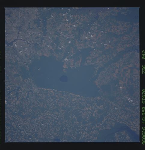
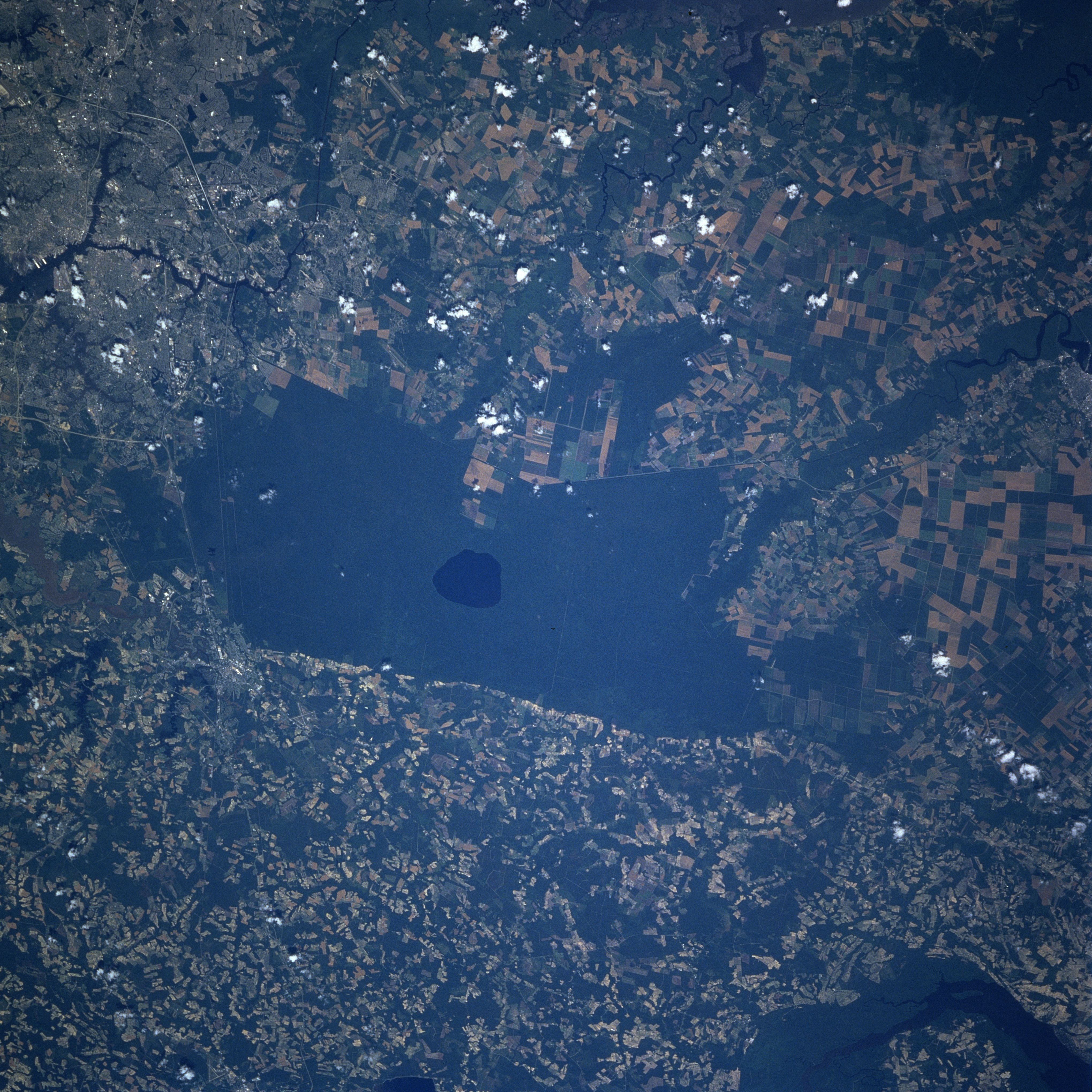
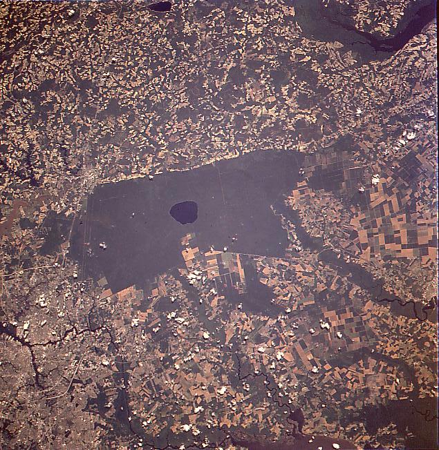
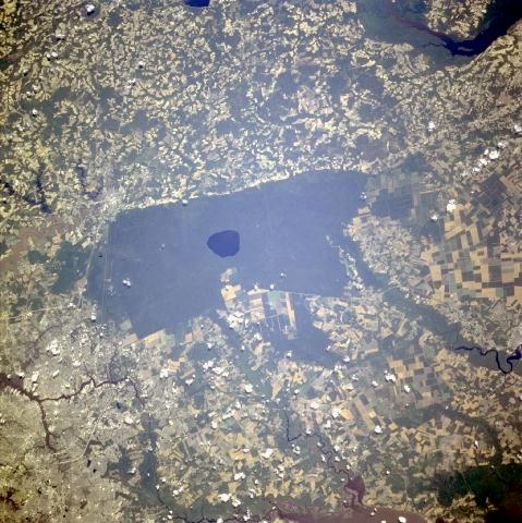
Image Caption: STS078-736-042 Great Dismal Swamp, Virginia June 1996
The remains of the Great Dismal Swamp are visible at the center of the image in this west-southwest-looking view. Once covering an area of 2200 sq miles (5700 sq km) from the mouth of the James River southward to near Albemarle Sound, the Great Dismal Swamp has been reduced to an area of less than 600 sq miles (1554 sq km) or 30 miles (48 km) long and 10 miles (16 km) wide. Draining of the swamp began in 1763. Today, the swamp is a National Wildlife Refuge and with its dense forests and tangled undergrowth, is a favorite site for sportsmen and naturalists. Drummond Lake, 7 miles (11 km) long and 5 miles (8 km) wide, situated at near 20 feet (6 meters) above sea level, can be seen as a dark blue circular feature in the middle of the swamp. Portions of the city of Portsmouth, Virginia are discernible in the lower left portion of the image. A small portion of the Chawan River in North Carolina can be seen in the upper right portion of the image.
The remains of the Great Dismal Swamp are visible at the center of the image in this west-southwest-looking view. Once covering an area of 2200 sq miles (5700 sq km) from the mouth of the James River southward to near Albemarle Sound, the Great Dismal Swamp has been reduced to an area of less than 600 sq miles (1554 sq km) or 30 miles (48 km) long and 10 miles (16 km) wide. Draining of the swamp began in 1763. Today, the swamp is a National Wildlife Refuge and with its dense forests and tangled undergrowth, is a favorite site for sportsmen and naturalists. Drummond Lake, 7 miles (11 km) long and 5 miles (8 km) wide, situated at near 20 feet (6 meters) above sea level, can be seen as a dark blue circular feature in the middle of the swamp. Portions of the city of Portsmouth, Virginia are discernible in the lower left portion of the image. A small portion of the Chawan River in North Carolina can be seen in the upper right portion of the image.
