< STS062-98-156 >

| NASA Photo ID | STS062-98-156 |
| Focal Length | 250mm |
| Date taken | 1994.03.12 |
| Time taken | 16:32:31 GMT |
Resolutions offered for this image:
3904 x 3872 pixels 639 x 634 pixels 5700 x 5900 pixels 500 x 518 pixels 640 x 480 pixels
3904 x 3872 pixels 639 x 634 pixels 5700 x 5900 pixels 500 x 518 pixels 640 x 480 pixels

Cloud masks available for this image:
Spacecraft nadir point: 38.6° N, 121.1° W
Photo center point: 37.5° N, 122.5° W
Photo center point by machine learning:
Photo center point: 37.5° N, 122.5° W
Photo center point by machine learning:
Nadir to Photo Center: Southwest
Spacecraft Altitude: 160 nautical miles (296km)
Country or Geographic Name: | USA-CALIFORNIA |
Features: | SAN FRANCISCO BAY AREA |
| Features Found Using Machine Learning: | |
Cloud Cover Percentage: | 0 (no clouds present) |
Sun Elevation Angle: | 24° |
Sun Azimuth: | 116° |
Camera: | Hasselblad |
Focal Length: | 250mm |
Camera Tilt: | 34 degrees |
Format: | 5048: Kodak, natural color positive, Lumiere 100x/5048, ASA 100x, standard base |
Film Exposure: | Normal |
| Additional Information | |
| Width | Height | Annotated | Cropped | Purpose | Links |
|---|---|---|---|---|---|
| 3904 pixels | 3872 pixels | No | No | Earth From Space collection | Download Image |
| 639 pixels | 634 pixels | No | No | Earth From Space collection | Download Image |
| 5700 pixels | 5900 pixels | No | No | Download Image Download Color Calibration Image for this Image |
|
| 500 pixels | 518 pixels | No | No | Download Image Download Color Calibration Image for this Image |
|
| 640 pixels | 480 pixels | No | No | Download Image |
Download Packaged File
Download a Google Earth KML for this Image
View photo footprint information
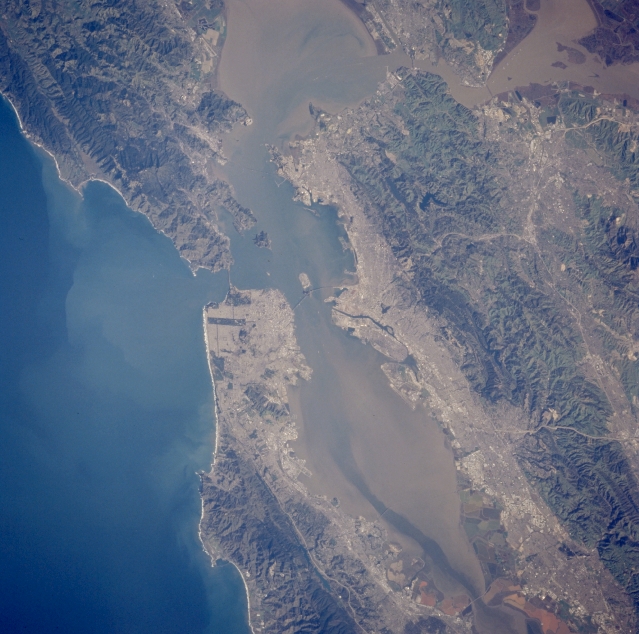
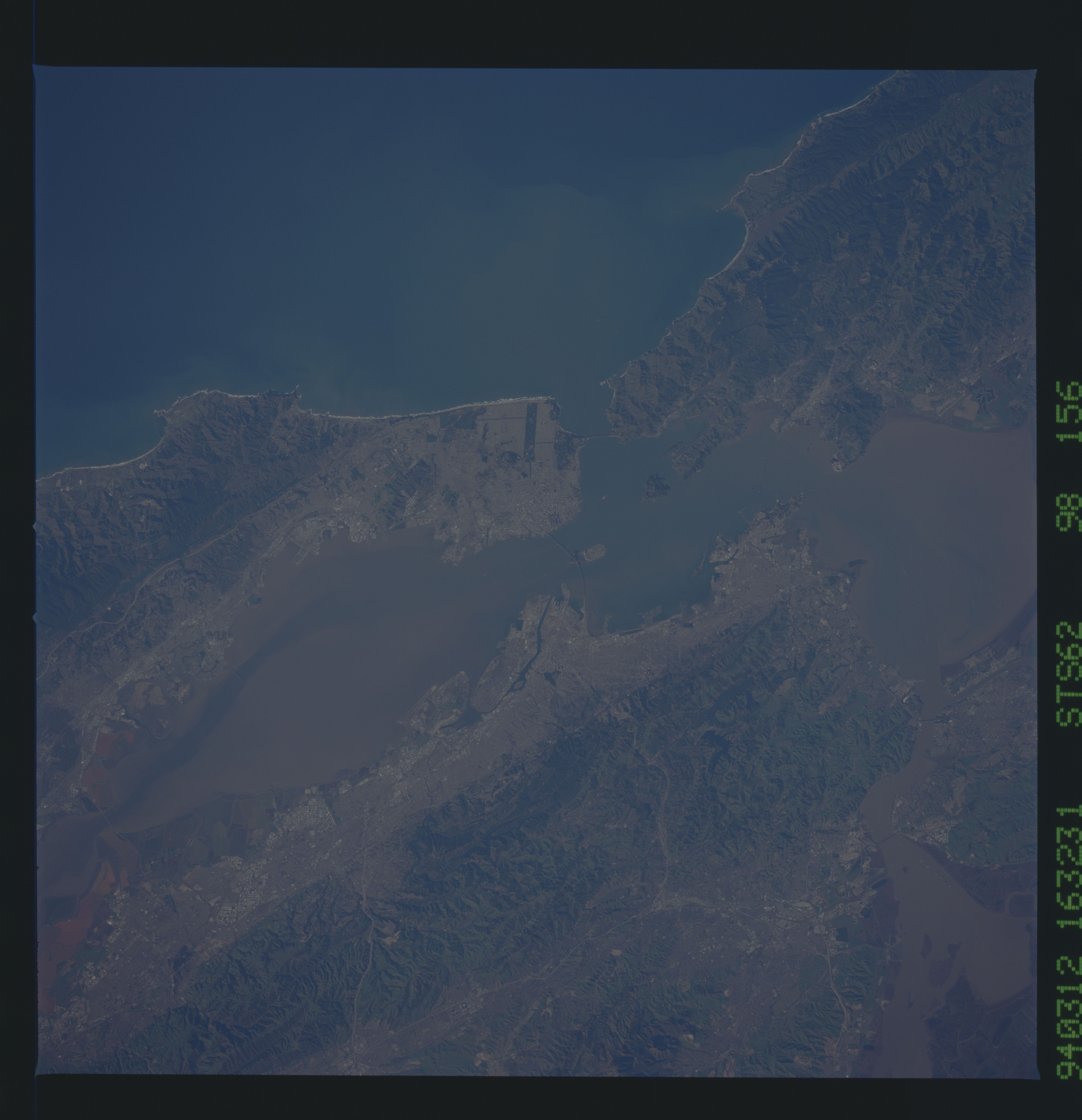
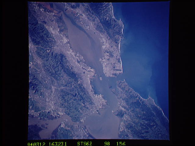
No GeoTIFF is available for this photo.Image Caption: STS062-098-156 San Francisco Bay, California, U.S.A. March 1994
Both urban areas and low, rugged mountains and ridges surrounding San Francisco are captured in this photograph. Two northwest-southeast-trending faults are discernible--Hayward Fault, bordering the urban area east of San Francisco Bay, and San Andreas Fault, crossing the mid-San Francisco Peninsula before dipping beneath the Pacific Ocean and surfacing again northwest of Golden Gate Bridge. Five major bridges connect Bay Area communities, and two highway arteries connect the densely populated Bay Area with the valley to the east and the communities of Walnut Creek, Concord, and Livermore. The colors along the southern edge of the bay are produced by the growth of algae in salt pans of varying degrees of salinity. Sediment plumes are visible in San Francisco Bay and the Pacific waters west of the Golden Gate Bridge.
Both urban areas and low, rugged mountains and ridges surrounding San Francisco are captured in this photograph. Two northwest-southeast-trending faults are discernible--Hayward Fault, bordering the urban area east of San Francisco Bay, and San Andreas Fault, crossing the mid-San Francisco Peninsula before dipping beneath the Pacific Ocean and surfacing again northwest of Golden Gate Bridge. Five major bridges connect Bay Area communities, and two highway arteries connect the densely populated Bay Area with the valley to the east and the communities of Walnut Creek, Concord, and Livermore. The colors along the southern edge of the bay are produced by the growth of algae in salt pans of varying degrees of salinity. Sediment plumes are visible in San Francisco Bay and the Pacific waters west of the Golden Gate Bridge.
