< STS068-229-15 >
| NASA Photo ID | STS068-229-15 |
| Focal Length | 40mm |
| Date taken | 1994.__.__ |
| Time taken | GMT |
Resolutions offered for this image:
3872 x 3872 pixels 639 x 639 pixels 5700 x 5900 pixels 500 x 518 pixels 640 x 480 pixels
3872 x 3872 pixels 639 x 639 pixels 5700 x 5900 pixels 500 x 518 pixels 640 x 480 pixels
Cloud masks available for this image:
Spacecraft nadir point:
Photo center point: 46.5° N, 85.0° W
Photo center point by machine learning:
Photo center point: 46.5° N, 85.0° W
Photo center point by machine learning:
Nadir to Photo Center:
Spacecraft Altitude: nautical miles (0km)
Country or Geographic Name: | USA-MICHIGAN |
Features: | WHITEFISH BAY, UPPER PEN |
| Features Found Using Machine Learning: | |
Cloud Cover Percentage: | 5 (1-10)% |
Sun Elevation Angle: | ° |
Sun Azimuth: | ° |
Camera: | Hasselblad |
Focal Length: | 40mm |
Camera Tilt: | Low Oblique |
Format: | 5046: Kodak, natural color positive, Lumiere 100/5046, ASA 100, standard base |
Film Exposure: | Normal |
| Additional Information | |
| Width | Height | Annotated | Cropped | Purpose | Links |
|---|---|---|---|---|---|
| 3872 pixels | 3872 pixels | No | No | Earth From Space collection | Download Image |
| 639 pixels | 639 pixels | No | No | Earth From Space collection | Download Image |
| 5700 pixels | 5900 pixels | No | No | Download Image Download Color Calibration Image for this Image |
|
| 500 pixels | 518 pixels | No | No | Download Image Download Color Calibration Image for this Image |
|
| 640 pixels | 480 pixels | No | No | Download Image |
Download Packaged File
Download a Google Earth KML for this Image
View photo footprint information
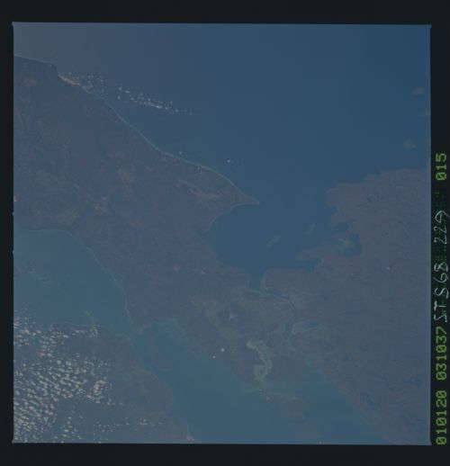
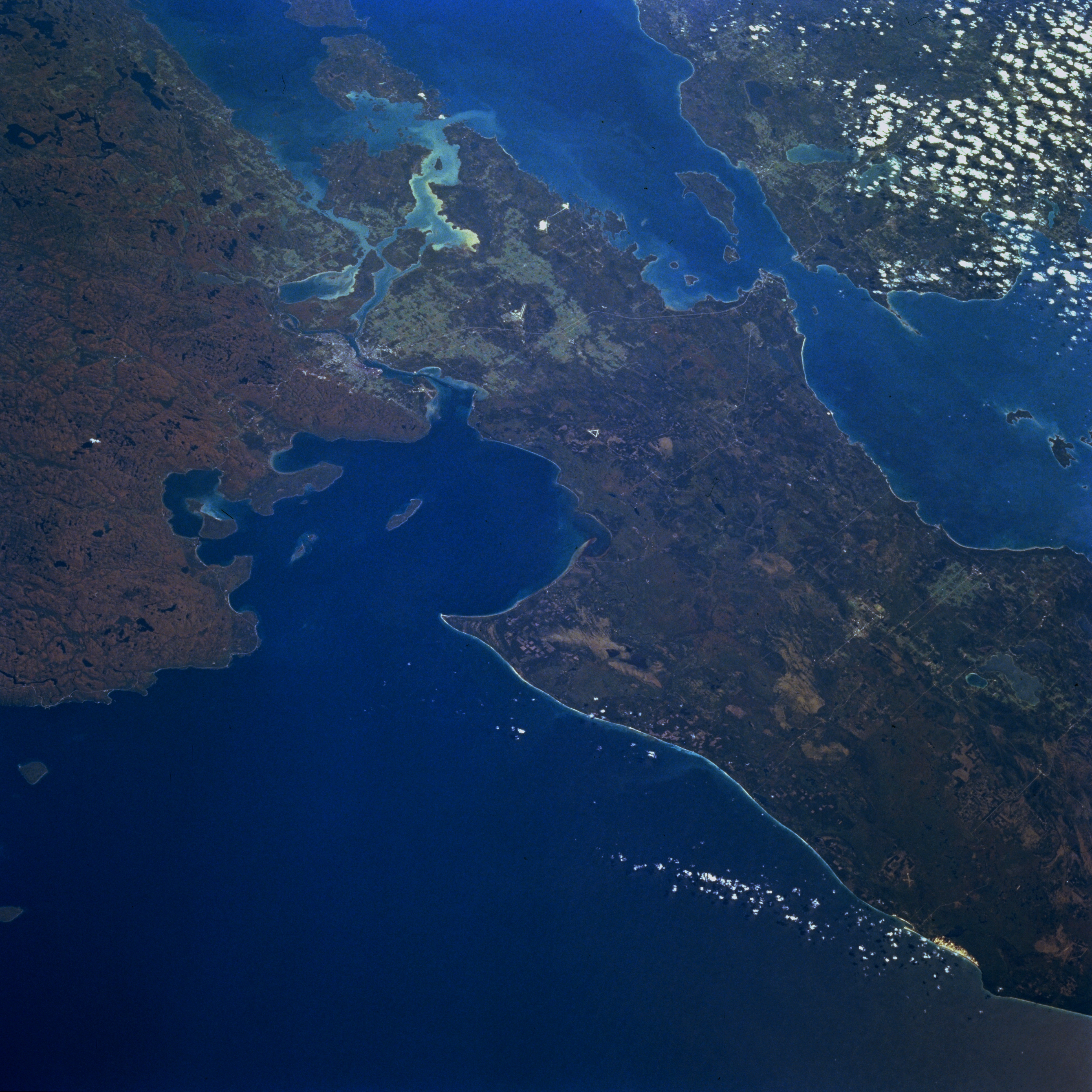
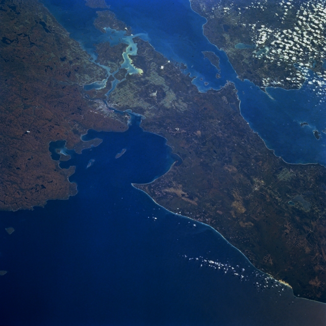
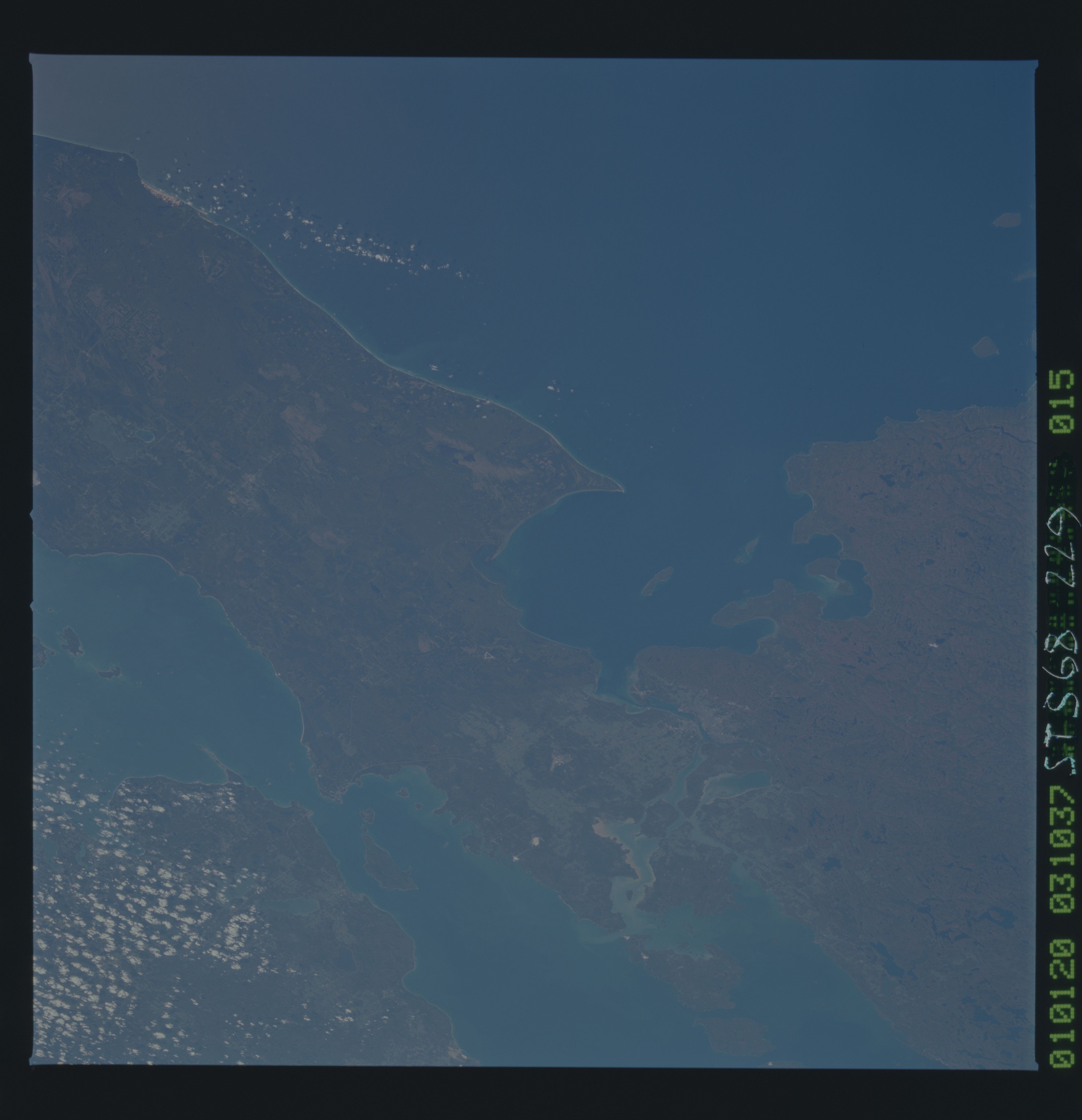
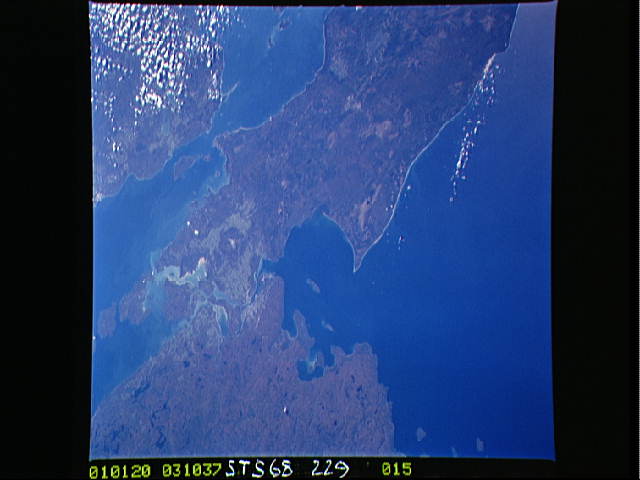
No GeoTIFF is available for this photo.Image Caption: STS068-229-015 Saint Marys River and Straits of Mackinac, Michigan, U.S.A. October 1994
This panoramic, southeast-looking, low-oblique photograph features sediment-laden Saint Marys River; Sault Sainte Marie; and the Straits of Mackinac, which separate lower Michigan and the Upper Peninsula. Saint Marys River and the Straits of Mackinac are important links in the Saint Lawrence Seaway. Visible are southeastern Lake Superior (bottom), northern Lake Huron (top center), and northern Lake Michigan (near right center). Whitefish Bay is apparent (nearly enclosed just left of center). Ontario Province in Canada lies north of Saint Marys River.
This panoramic, southeast-looking, low-oblique photograph features sediment-laden Saint Marys River; Sault Sainte Marie; and the Straits of Mackinac, which separate lower Michigan and the Upper Peninsula. Saint Marys River and the Straits of Mackinac are important links in the Saint Lawrence Seaway. Visible are southeastern Lake Superior (bottom), northern Lake Huron (top center), and northern Lake Michigan (near right center). Whitefish Bay is apparent (nearly enclosed just left of center). Ontario Province in Canada lies north of Saint Marys River.
