< ISS017-E-13700 >

| NASA Photo ID | ISS017-E-13700 |
| Focal Length | 31mm |
| Date taken | 2008.08.19 |
| Time taken | 20:42:51 GMT |
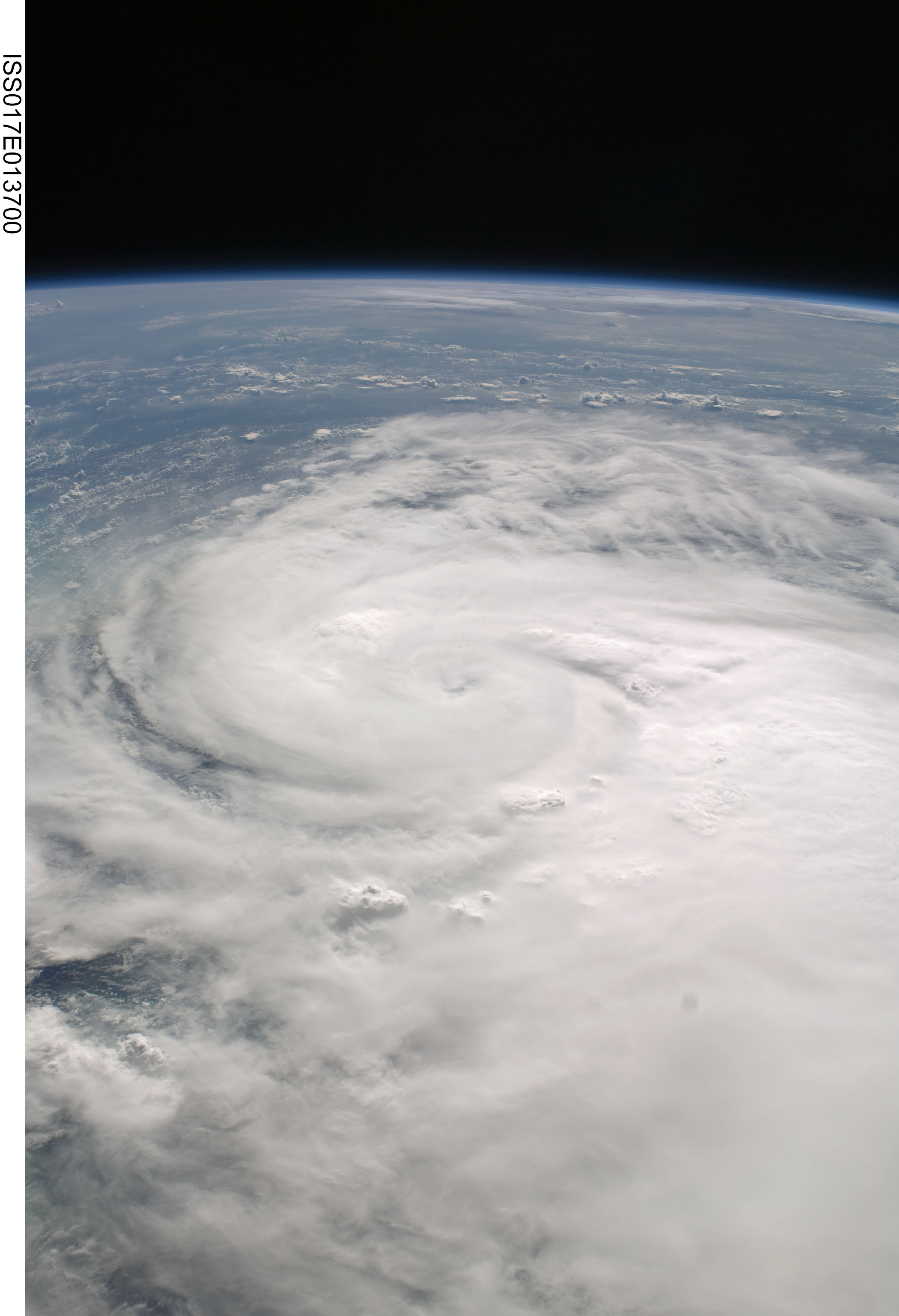

Spacecraft nadir point: 28.6° N, 75.2° W
Photo center point: 27.3° N, 81.0° W
Photo center point by machine learning:
Photo center point: 27.3° N, 81.0° W
Photo center point by machine learning:
Nadir to Photo Center: West
Spacecraft Altitude: 191 nautical miles (354km)
Country or Geographic Name: | USA-FLORIDA |
Features: | PAN-TROPICAL STORM FAY |
| Features Found Using Machine Learning: | PAN- |
Cloud Cover Percentage: | 75 (51-75)% |
Sun Elevation Angle: | 37° |
Sun Azimuth: | 264° |
Camera: | Nikon D2Xs Electronic Still Camera |
Focal Length: | 31mm |
Camera Tilt: | High Oblique |
Format: | 4288E: 4288 x 2848 pixel CMOS sensor, RGBG imager color filter |
Film Exposure: | |
| Additional Information | |
| Width | Height | Annotated | Cropped | Purpose | Links |
|---|---|---|---|---|---|
| 2098 pixels | 3072 pixels | No | No | Download Image | |
| 437 pixels | 640 pixels | No | No | Download Image |
Download Packaged File
Download a Google Earth KML for this Image
View photo footprint information
No GeoTIFF is available for this photo.Image Caption: none
