ISS017-E-13701
| NASA Photo ID | ISS017-E-13701 |
| Focal Length | 31mm |
| Date taken | 2008.08.19 |
| Time taken | 20:42:57 GMT |
Cloud masks available for this image:
Spacecraft nadir point: 28.3° N, 74.9° W
Photo center point: 27.3° N, 81.0° W
Photo center point by machine learning:
Photo center point: 27.3° N, 81.0° W
Photo center point by machine learning:
Nadir to Photo Center: West
Spacecraft Altitude: 191 nautical miles (354km)
Country or Geographic Name: | USA-FLORIDA |
Features: | PAN-TROPICAL STORM FAY |
| Features Found Using Machine Learning: | PAN- |
Cloud Cover Percentage: | 75 (51-75)% |
Sun Elevation Angle: | 37° |
Sun Azimuth: | 265° |
Camera: | Nikon D2Xs Electronic Still Camera |
Focal Length: | 31mm |
Camera Tilt: | High Oblique |
Format: | 4288E: 4288 x 2848 pixel CMOS sensor, RGBG imager color filter |
Film Exposure: | |
| Additional Information | |
| Width | Height | Annotated | Cropped | Purpose | Links |
|---|---|---|---|---|---|
| 3072 pixels | 2098 pixels | No | No | Download Image | |
| 640 pixels | 437 pixels | No | No | Download Image |
Download Packaged File
Download a Google Earth KML for this Image
View photo footprint information
Download a GeoTIFF for this photo
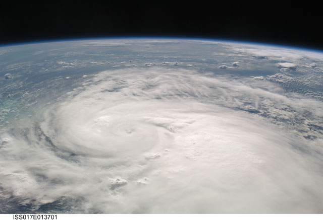
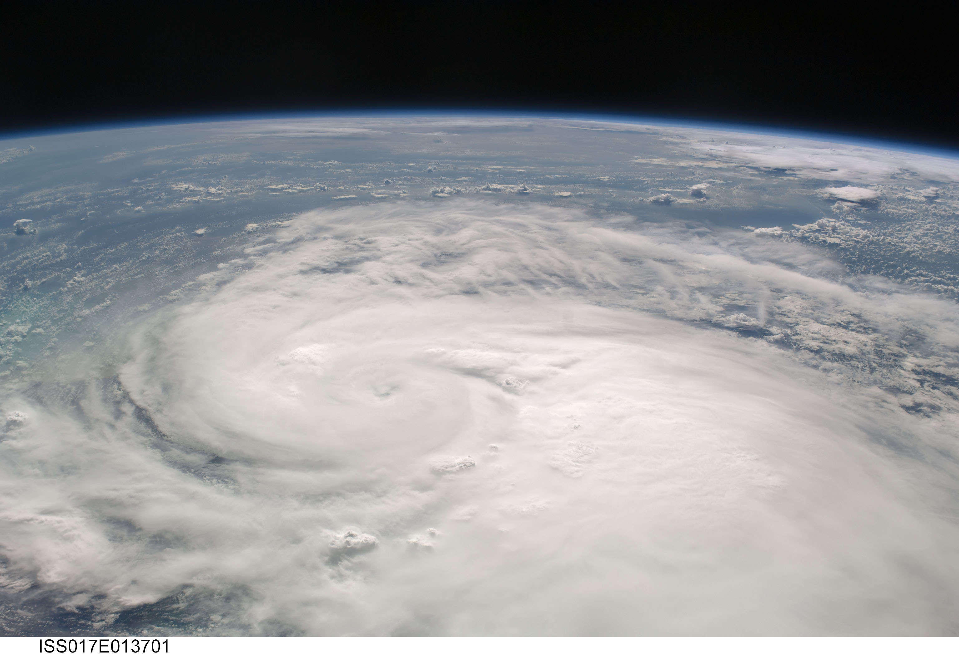
Image Caption: ISS017-E-013701 (19 Aug. 2008) ---- This frame is a westward-looking oblique view of Tropical Storm Fay, as seen about 4:43 p.m. (EDT) on Aug. 19, 2008 from the International Space Station from a vantage point of 220 statute miles above the Atlantic Ocean just northeast of the Bahama Islands (approximately 28.4 degrees north latitude and 75.0 degrees west longitude). Fay had sustained winds of 55 nautical miles per hour with gusts to 65 nautical miles per hour and was estimated to be centered just northwest of Lake Okeechobee, Florida (around 27.3 degrees north latitude and 81.0 degrees west longitude. This panoramic view includes the Gulf of Mexico to the west of the storm.
