STS112-E-5628
| NASA Photo ID | STS112-E-5628 |
| Focal Length | 400mm |
| Date taken | 2002.10.15 |
| Time taken | 01:23:19 GMT |
Resolutions offered for this image:
540 x 405 pixels 1000 x 921 pixels 3032 x 2064 pixels 639 x 435 pixels
540 x 405 pixels 1000 x 921 pixels 3032 x 2064 pixels 639 x 435 pixels
Cloud masks available for this image:
Spacecraft nadir point: 8.7° S, 119.7° E
Photo center point: 8.0° S, 119.0° E
Photo center point by machine learning:
Photo center point: 8.0° S, 119.0° E
Photo center point by machine learning:
Nadir to Photo Center: Northwest
Spacecraft Altitude: 205 nautical miles (380km)
Country or Geographic Name: | INDONESIA |
Features: | SANGEANG API |
| Features Found Using Machine Learning: | |
Cloud Cover Percentage: | 25 (11-25)% |
Sun Elevation Angle: | 54° |
Sun Azimuth: | 92° |
Camera: | Kodak DCS760c Electronic Still Camera |
Focal Length: | 400mm |
Camera Tilt: | 16 degrees |
Format: | 3060E: 3060 x 2036 pixel CCD, RGBG array |
Film Exposure: | |
| Additional Information | |
| Width | Height | Annotated | Cropped | Purpose | Links |
|---|---|---|---|---|---|
| 540 pixels | 405 pixels | Yes | Yes | Earth From Space collection | Download Image |
| 1000 pixels | 921 pixels | No | Yes | NASA's Earth Observatory web site | Download Image |
| 3032 pixels | 2064 pixels | No | No | Download Image | |
| 639 pixels | 435 pixels | No | No | Download Image |
Download Packaged File
Download a Google Earth KML for this Image
View photo footprint information
Download a GeoTIFF for this photo
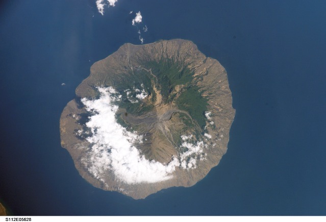
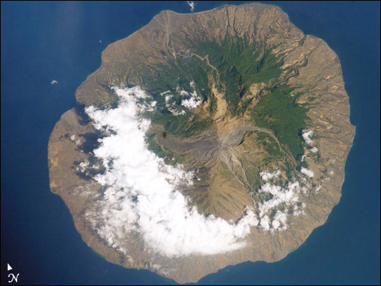
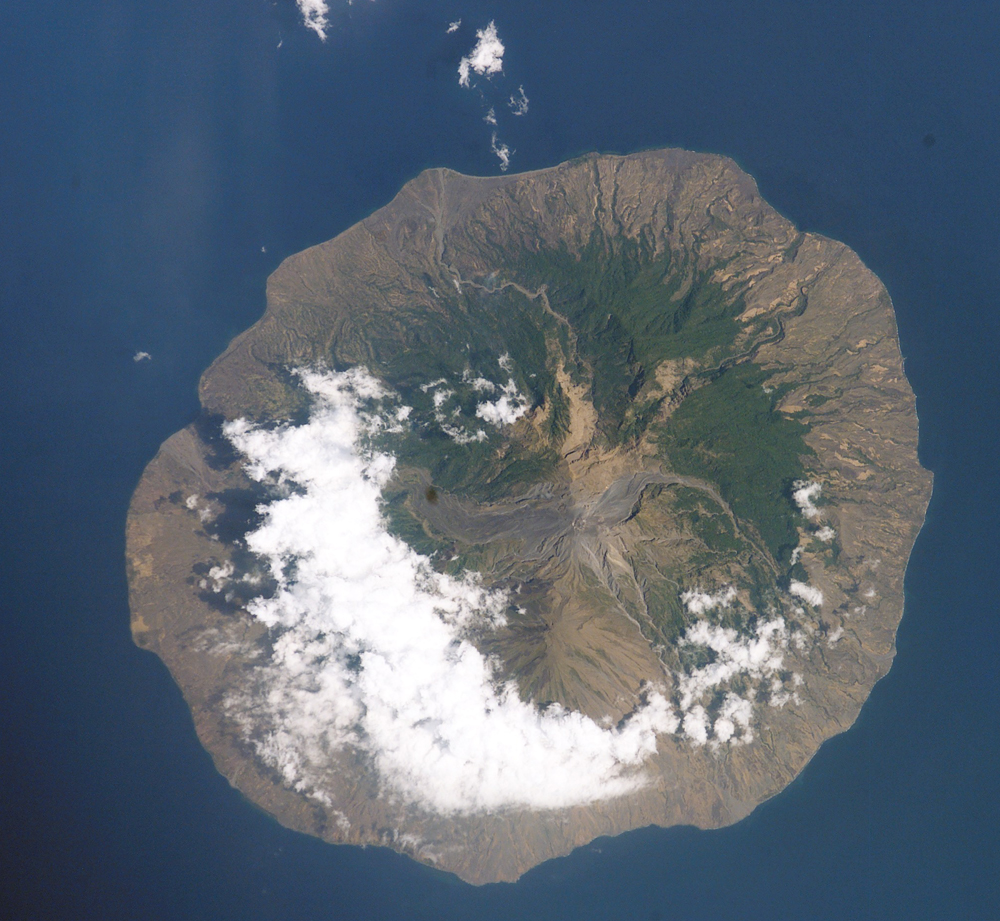
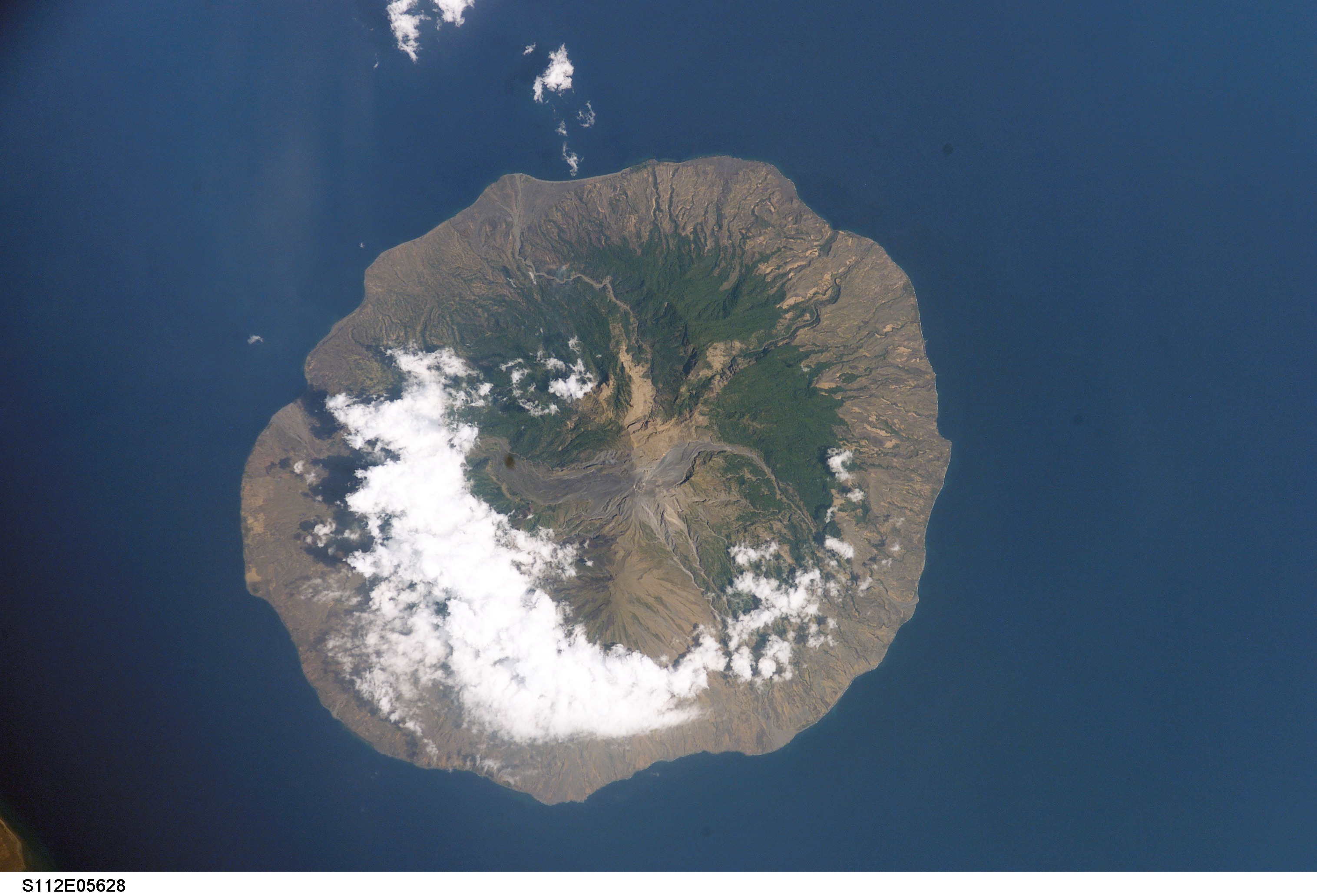
Image Caption: In 1985, the small Indonesian island of Sangeang Api (for scale, the island is 13 km wide) off the northeast coast of Sumbawa began to erupt. Within a month, the 1250 inhabitants had evacuated to Sumbawa. The eruption lasted until 1988. The lava and pyroclastic flows--the wide channel running west from the summit--are still easily traced on this image taken last week by Space Shuttle astronauts (STS-112) . Today, the island's summit crater (1949 m) produces intermittent steam clouds.
Compare this photograph to an earlier Space Shuttle photograph taken in November 1985.
Compare this photograph to an earlier Space Shuttle photograph taken in November 1985.
