STS078-732-53
| NASA Photo ID | STS078-732-53 |
| Focal Length | 250mm |
| Date taken | 1996.06.24 |
| Time taken | 10:27:07 GMT |
Resolutions offered for this image:
4043 x 4043 pixels 640 x 640 pixels 5700 x 5900 pixels 483 x 500 pixels
4043 x 4043 pixels 640 x 640 pixels 5700 x 5900 pixels 483 x 500 pixels

Cloud masks available for this image:
Spacecraft nadir point: 37.2° N, 25.9° E
Photo center point: 38.5° N, 26.0° E
Photo center point by machine learning:
Photo center point: 38.5° N, 26.0° E
Photo center point by machine learning:
Nadir to Photo Center: North
Spacecraft Altitude: 145 nautical miles (269km)
Country or Geographic Name: | GREECE |
Features: | KHIOS ISLAND, TURKEY, COAST |
| Features Found Using Machine Learning: | |
Cloud Cover Percentage: | 0 (no clouds present) |
Sun Elevation Angle: | 76° |
Sun Azimuth: | 188° |
Camera: | Hasselblad |
Focal Length: | 250mm |
Camera Tilt: | 28 degrees |
Format: | 5046: Kodak, natural color positive, Lumiere 100/5046, ASA 100, standard base |
Film Exposure: | Normal |
| Additional Information | |
| Width | Height | Annotated | Cropped | Purpose | Links |
|---|---|---|---|---|---|
| 4043 pixels | 4043 pixels | No | No | Earth From Space collection | Download Image |
| 640 pixels | 640 pixels | No | No | Earth From Space collection | Download Image |
| 5700 pixels | 5900 pixels | No | No | Download Image | |
| 483 pixels | 500 pixels | No | No | Download Image |
Download Packaged File
Download a Google Earth KML for this Image
View photo footprint information
Download a GeoTIFF for this photo
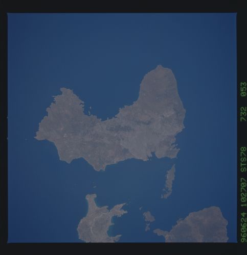
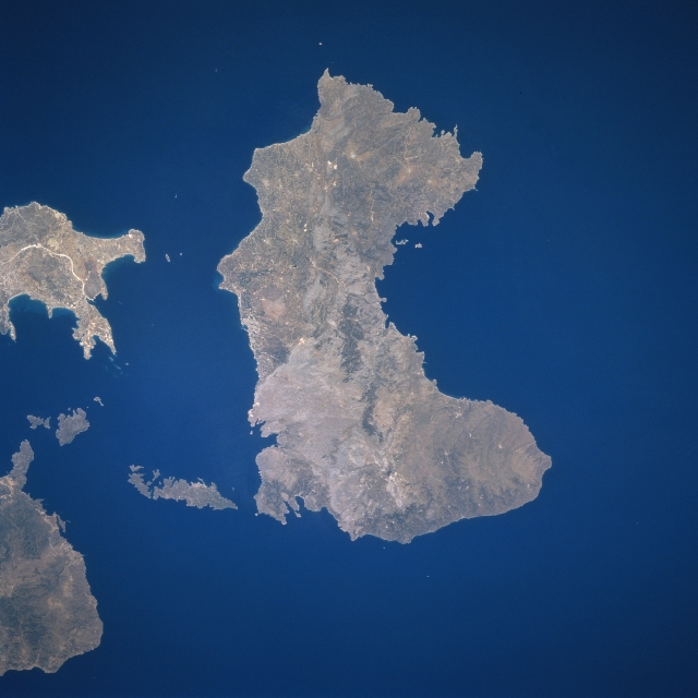
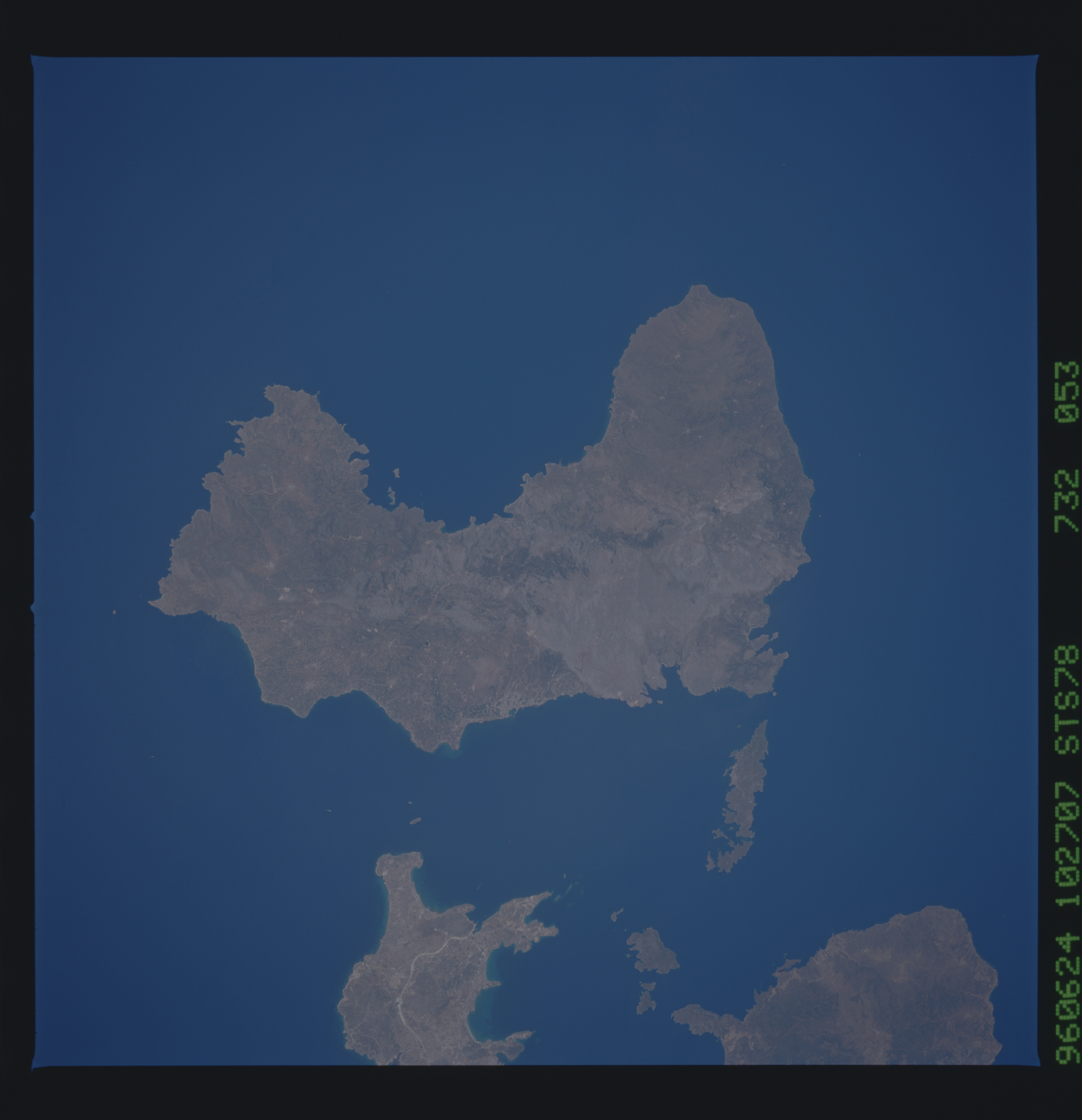
Image Caption: STS078-732-053 Khios Island, Greece June 1996
Located in the eastern Aegean Sea just off the coast of western Turkey, the Greek island of Khios can be seen in this near-nadir view. Khios Island is 30 miles (48 km) long and 8 to 15 miles (13 to 24 km) wide and covers an area of 350 sq. miles (905 sq. km). The island is hilly, scenic, and fertile with a good climate. Khios produces olives, figs, and mastic and has marble quarries, lignite deposits, and sulfur springs. Khios is noted in antiquity for its claims as Homer's birthplace and for its school of epic poets, the Homeridae. The land visible at the left center and bottom left is part of the country of Turkey.
Located in the eastern Aegean Sea just off the coast of western Turkey, the Greek island of Khios can be seen in this near-nadir view. Khios Island is 30 miles (48 km) long and 8 to 15 miles (13 to 24 km) wide and covers an area of 350 sq. miles (905 sq. km). The island is hilly, scenic, and fertile with a good climate. Khios produces olives, figs, and mastic and has marble quarries, lignite deposits, and sulfur springs. Khios is noted in antiquity for its claims as Homer's birthplace and for its school of epic poets, the Homeridae. The land visible at the left center and bottom left is part of the country of Turkey.
