STS033-79-44
| NASA Photo ID | STS033-79-44 |
| Focal Length | 250mm |
| Date taken | 1989.11.24 |
| Time taken | 01:56:25 GMT |
Resolutions offered for this image:
3899 x 3907 pixels 638 x 640 pixels 5700 x 5900 pixels 500 x 518 pixels 640 x 480 pixels
3899 x 3907 pixels 638 x 640 pixels 5700 x 5900 pixels 500 x 518 pixels 640 x 480 pixels


Cloud masks available for this image:
Spacecraft nadir point: 12.6° S, 135.7° E
Photo center point: 14.0° S, 137.0° E
Photo center point by machine learning:
Photo center point: 14.0° S, 137.0° E
Photo center point by machine learning:
Nadir to Photo Center: Southeast
Spacecraft Altitude: 201 nautical miles (372km)
Country or Geographic Name: | AUSTRALIA-NT |
Features: | GROOTE EYLANDT |
| Features Found Using Machine Learning: | |
Cloud Cover Percentage: | 0 (no clouds present) |
Sun Elevation Angle: | 76° |
Sun Azimuth: | 126° |
Camera: | Hasselblad |
Focal Length: | 250mm |
Camera Tilt: | 30 degrees |
Format: | 5017: Kodak, natural color positive, Ektachrome, X Professional, ASA 64, standard base |
Film Exposure: | Normal |
| Additional Information | |
| Width | Height | Annotated | Cropped | Purpose | Links |
|---|---|---|---|---|---|
| 3899 pixels | 3907 pixels | No | No | Earth From Space collection | Download Image |
| 638 pixels | 640 pixels | No | No | Earth From Space collection | Download Image |
| 5700 pixels | 5900 pixels | No | No | Download Image | |
| 500 pixels | 518 pixels | No | No | Download Image | |
| 640 pixels | 480 pixels | No | No | Download Image |
Download Packaged File
Download a Google Earth KML for this Image
View photo footprint information
Download a GeoTIFF for this photo
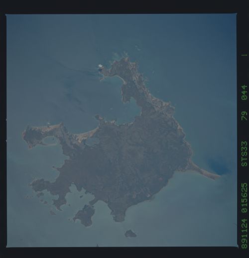
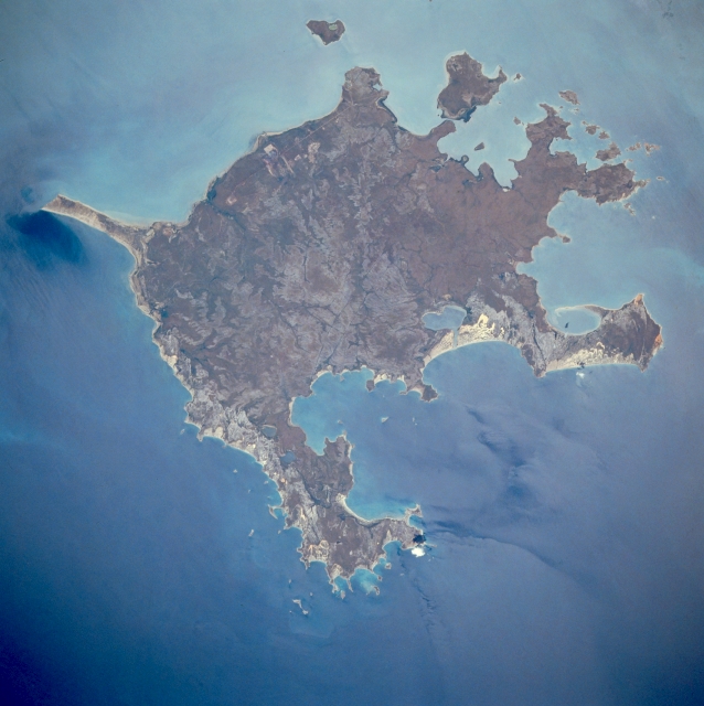
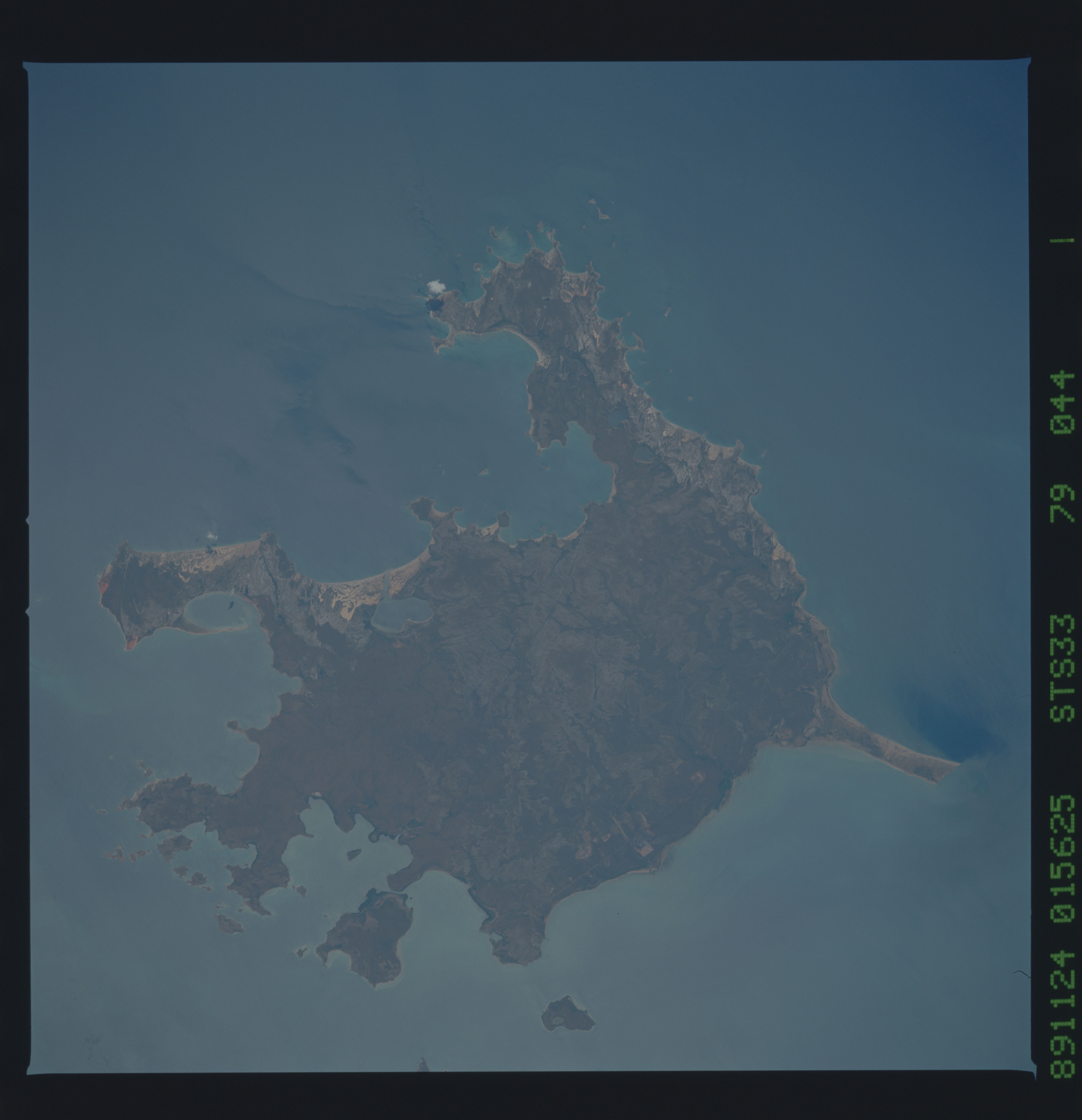
Image Caption: STS033-079-044 Groote Eylandt, Northern Territory, Australia November 1989
Groote Eylandt is the largest island in the Gulf of Carpentaria. Located near the eastern shore of the Northern Territory, the island is governed as part of that province. The highest elevation on the island is Central Hill, 689 feet (210 meters) above sea level, which is located near the center of the island. A small airport with an east-west runway (barely discernible as a light colored, east-west oriented, linear feature on this image) is located near the mid section of the west side of Groote Eylandt. Manganese ore and tropical fruits are the two major economic products that are presently exported from the island.
Groote Eylandt is the largest island in the Gulf of Carpentaria. Located near the eastern shore of the Northern Territory, the island is governed as part of that province. The highest elevation on the island is Central Hill, 689 feet (210 meters) above sea level, which is located near the center of the island. A small airport with an east-west runway (barely discernible as a light colored, east-west oriented, linear feature on this image) is located near the mid section of the west side of Groote Eylandt. Manganese ore and tropical fruits are the two major economic products that are presently exported from the island.
