ISS042-E-241898

| NASA Photo ID | ISS042-E-241898 |
| Focal Length | 20mm |
| Date taken | 2015.02.11 |
| Time taken | 07:08:58 GMT |
Resolutions offered for this image:
1000 x 665 pixels 540 x 359 pixels 2400 x 1597 pixels 720 x 480 pixels 4928 x 3280 pixels 640 x 426 pixels
1000 x 665 pixels 540 x 359 pixels 2400 x 1597 pixels 720 x 480 pixels 4928 x 3280 pixels 640 x 426 pixels


Cloud masks available for this image:
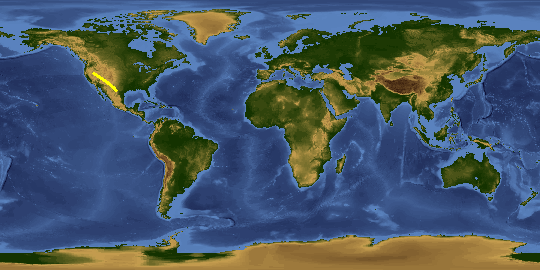
Spacecraft nadir point: 30.8° N, 103.6° W
Photo center point: 25.0° N, 95.5° W
Photo center point by machine learning:
Photo center point: 25.0° N, 95.5° W
Photo center point by machine learning:
Nadir to Photo Center: Southeast
Spacecraft Altitude: 217 nautical miles (402km)
Country or Geographic Name: | GULF OF MEXICO |
Features: | PAN- TEXAS CITIES AT NIGHT, MOON GLINT |
| Features Found Using Machine Learning: | PAN- |
Cloud Cover Percentage: | 0 (no clouds present) |
Sun Elevation Angle: | -73° |
Sun Azimuth: | 0° |
Camera: | Nikon D4 Electronic Still Camera |
Focal Length: | 20mm |
Camera Tilt: | High Oblique |
Format: | 4928E: 4928 x 3280 pixel CMOS sensor, 36.0mm x 23.9mm, total pixels: 16.6 million, Nikon FX format |
Film Exposure: | |
| Additional Information | |
This photo is one of the photos used to create this time-lapse video:
| Width | Height | Annotated | Cropped | Purpose | Links |
|---|---|---|---|---|---|
| 1000 pixels | 665 pixels | No | No | Earth From Space collection | Download Image |
| 540 pixels | 359 pixels | Yes | No | Earth From Space collection | Download Image |
| 2400 pixels | 1597 pixels | No | No | Download Image | |
| 720 pixels | 480 pixels | Yes | No | NASA's Earth Observatory web site | Download Image |
| 4928 pixels | 3280 pixels | No | No | Download Image | |
| 640 pixels | 426 pixels | No | No | Download Image |
Download Packaged File
Download a Google Earth KML for this Image
View photo footprint information
Download a GeoTIFF for this photo
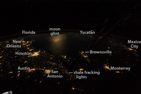
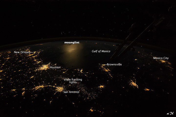
Image Caption: Texas at night
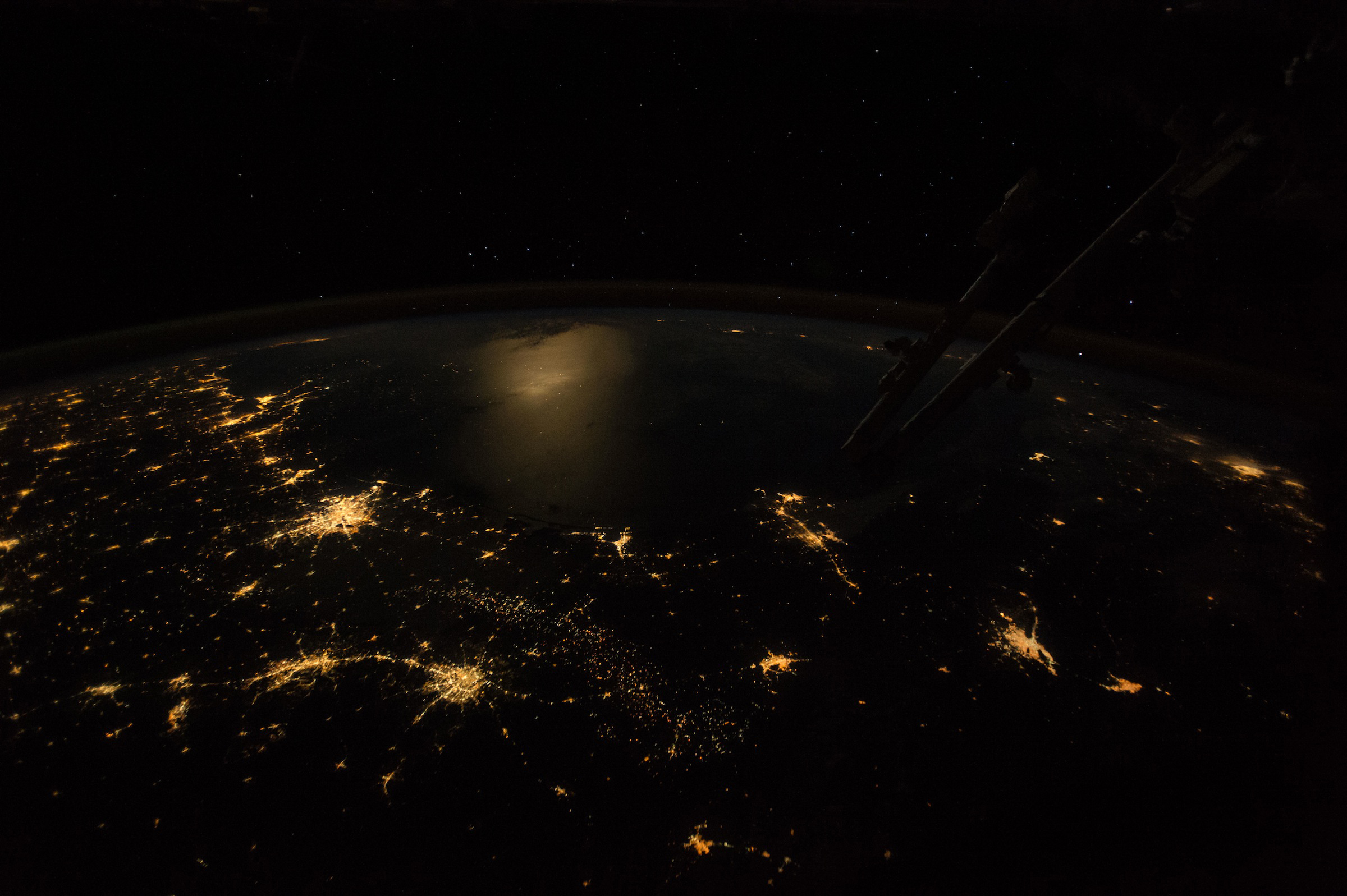
This wide-angle, nighttime image was taken by astronauts looking from the International Space Station out southeastward over the Gulf of Mexico. Moonlight reflects diffusely off the waters of the gulf (image center left) making the largest illuminated area in the image. The sharp edge of light patterns of coastal cities trace out the long curve of the gulf shoreline!afrom New Orleans at the mouth of the Mississippi River, to Houston (both image left), to Brownsville (image center) in the westernmost gulf. City lights at great distances in Florida (image top left) and on Mexico!-s Yucat"C/n peninsula (image center right) suggest the full extent of the gulf basin (more than 1500 km, or 930 miles, from Brownsville to Florida).
Other city patterns are the arcing string of lights of the Austin"CSan Antonio conurbation in central Texas, and Mexico!-s first and second cities, Mexico City and Monterrey (image right). In recent years a new pattern of lights has appeared revealing the oil- and gas-production zone of south-central Texas"Dhere a long, less dense swath of pinpoints (image lower center) shows the 330 km extent of what is now known now as shale fracking country.
