ISS040-E-105768

| NASA Photo ID | ISS040-E-105768 |
| Focal Length | 70mm |
| Date taken | 2014.08.23 |
| Time taken | 09:17:57 GMT |


Spacecraft nadir point: 24.0° N, 35.9° E
Photo center point:
Photo center point by machine learning:
Photo center point:
Photo center point by machine learning:
Nadir to Photo Center:
Spacecraft Altitude: 221 nautical miles (409km)
Country or Geographic Name: | |
Features: | |
| Features Found Using Machine Learning: | |
Cloud Cover Percentage: | 1 (1-10)% |
Sun Elevation Angle: | 77° |
Sun Azimuth: | 157° |
Camera: | NIKON D3S S/N: 2007931 |
Focal Length: | 70mm |
Camera Tilt: | |
Format: | |
Film Exposure: | |
| Additional Information | |
| Width | Height | Annotated | Cropped | Purpose | Links |
|---|---|---|---|---|---|
| 4256 pixels | 2832 pixels | No | No | Download Image | |
| 640 pixels | 426 pixels | No | No | Download Image |
Download Packaged File
Download a Google Earth KML for this Image
View photo footprint information
Download a GeoTIFF for this photo
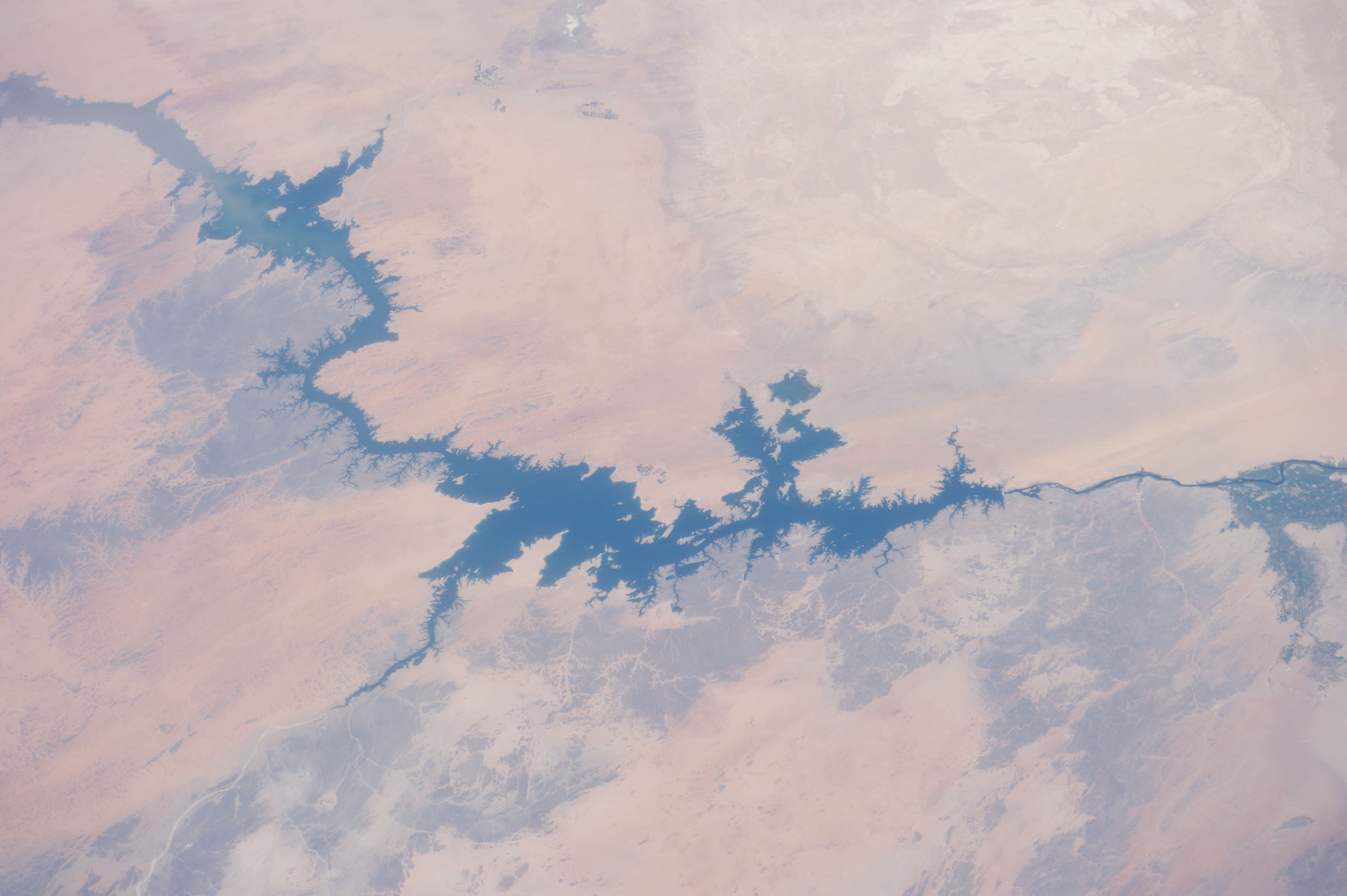
Image Caption: ISS040-E-105768 (23 Aug. 2014) --- One of the Expedition 40 crew members aboard the International Space Station, flying at an altitude of 221 nautical miles, captured this image of Egypt's Nile River and Lake Nasser on Aug. 23, 2014. The Aswan High Dam is to the right of center in the 70mm focal-length image, as the Nile flows southward (to the right in this image) toward Cairo and its Mediterranean delta (both out of frame at right). The Red Sea, which runs more or less parallel to the Nile, is out of frame at bottom.
