ISS040-E-080797
| NASA Photo ID | ISS040-E-080797 |
| Focal Length | 50mm |
| Date taken | 2014.07.25 |
| Time taken | 08:10:54 GMT |

Cloud masks available for this image:
Spacecraft nadir point: 16.7° N, 11.1° E
Photo center point: 14.0° N, 14.0° E
Photo center point by machine learning:
Photo center point: 14.0° N, 14.0° E
Photo center point by machine learning:
Nadir to Photo Center: Southeast
Spacecraft Altitude: 225 nautical miles (417km)
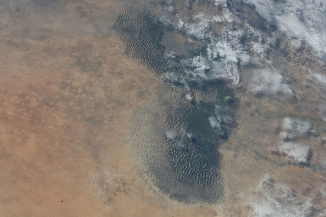
Country or Geographic Name: | CHAD |
Features: | LAKE CHAD, DUNES, WETLANDS, OPEN WATER, DESERT, CHAD BASIN |
| Features Found Using Machine Learning: | |
Cloud Cover Percentage: | 50 (26-50)% |
Sun Elevation Angle: | 45° |
Sun Azimuth: | 79° |
Camera: | Nikon D3S Electronic Still Camera |
Focal Length: | 50mm |
Camera Tilt: | 47 degrees |
Format: | 4256E: 4256 x 2832 pixel CMOS sensor, 36.0mm x 23.9mm, total pixels: 12.87 million, Nikon FX format |
Film Exposure: | |
| Additional Information | |
| Width | Height | Annotated | Cropped | Purpose | Links |
|---|---|---|---|---|---|
| 4256 pixels | 2832 pixels | No | No | Download Image | |
| 640 pixels | 426 pixels | No | No | Download Image |
Download Packaged File
Download a Google Earth KML for this Image
View photo footprint information
Download a GeoTIFF for this photo
Image Caption: ISS040-E-080797 (25 July 2014) --- From an altitude of 225 nautical miles, one of the Expedition 40 crew members aboard the International Space Station was looking almost straight down when he photographed this picture of Lake Chad, which is spread over parts of four African nations -- Chad, Niger, Cameroon and Nigeria. A 50mm focal length was used to capture the image.
