ISS040-E-070412

| NASA Photo ID | ISS040-E-070412 |
| Focal Length | 80mm |
| Date taken | 2014.07.19 |
| Time taken | 15:47:29 GMT |
Cloud masks available for this image:
Spacecraft nadir point: 49.7° N, 123.6° W
Photo center point:
Photo center point by machine learning:
Photo center point:
Photo center point by machine learning:
Nadir to Photo Center:
Spacecraft Altitude: 223 nautical miles (413km)
Country or Geographic Name: | |
Features: | |
| Features Found Using Machine Learning: | |
Cloud Cover Percentage: | 19 (11-25)% |
Sun Elevation Angle: | 30° |
Sun Azimuth: | 92° |
Camera: | NIKON D3S S/N: 2007945 |
Focal Length: | 80mm |
Camera Tilt: | |
Format: | |
Film Exposure: | |
| Additional Information | |
| Width | Height | Annotated | Cropped | Purpose | Links |
|---|---|---|---|---|---|
| 4256 pixels | 2832 pixels | No | No | Download Image | |
| 640 pixels | 426 pixels | No | No | Download Image |
Download Packaged File
Download a Google Earth KML for this Image
View photo footprint information
Download a GeoTIFF for this photo
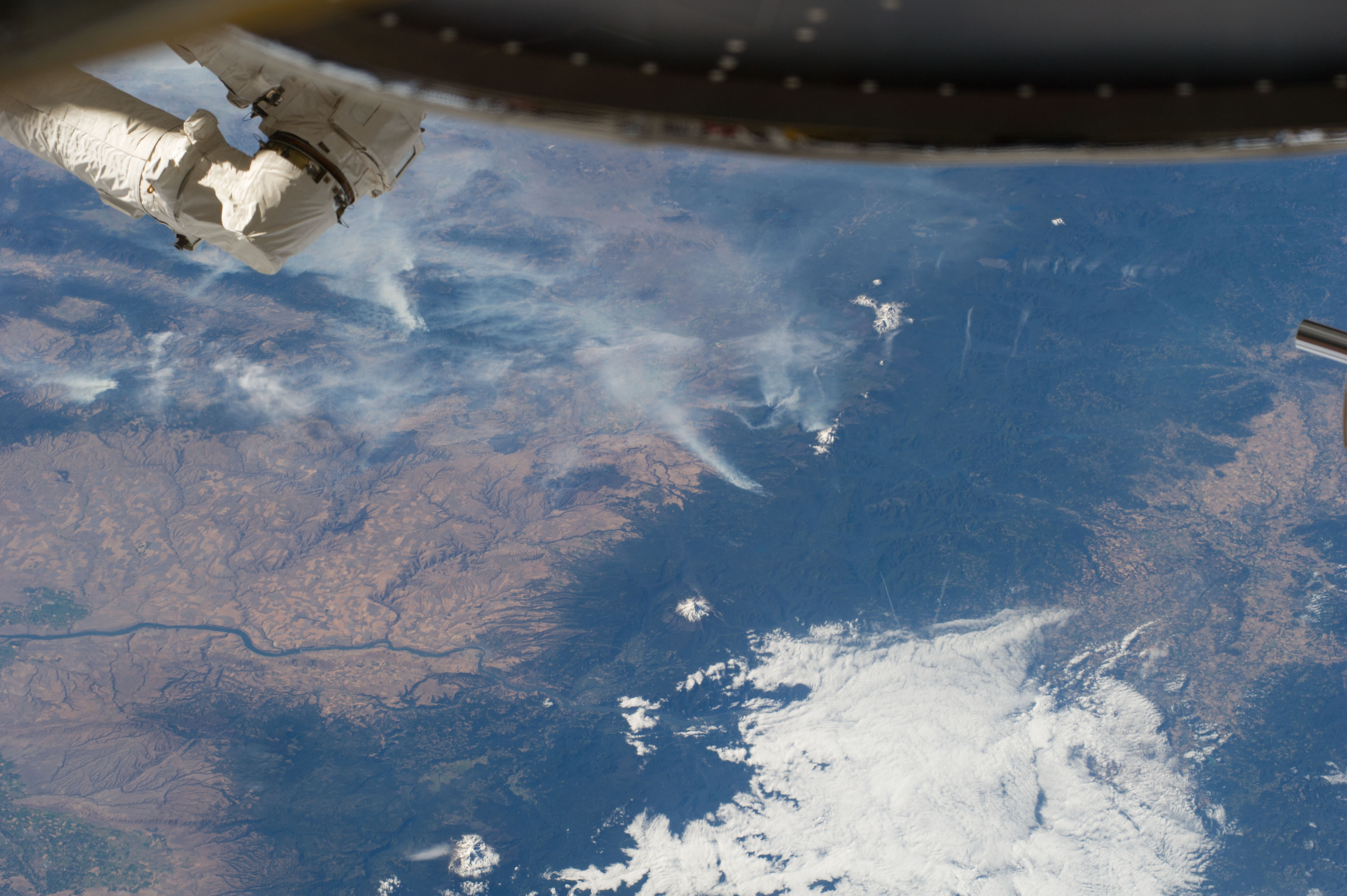
Image Caption: ISS040-E-070412 (19 July 2014) --- One of the Expedition 40 crew members aboard the Earth-orbiting International Space Station recorded this July 19 panorama featuring wildfires which are plaguing the Northwest and causing widespread destruction. (Note: south is at the top of the frame). The orbital outpost was flying 223 nautical miles above Earth at the time of the photo. Parts of Oregon and Washington are included in the scene. Mt. Jefferson, Three Sisters and Mt. St. Helens are all snow-capped and visible in the photo, and the Columbia River can also be delineated.
